


12,5 km | 14,7 km-effort
Emmerthal : Entdecken Sie die besten Touren : 10 zu fuß. Alle diese Touren, Trails, Routen und Outdoor-Aktivitäten sind in unseren SityTrail-Apps für Smartphones und Tablets verfügbar.
Zu Fuß


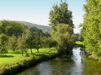
• Das natour.NAH.zentrum Schillat- Höhle ist der ideale Ausgangspunkt für Strecken- und Rundwandertouren. Der Weserberg...
Zu Fuß
• Symbol: blaue 6 auf gelbem Grund Website: https://pages.et4.de/de/westliches-weserbergland_neu/default/detail/Tour/...

Zu Fuß
• Das natour.NAH.zentrum Schillat- Höhle ist der ideale Ausgangspunkt für Strecken- und Rundwandertouren. Der Weserberg...
Zu Fuß
• Das natour.NAH.zentrum Schillat- Höhle ist der ideale Ausgangspunkt für Strecken- und Rundwandertouren. Der Weserberg...
Zu Fuß
• Das natour.NAH.zentrum Schillat- Höhle ist der ideale Ausgangspunkt für Strecken- und Rundwandertouren. Der Weserberg...

Zu Fuß
• Das natour.NAH.zentrum Schillat- Höhle ist der ideale Ausgangspunkt für Strecken- und Rundwandertouren. Der Weserberg...
Zu Fuß
• Das natour.NAH.zentrum Schillat- Höhle ist der ideale Ausgangspunkt für Strecken- und Rundwandertouren. Der Weserberg...
Zu Fuß
• Symbol: blaue 11 auf gelbem Grund Website: https://pages.et4.de/de/westliches-weserbergland_neu/default/detail/Tour...
Zu Fuß
• Symbol: blaue 13 auf gelbem Grund Website: https://pages.et4.de/de/westliches-weserbergland_neu/default/detail/Tour...
Zu Fuß
• Das natour.NAH.zentrum Schillat- Höhle ist der ideale Ausgangspunkt für Strecken- und Rundwandertouren. Der Weserberg...
10 Angezeigte Touren bei 10
Kostenlosegpshiking-Anwendung
 SityTrail
IGN / Geografische Institute
SityTrail World
Die Welt öffnet sich für Sie