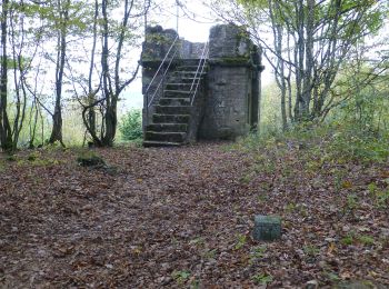
![](/images/other/stat-length.png)
- Touren
- Zu Fuß
- Germany
- Rheinland-Pfalz
- Landkreis Kusel
- Wolfstein
Wolfstein, Landkreis Kusel, Zu Fuß: Die besten Touren, Trails, Trecks und Wanderungen
Wolfstein : Entdecken Sie die besten Touren : 7 zu fuß. Alle diese Touren, Trails, Routen und Outdoor-Aktivitäten sind in unseren SityTrail-Apps für Smartphones und Tablets verfügbar.
Die besten Spuren (7)
![Tour Zu Fuß Wolfstein - Ritschelbusch-Runde - Photo](https://media.geolcdn.com/t/350/260/3d91b98d-4fd8-4308-ad9b-757452b44742.jpeg&format=jpg&maxdim=2)
![Zu Fuß Zu Fuß](https://static1.geolcdn.com/sitytour/trail-icons/100.png)
Km
Zu Fuß
![](/images/other/stat-length.png)
![](https://static1.geolcdn.com/siteimages/upload/files/1508320355ic_sort_den_pos_24dp.png)
![](https://static1.geolcdn.com/siteimages/upload/files/1508320355ic_sort_den_neg_24dp.png)
![](https://static1.geolcdn.com/siteimages/upload/files/16400158638029165_repeat_loop_refresh_sync_direction_icon.png)
• Trail created by Stadt Wolfstein. Symbol: Schwarzes R mit kleinerem B auf weißem Grund
![Tour Zu Fuß Wolfstein - Leienbergweg - Photo](https://media.geolcdn.com/t/350/260/ce90c7f6-de24-4760-bcca-e1d6978c6d1e.jpeg&format=jpg&maxdim=2)
![Zu Fuß Zu Fuß](https://static1.geolcdn.com/sitytour/trail-icons/100.png)
Km
Zu Fuß
![](/images/other/stat-length.png)
![](https://static1.geolcdn.com/siteimages/upload/files/1508320355ic_sort_den_pos_24dp.png)
![](https://static1.geolcdn.com/siteimages/upload/files/1508320355ic_sort_den_neg_24dp.png)
![](https://static1.geolcdn.com/siteimages/upload/files/16400158638029165_repeat_loop_refresh_sync_direction_icon.png)
• Trail created by Stadt Wolfstein. Symbol: Drei rote Rauten bilden ein Herz auf weißem Grund
![Tour Zu Fuß Wolfstein - Königsbachweg - Photo](https://media.geolcdn.com/t/350/260/b9983b84-90ea-4278-aa04-69859a0939dd.jpeg&format=jpg&maxdim=2)
![Zu Fuß Zu Fuß](https://static1.geolcdn.com/sitytour/trail-icons/100.png)
Km
Zu Fuß
![](/images/other/stat-length.png)
![](https://static1.geolcdn.com/siteimages/upload/files/1508320355ic_sort_den_pos_24dp.png)
![](https://static1.geolcdn.com/siteimages/upload/files/1508320355ic_sort_den_neg_24dp.png)
![](https://static1.geolcdn.com/siteimages/upload/files/16400158638029165_repeat_loop_refresh_sync_direction_icon.png)
• Trail created by Stadt Wolfstein. Symbol: Drei rote Rauten bilden ein Herz auf gelbem Grund
![Tour Zu Fuß Wolfstein - Rundwanderweg Wolfstein 3 - Photo](https://media.geolcdn.com/t/350/260/ce90c7f6-de24-4760-bcca-e1d6978c6d1e.jpeg&format=jpg&maxdim=2)
![Zu Fuß Zu Fuß](https://static1.geolcdn.com/sitytour/trail-icons/100.png)
Km
Zu Fuß
![](/images/other/stat-length.png)
![](https://static1.geolcdn.com/siteimages/upload/files/1508320355ic_sort_den_pos_24dp.png)
![](https://static1.geolcdn.com/siteimages/upload/files/1508320355ic_sort_den_neg_24dp.png)
![](https://static1.geolcdn.com/siteimages/upload/files/16400158638029165_repeat_loop_refresh_sync_direction_icon.png)
• Symbol: Schwarze 3 in weißem Kreis
![Tour Zu Fuß Wolfstein - Wolfsweg - Photo](https://media.geolcdn.com/t/350/260/ce90c7f6-de24-4760-bcca-e1d6978c6d1e.jpeg&format=jpg&maxdim=2)
![Zu Fuß Zu Fuß](https://static1.geolcdn.com/sitytour/trail-icons/100.png)
Km
Zu Fuß
![](/images/other/stat-length.png)
![](https://static1.geolcdn.com/siteimages/upload/files/1508320355ic_sort_den_pos_24dp.png)
![](https://static1.geolcdn.com/siteimages/upload/files/1508320355ic_sort_den_neg_24dp.png)
![](https://static1.geolcdn.com/siteimages/upload/files/16400158638029165_repeat_loop_refresh_sync_direction_icon.png)
• Trail created by Stadt Wolfstein. Symbol: Drei rote Rauten bilden ein Herz auf gelbem Grund
![Tour Zu Fuß Wolfstein - Maikurweg - Photo](https://media.geolcdn.com/t/350/260/ce90c7f6-de24-4760-bcca-e1d6978c6d1e.jpeg&format=jpg&maxdim=2)
![Zu Fuß Zu Fuß](https://static1.geolcdn.com/sitytour/trail-icons/100.png)
Km
Zu Fuß
![](/images/other/stat-length.png)
![](https://static1.geolcdn.com/siteimages/upload/files/1508320355ic_sort_den_pos_24dp.png)
![](https://static1.geolcdn.com/siteimages/upload/files/1508320355ic_sort_den_neg_24dp.png)
![](https://static1.geolcdn.com/siteimages/upload/files/16400158638029165_repeat_loop_refresh_sync_direction_icon.png)
• Trail created by Stadt Wolfstein. Symbol: Drei rote Rauten bilden ein Herz auf blauem Grund
![Tour Zu Fuß Wolfstein - Gipfelsteig - Photo](https://media.geolcdn.com/t/350/260/ce90c7f6-de24-4760-bcca-e1d6978c6d1e.jpeg&format=jpg&maxdim=2)
![Zu Fuß Zu Fuß](https://static1.geolcdn.com/sitytour/trail-icons/100.png)
Km
Zu Fuß
![](/images/other/stat-length.png)
![](https://static1.geolcdn.com/siteimages/upload/files/1508320355ic_sort_den_pos_24dp.png)
![](https://static1.geolcdn.com/siteimages/upload/files/1508320355ic_sort_den_neg_24dp.png)
![](https://static1.geolcdn.com/siteimages/upload/files/16400158638029165_repeat_loop_refresh_sync_direction_icon.png)
• Trail created by Stadt Wolfstein. Symbol: Drei rote Rauten bilden ein Herz auf grünem Grund
7 Angezeigte Touren bei 7
Kostenlosegpshiking-Anwendung