![](/images/other/stat-length.png)
- Touren
- Zu Fuß
- Germany
- Rheinland-Pfalz
- Rhein-Lahn-Kreis
- Sankt Goarshausen
Sankt Goarshausen, Rhein-Lahn-Kreis, Zu Fuß: Die besten Touren, Trails, Trecks und Wanderungen
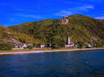
Sankt Goarshausen : Entdecken Sie die besten Touren : 3 zu fuß. Alle diese Touren, Trails, Routen und Outdoor-Aktivitäten sind in unseren SityTrail-Apps für Smartphones und Tablets verfügbar.
Die besten Spuren (3)
![Tour Zu Fuß Sankt Goarshausen - Rheinsteig-Zuweg Nochem - Photo](https://media.geolcdn.com/t/350/260/3f5191fc-70ef-45e0-a9cd-2f36cd7a53a2.jpeg&format=jpg&maxdim=2)
![Zu Fuß Zu Fuß](https://static1.geolcdn.com/sitytour/trail-icons/100.png)
Km
Zu Fuß
![](/images/other/stat-length.png)
![](https://static1.geolcdn.com/siteimages/upload/files/1508320355ic_sort_den_pos_24dp.png)
![](https://static1.geolcdn.com/siteimages/upload/files/1508320355ic_sort_den_neg_24dp.png)
![](https://static1.geolcdn.com/siteimages/upload/files/16400158638029165_repeat_loop_refresh_sync_direction_icon.png)
• Trail created by Romantischer Rhein Tourismus GmbH. Symbol: Stilisiertes weißes R auf gelbem Grund
![Tour Zu Fuß Sankt Goarshausen - Bergbau- und Landschaftspfad Ehrenthal-Prath-Wellmich - Photo](https://media.geolcdn.com/t/350/260/0dfd71a0-f287-4e08-a807-e482a6a17141.jpeg&format=jpg&maxdim=2)
![Zu Fuß Zu Fuß](https://static1.geolcdn.com/sitytour/trail-icons/100.png)
Km
Zu Fuß
![](/images/other/stat-length.png)
![](https://static1.geolcdn.com/siteimages/upload/files/1508320355ic_sort_den_pos_24dp.png)
![](https://static1.geolcdn.com/siteimages/upload/files/1508320355ic_sort_den_neg_24dp.png)
![](https://static1.geolcdn.com/siteimages/upload/files/16400158638029165_repeat_loop_refresh_sync_direction_icon.png)
• Trail created by Nachhaltige Regionalentwicklung an Rhein-Lahn-Aar e.V.. Symbol: Bergwerkssymbol
![Tour Zu Fuß Sankt Goarshausen - Rheinsteig [St. Goarshausen - Kaub] - Photo](https://media.geolcdn.com/t/350/260/ext.jpg?maxdim=2&url=https%3A%2F%2Fstatic1.geolcdn.com%2Fsiteimages%2Fupload%2Ffiles%2F1545311037marcheuse_200dpi.jpg)
![Zu Fuß Zu Fuß](https://static1.geolcdn.com/sitytour/trail-icons/100.png)
Km
Zu Fuß
![](/images/other/stat-length.png)
![](https://static1.geolcdn.com/siteimages/upload/files/1508320355ic_sort_den_pos_24dp.png)
![](https://static1.geolcdn.com/siteimages/upload/files/1508320355ic_sort_den_neg_24dp.png)
![](https://static1.geolcdn.com/siteimages/upload/files/16400158638029165_repeat_loop_refresh_sync_direction_icon.png)
3 Angezeigte Touren bei 3
Kostenlosegpshiking-Anwendung