


10,3 km | 12,3 km-effort
Unbekannt : Entdecken Sie die besten Touren : 41 zu fuß und 3 wandern. Alle diese Touren, Trails, Routen und Outdoor-Aktivitäten sind in unseren SityTrail-Apps für Smartphones und Tablets verfügbar.
Zu Fuß


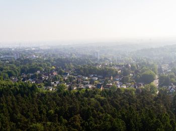
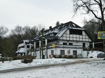
• Ausflugsziele, Freizeit und Übernachten in der Nordheide, dem nördlichen Teil der Lüneburger Heide, verkehrsgünstig i...

Zu Fuß
• Ausflugsziele, Freizeit und Übernachten in der Nordheide, dem nördlichen Teil der Lüneburger Heide, verkehrsgünstig i...
Zu Fuß
• Trail created by Wanderverband Norddeutschland;Wanderfreunde Hamburg. Symbol: gelber Pfeil auf weißem Grund
Zu Fuß
• Trail created by Wanderfreunde Hamburg e.V..
Zu Fuß
• Trail created by Wanderfreunde Hamburg e.V..
Zu Fuß
• Trail created by Wanderfreunde Hamburg e.V..
Zu Fuß
• Trail created by Wanderfreunde Hamburg e.V..
Zu Fuß
• Trail created by Wanderverband Norddeutschland e.V.. logisch gesehen müsste es diesen Weg geben um die Verbindung zw...
Zu Fuß
• Ausflugsziele, Freizeit und Übernachten in der Nordheide, dem nördlichen Teil der Lüneburger Heide, verkehrsgünstig i...
Zu Fuß
• Trail created by Wanderverband Norddeutschland e.V.. Symbol: gelber Pfeil auf weissem Grund Website: http://www.wa...
Zu Fuß
• Trail created by Wanderverband Norddeutschland e.V.. Symbol: gelber Pfeil auf weissem Grund Website: http://www.wa...
Zu Fuß
• Trail created by Wanderverband Norddeutschland e.V.. Symbol: gelber Pfeil auf weissem Grund Website: http://www.wa...
Zu Fuß
• Trail created by Wanderverband Norddeutschland e.V.. Symbol: gelber Pfeil auf weissem Grund Website: http://www.wa...
Zu Fuß
• Trail created by Wanderverband Norddeutschland e.V.. Symbol: gelber Pfeil auf weissem Grund Website: http://www.wa...
Zu Fuß
• Trail created by Wanderverband Norddeutschland e.V.. Symbol: gelber Pfeil auf weissem Grund Website: http://www.wa...
Zu Fuß
• Trail created by Wanderverband Norddeutschland e.V.. Symbol: gelber Pfeil auf weissem Grund Website: http://www.wa...
Zu Fuß
• Trail created by Wanderverband Norddeutschland e.V.. Symbol: gelber Pfeil auf weissem Grund Website: http://www.wa...
Zu Fuß
• Ausflugsziele, Freizeit und Übernachten in der Nordheide, dem nördlichen Teil der Lüneburger Heide, verkehrsgünstig i...
Zu Fuß
• Trail created by Wanderverband Norddeutschland e.V.. Symbol: gelber Pfeil auf weissem Grund Website: http://www.wa...

Zu Fuß
• Symbol: blaues Eichhörnchen
20 Angezeigte Touren bei 44
Kostenlosegpshiking-Anwendung
 SityTrail
IGN / Geografische Institute
SityTrail World
Die Welt öffnet sich für Sie