


14,8 km | 18,2 km-effort
Städteregion Aachen : Entdecken Sie die besten Touren : 144 wandern, 3 laufen, 1 nordic walking, 2 pfad und 106 zu fuß. Alle diese Touren, Trails, Routen und Outdoor-Aktivitäten sind in unseren SityTrail-Apps für Smartphones und Tablets verfügbar.
Wandern


Wandern
Wandern
Wandern
Wandern
Wandern

Wandern

Wandern
Zu Fuß
• Trail created by Naturfreunde NRW. Symbol: Grüner Wanderer auf blauen Wellen mit Überschrift WasserWege auf weißem G...
Zu Fuß
• Trail created by Rursee-Touristik.
Zu Fuß
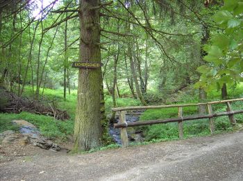
• Trail created by Eifelverein OG Eicherscheid.
Zu Fuß
• Trail created by Eifelverein OG Eicherscheid.
Zu Fuß
• Trail created by Eifelverein OG Eicherscheid.
Zu Fuß
• Trail created by Eifelverein - OG Eicherscheid.
Zu Fuß
• Trail created by Eifelverein.
Zu Fuß
• Trail created by Eifelverein Simmerath.
Zu Fuß
• Trail created by Eifelverein Eicherscheid.
Zu Fuß
• Trail created by Eifelverein.
Zu Fuß
• Trail created by Eifelverein Simmerath.
Zu Fuß
• Trail created by Eifelverein Lammersdorf.
20 Angezeigte Touren bei 255
Kostenlosegpshiking-Anwendung
 SityTrail
IGN / Geografische Institute
SityTrail World
Die Welt öffnet sich für Sie