![](/images/other/stat-length.png)
Pfofeld, Landkreis Weißenburg-Gunzenhausen, Zu Fuß: Die besten Touren, Trails, Trecks und Wanderungen
Pfofeld : Entdecken Sie die besten Touren : 7 zu fuß. Alle diese Touren, Trails, Routen und Outdoor-Aktivitäten sind in unseren SityTrail-Apps für Smartphones und Tablets verfügbar.
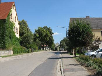
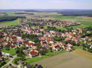
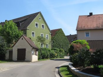
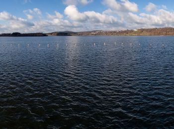
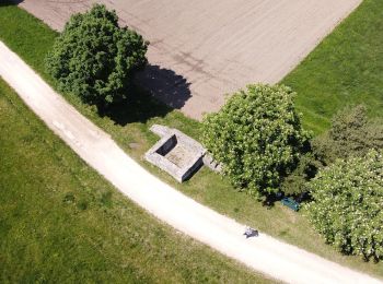
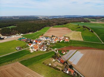
Die besten Spuren (7)
![Tour Zu Fuß Pfofeld - Fränkisches Seenland - Photo](https://media.geolcdn.com/t/350/260/f1fe3333-eadb-4a7f-87a9-e5eec59a8f55.jpeg&format=jpg&maxdim=2)
![Zu Fuß Zu Fuß](https://static1.geolcdn.com/sitytour/trail-icons/100.png)
Km
Zu Fuß
![](/images/other/stat-length.png)
![](https://static1.geolcdn.com/siteimages/upload/files/1508320355ic_sort_den_pos_24dp.png)
![](https://static1.geolcdn.com/siteimages/upload/files/1508320355ic_sort_den_neg_24dp.png)
![](https://static1.geolcdn.com/siteimages/upload/files/16400158638029165_repeat_loop_refresh_sync_direction_icon.png)
• Trail created by Fränkisches Seenland. abgeschlossen (Februar 2014, by cycling_zno) Symbol: Blaue Tafel mit weißer ...
![Tour Zu Fuß Pfofeld - Fränkisches Seenland - Photo](https://media.geolcdn.com/t/350/260/fd674d02-59b8-4e10-95f3-470615377e3e.jpeg&format=jpg&maxdim=2)
![Zu Fuß Zu Fuß](https://static1.geolcdn.com/sitytour/trail-icons/100.png)
Km
Zu Fuß
![](/images/other/stat-length.png)
![](https://static1.geolcdn.com/siteimages/upload/files/1508320355ic_sort_den_pos_24dp.png)
![](https://static1.geolcdn.com/siteimages/upload/files/1508320355ic_sort_den_neg_24dp.png)
![](https://static1.geolcdn.com/siteimages/upload/files/16400158638029165_repeat_loop_refresh_sync_direction_icon.png)
• Trail created by Fränkisches Seenland. abgeschlossen (Februar 2014, by cycling_zno) Symbol: Blaue Tafel mit weißer ...
![Tour Zu Fuß Pfofeld - Fränkisches Seenland 137 - Photo](https://media.geolcdn.com/t/350/260/9f86e1db-6890-4e21-94ed-57589fcbc97d.jpeg&format=jpg&maxdim=2)
![Zu Fuß Zu Fuß](https://static1.geolcdn.com/sitytour/trail-icons/100.png)
Km
Zu Fuß
![](/images/other/stat-length.png)
![](https://static1.geolcdn.com/siteimages/upload/files/1508320355ic_sort_den_pos_24dp.png)
![](https://static1.geolcdn.com/siteimages/upload/files/1508320355ic_sort_den_neg_24dp.png)
![](https://static1.geolcdn.com/siteimages/upload/files/16400158638029165_repeat_loop_refresh_sync_direction_icon.png)
• Trail created by Fränkisches Seenland. abgeschlossen (Februar 2014, by cycling_zno) Symbol: Blaue Tafel mit weißer ...
![Tour Zu Fuß Pfofeld - Fränkisches Seenland 138 - Photo](https://media.geolcdn.com/t/350/260/1bd27505-4801-40a3-a77c-ae4d2834950d.jpeg&format=jpg&maxdim=2)
![Zu Fuß Zu Fuß](https://static1.geolcdn.com/sitytour/trail-icons/100.png)
Km
Zu Fuß
![](/images/other/stat-length.png)
![](https://static1.geolcdn.com/siteimages/upload/files/1508320355ic_sort_den_pos_24dp.png)
![](https://static1.geolcdn.com/siteimages/upload/files/1508320355ic_sort_den_neg_24dp.png)
![](https://static1.geolcdn.com/siteimages/upload/files/16400158638029165_repeat_loop_refresh_sync_direction_icon.png)
• Trail created by Fränkisches Seenland. abgeschlossen (Februar 2014, by cycling_zno) Symbol: Blaue Tafel mit weißer ...
![Tour Zu Fuß Pfofeld - Fränkisches Seenland 142 - Photo](https://media.geolcdn.com/t/350/260/057a8a3e-7a1e-4768-9f28-660be56e0fc3.jpeg&format=jpg&maxdim=2)
![Zu Fuß Zu Fuß](https://static1.geolcdn.com/sitytour/trail-icons/100.png)
Km
Zu Fuß
![](/images/other/stat-length.png)
![](https://static1.geolcdn.com/siteimages/upload/files/1508320355ic_sort_den_pos_24dp.png)
![](https://static1.geolcdn.com/siteimages/upload/files/1508320355ic_sort_den_neg_24dp.png)
![](https://static1.geolcdn.com/siteimages/upload/files/16400158638029165_repeat_loop_refresh_sync_direction_icon.png)
• Trail created by Fränkisches Seenland. abgeschlossen (Februar 2014, by cycling_zno) Symbol: Blaue Tafel mit weißer ...
![Tour Zu Fuß Pfofeld - Fränkisches Seenland 131 - Photo](https://media.geolcdn.com/t/350/260/c62711c8-baad-47cd-a861-f945267102be.jpeg&format=jpg&maxdim=2)
![Zu Fuß Zu Fuß](https://static1.geolcdn.com/sitytour/trail-icons/100.png)
Km
Zu Fuß
![](/images/other/stat-length.png)
![](https://static1.geolcdn.com/siteimages/upload/files/1508320355ic_sort_den_pos_24dp.png)
![](https://static1.geolcdn.com/siteimages/upload/files/1508320355ic_sort_den_neg_24dp.png)
![](https://static1.geolcdn.com/siteimages/upload/files/16400158638029165_repeat_loop_refresh_sync_direction_icon.png)
• Trail created by Fränkisches Seenland. abgeschlossen (Februar 2014, by cycling_zno) Symbol: Blaue Tafel mit weißer ...
![Tour Zu Fuß Pfofeld - Fränkisches Seenland 130 - Photo](https://media.geolcdn.com/t/350/260/c62711c8-baad-47cd-a861-f945267102be.jpeg&format=jpg&maxdim=2)
![Zu Fuß Zu Fuß](https://static1.geolcdn.com/sitytour/trail-icons/100.png)
Km
Zu Fuß
![](/images/other/stat-length.png)
![](https://static1.geolcdn.com/siteimages/upload/files/1508320355ic_sort_den_pos_24dp.png)
![](https://static1.geolcdn.com/siteimages/upload/files/1508320355ic_sort_den_neg_24dp.png)
![](https://static1.geolcdn.com/siteimages/upload/files/16400158638029165_repeat_loop_refresh_sync_direction_icon.png)
• Trail created by Fränkisches Seenland. abgeschlossen (Februar 2014, by cycling_zno) Symbol: Blaue Tafel mit weißer ...
7 Angezeigte Touren bei 7
Kostenlosegpshiking-Anwendung