![](/images/other/stat-length.png)
- Touren
- Zu Fuß
- Germany
- Bayern
- Landkreis Haßberge
- Ebelsbach
Ebelsbach, Landkreis Haßberge, Zu Fuß: Die besten Touren, Trails, Trecks und Wanderungen
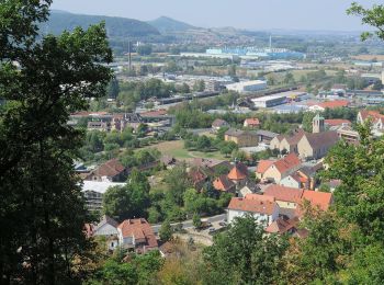
Ebelsbach : Entdecken Sie die besten Touren : 12 zu fuß. Alle diese Touren, Trails, Routen und Outdoor-Aktivitäten sind in unseren SityTrail-Apps für Smartphones und Tablets verfügbar.
Die besten Spuren (12)
![Tour Zu Fuß Ebelsbach - Rundwanderweg Milan Rudendorf - Photo](https://media.geolcdn.com/t/350/260/caeb0628-07aa-48cc-9718-d1fd0de5c211.jpeg&format=jpg&maxdim=2)
![Zu Fuß Zu Fuß](https://static1.geolcdn.com/sitytour/trail-icons/100.png)
Km
Zu Fuß
![](/images/other/stat-length.png)
![](https://static1.geolcdn.com/siteimages/upload/files/1508320355ic_sort_den_pos_24dp.png)
![](https://static1.geolcdn.com/siteimages/upload/files/1508320355ic_sort_den_neg_24dp.png)
![](https://static1.geolcdn.com/siteimages/upload/files/16400158638029165_repeat_loop_refresh_sync_direction_icon.png)
• Trail created by Haßbergverein Rudendorf. Symbol: Schwarzer Milan auf gelbem Hintergrund
![Tour Zu Fuß Ebelsbach - Schönbrunner Runde - Photo](https://media.geolcdn.com/t/350/260/b8a8e494-baff-4cb2-927a-1c9b3e6c8895.jpeg&format=jpg&maxdim=2)
![Zu Fuß Zu Fuß](https://static1.geolcdn.com/sitytour/trail-icons/100.png)
Km
Zu Fuß
![](/images/other/stat-length.png)
![](https://static1.geolcdn.com/siteimages/upload/files/1508320355ic_sort_den_pos_24dp.png)
![](https://static1.geolcdn.com/siteimages/upload/files/1508320355ic_sort_den_neg_24dp.png)
![](https://static1.geolcdn.com/siteimages/upload/files/16400158638029165_repeat_loop_refresh_sync_direction_icon.png)
• Trail created by Gemeinde Ebelsbach. Symbol: Grünes, liegendes Dreieck auf weißem Hintergrund
![Tour Zu Fuß Ebelsbach - Mohrenbergrunde - Photo](https://media.geolcdn.com/t/350/260/8e659af4-270e-4875-af02-54a73a499cf6.jpeg&format=jpg&maxdim=2)
![Zu Fuß Zu Fuß](https://static1.geolcdn.com/sitytour/trail-icons/100.png)
Km
Zu Fuß
![](/images/other/stat-length.png)
![](https://static1.geolcdn.com/siteimages/upload/files/1508320355ic_sort_den_pos_24dp.png)
![](https://static1.geolcdn.com/siteimages/upload/files/1508320355ic_sort_den_neg_24dp.png)
![](https://static1.geolcdn.com/siteimages/upload/files/16400158638029165_repeat_loop_refresh_sync_direction_icon.png)
• Trail created by Gemeinde Ebelsbach. Symbol: Blaues, liegendes Dreieck auf weißem Hintergrund
![Tour Zu Fuß Ebelsbach - Rundwanderweg Milan Ebelsbach - Photo](https://media.geolcdn.com/t/350/260/b8a8e494-baff-4cb2-927a-1c9b3e6c8895.jpeg&format=jpg&maxdim=2)
![Zu Fuß Zu Fuß](https://static1.geolcdn.com/sitytour/trail-icons/100.png)
Km
Zu Fuß
![](/images/other/stat-length.png)
![](https://static1.geolcdn.com/siteimages/upload/files/1508320355ic_sort_den_pos_24dp.png)
![](https://static1.geolcdn.com/siteimages/upload/files/1508320355ic_sort_den_neg_24dp.png)
![](https://static1.geolcdn.com/siteimages/upload/files/16400158638029165_repeat_loop_refresh_sync_direction_icon.png)
• Trail created by Wanderabteilung SC Rapid Ebelsbach. Symbol: Schwarzer Milan auf gelbem Hintergrund
![Tour Zu Fuß Ebelsbach - Lauftour EBL1 - Photo](https://media.geolcdn.com/t/350/260/e69f09a3-4d7d-42d3-a4aa-e629cfdfc1cd.jpeg&format=jpg&maxdim=2)
![Zu Fuß Zu Fuß](https://static1.geolcdn.com/sitytour/trail-icons/100.png)
Km
Zu Fuß
![](/images/other/stat-length.png)
![](https://static1.geolcdn.com/siteimages/upload/files/1508320355ic_sort_den_pos_24dp.png)
![](https://static1.geolcdn.com/siteimages/upload/files/1508320355ic_sort_den_neg_24dp.png)
![](https://static1.geolcdn.com/siteimages/upload/files/16400158638029165_repeat_loop_refresh_sync_direction_icon.png)
• Symbol: blaues EBL1 auf weißem Grund
![Tour Zu Fuß Ebelsbach - Hirschkäfer-Wanderweg Ebelsbach - Photo](https://media.geolcdn.com/t/350/260/f9148861-4bf0-4db5-bf20-3da14dee3422.jpeg&format=jpg&maxdim=2)
![Zu Fuß Zu Fuß](https://static1.geolcdn.com/sitytour/trail-icons/100.png)
Km
Zu Fuß
![](/images/other/stat-length.png)
![](https://static1.geolcdn.com/siteimages/upload/files/1508320355ic_sort_den_pos_24dp.png)
![](https://static1.geolcdn.com/siteimages/upload/files/1508320355ic_sort_den_neg_24dp.png)
![](https://static1.geolcdn.com/siteimages/upload/files/16400158638029165_repeat_loop_refresh_sync_direction_icon.png)
• Trail created by Wanderabteilung SC Rapid Ebelsbach. Symbol: schwarzer Hirschkäfer auf gelbem Grund
![Tour Zu Fuß Ebelsbach - Heilig-Länder-Runde - Photo](https://media.geolcdn.com/t/350/260/46ee1de6-101d-4a74-955f-4701bdfe06b1.jpeg&format=jpg&maxdim=2)
![Zu Fuß Zu Fuß](https://static1.geolcdn.com/sitytour/trail-icons/100.png)
Km
Zu Fuß
![](/images/other/stat-length.png)
![](https://static1.geolcdn.com/siteimages/upload/files/1508320355ic_sort_den_pos_24dp.png)
![](https://static1.geolcdn.com/siteimages/upload/files/1508320355ic_sort_den_neg_24dp.png)
![](https://static1.geolcdn.com/siteimages/upload/files/16400158638029165_repeat_loop_refresh_sync_direction_icon.png)
• Trail created by Gemeinde Ebelsbach. Symbol: hellrotes, liegendes Dreieck auf weißem Grund
![Tour Zu Fuß Ebelsbach - Lauftour EBL3 - Photo](https://media.geolcdn.com/t/350/260/3e02d0ea-a520-4f20-924c-2db206794502.jpeg&format=jpg&maxdim=2)
![Zu Fuß Zu Fuß](https://static1.geolcdn.com/sitytour/trail-icons/100.png)
Km
Zu Fuß
![](/images/other/stat-length.png)
![](https://static1.geolcdn.com/siteimages/upload/files/1508320355ic_sort_den_pos_24dp.png)
![](https://static1.geolcdn.com/siteimages/upload/files/1508320355ic_sort_den_neg_24dp.png)
![](https://static1.geolcdn.com/siteimages/upload/files/16400158638029165_repeat_loop_refresh_sync_direction_icon.png)
• Symbol: blaues EBL3 auf weißem Grund
![Tour Zu Fuß Ebelsbach - Lauftour EBL2 - Photo](https://media.geolcdn.com/t/350/260/b8a8e494-baff-4cb2-927a-1c9b3e6c8895.jpeg&format=jpg&maxdim=2)
![Zu Fuß Zu Fuß](https://static1.geolcdn.com/sitytour/trail-icons/100.png)
Km
Zu Fuß
![](/images/other/stat-length.png)
![](https://static1.geolcdn.com/siteimages/upload/files/1508320355ic_sort_den_pos_24dp.png)
![](https://static1.geolcdn.com/siteimages/upload/files/1508320355ic_sort_den_neg_24dp.png)
![](https://static1.geolcdn.com/siteimages/upload/files/16400158638029165_repeat_loop_refresh_sync_direction_icon.png)
• Trail created by Landkreis Haßberge. Symbol: blaue EBL2 auf weißem Grund
![Tour Zu Fuß Ebelsbach - Rundwanderweg Maus Ebelsbach - Photo](https://media.geolcdn.com/t/350/260/8e659af4-270e-4875-af02-54a73a499cf6.jpeg&format=jpg&maxdim=2)
![Zu Fuß Zu Fuß](https://static1.geolcdn.com/sitytour/trail-icons/100.png)
Km
Zu Fuß
![](/images/other/stat-length.png)
![](https://static1.geolcdn.com/siteimages/upload/files/1508320355ic_sort_den_pos_24dp.png)
![](https://static1.geolcdn.com/siteimages/upload/files/1508320355ic_sort_den_neg_24dp.png)
![](https://static1.geolcdn.com/siteimages/upload/files/16400158638029165_repeat_loop_refresh_sync_direction_icon.png)
• Trail created by Wanderabteilung SC Rapid Ebelsbach. Symbol: Schwarze Maus auf gelbem Hintergrund
![Tour Zu Fuß Ebelsbach - Ebelsbach/Zeil Weintal-Route - Photo](https://media.geolcdn.com/t/350/260/ef0a5e09-f679-4d78-b150-16c899e6598e.jpeg&format=jpg&maxdim=2)
![Zu Fuß Zu Fuß](https://static1.geolcdn.com/sitytour/trail-icons/100.png)
Km
Zu Fuß
![](/images/other/stat-length.png)
![](https://static1.geolcdn.com/siteimages/upload/files/1508320355ic_sort_den_pos_24dp.png)
![](https://static1.geolcdn.com/siteimages/upload/files/1508320355ic_sort_den_neg_24dp.png)
![](https://static1.geolcdn.com/siteimages/upload/files/16400158638029165_repeat_loop_refresh_sync_direction_icon.png)
• kaum markiert, Verlauf nach aufgestellten Karten Symbol: Blaue 5 auf weißem Hintergrund
![Tour Zu Fuß Ebelsbach - Schönbacher Runde - Photo](https://media.geolcdn.com/t/350/260/ext.jpg?maxdim=2&url=https%3A%2F%2Fstatic1.geolcdn.com%2Fsiteimages%2Fupload%2Ffiles%2F1545311037marcheuse_200dpi.jpg)
![Zu Fuß Zu Fuß](https://static1.geolcdn.com/sitytour/trail-icons/100.png)
Km
Zu Fuß
![](/images/other/stat-length.png)
![](https://static1.geolcdn.com/siteimages/upload/files/1508320355ic_sort_den_pos_24dp.png)
![](https://static1.geolcdn.com/siteimages/upload/files/1508320355ic_sort_den_neg_24dp.png)
![](https://static1.geolcdn.com/siteimages/upload/files/16400158638029165_repeat_loop_refresh_sync_direction_icon.png)
• Trail created by Wanderabteilung SC Rapid Ebelsbach. Symbol: liegendes rotes Dreieck auf weißem Grund
12 Angezeigte Touren bei 12
Kostenlosegpshiking-Anwendung