![](/images/other/stat-length.png)
- Touren
- Zu Fuß
- Germany
- Bayern
- Landkreis Rosenheim
- Aschau im Chiemgau
Aschau im Chiemgau, Landkreis Rosenheim, Zu Fuß: Die besten Touren, Trails, Trecks und Wanderungen
Aschau im Chiemgau : Entdecken Sie die besten Touren : 21 zu fuß. Alle diese Touren, Trails, Routen und Outdoor-Aktivitäten sind in unseren SityTrail-Apps für Smartphones und Tablets verfügbar.
Die besten Spuren (21)
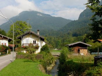
![Tour Zu Fuß Aschau im Chiemgau - Wanderweg 1 - Von Sachrang nach Walchsee - Photo](https://media.geolcdn.com/t/350/260/d0aba310-1364-491c-a5a9-de0387879306.jpeg&format=jpg&maxdim=2)
![Zu Fuß Zu Fuß](https://static1.geolcdn.com/sitytour/trail-icons/100.png)
Km
Zu Fuß
![](/images/other/stat-length.png)
![](https://static1.geolcdn.com/siteimages/upload/files/1508320355ic_sort_den_pos_24dp.png)
![](https://static1.geolcdn.com/siteimages/upload/files/1508320355ic_sort_den_neg_24dp.png)
![](https://static1.geolcdn.com/siteimages/upload/files/16400158638029165_repeat_loop_refresh_sync_direction_icon.png)
• Trail created by Tourist Info Aschau i.Ch.. Symbol: Grüne Schilder mit weißer Schrift
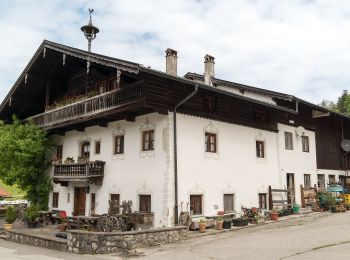
![Tour Zu Fuß Aschau im Chiemgau - Öko-Kultur-Weg - Photo](https://media.geolcdn.com/t/350/260/f9e0c46c-713d-4420-8056-2cdeb226aa8f.jpeg&format=jpg&maxdim=2)
![Zu Fuß Zu Fuß](https://static1.geolcdn.com/sitytour/trail-icons/100.png)
Km
Zu Fuß
![](/images/other/stat-length.png)
![](https://static1.geolcdn.com/siteimages/upload/files/1508320355ic_sort_den_pos_24dp.png)
![](https://static1.geolcdn.com/siteimages/upload/files/1508320355ic_sort_den_neg_24dp.png)
![](https://static1.geolcdn.com/siteimages/upload/files/16400158638029165_repeat_loop_refresh_sync_direction_icon.png)
• Symbol: Holzschilder mit der Aufschrift "Öko-Kultur-Weg" oder hellblaue Blechschilder mit weißen Silouetten von Kirch...
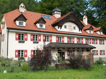
![Tour Zu Fuß Aschau im Chiemgau - Wanderweg 10 - Aschau - Photo](https://media.geolcdn.com/t/350/260/93b3eb26-eb80-4cf9-86bf-ccd0a1b83df3.jpeg&format=jpg&maxdim=2)
![Zu Fuß Zu Fuß](https://static1.geolcdn.com/sitytour/trail-icons/100.png)
Km
Zu Fuß
![](/images/other/stat-length.png)
![](https://static1.geolcdn.com/siteimages/upload/files/1508320355ic_sort_den_pos_24dp.png)
![](https://static1.geolcdn.com/siteimages/upload/files/1508320355ic_sort_den_neg_24dp.png)
![](https://static1.geolcdn.com/siteimages/upload/files/16400158638029165_repeat_loop_refresh_sync_direction_icon.png)
• Trail created by Tourist Info Aschau i.Ch..
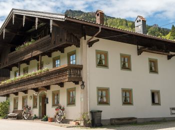
![Tour Zu Fuß Aschau im Chiemgau - Wanderweg 8 - Von Innerwald zum Spitzsteinhaus bzw. Klausenhütte - Photo](https://media.geolcdn.com/t/350/260/7065dbec-1bfa-44b5-81e5-053df54127dd.jpeg&format=jpg&maxdim=2)
![Zu Fuß Zu Fuß](https://static1.geolcdn.com/sitytour/trail-icons/100.png)
Km
Zu Fuß
![](/images/other/stat-length.png)
![](https://static1.geolcdn.com/siteimages/upload/files/1508320355ic_sort_den_pos_24dp.png)
![](https://static1.geolcdn.com/siteimages/upload/files/1508320355ic_sort_den_neg_24dp.png)
![](https://static1.geolcdn.com/siteimages/upload/files/16400158638029165_repeat_loop_refresh_sync_direction_icon.png)
• Trail created by Tourist Info Aschau i.Ch.. Symbol: Orange Blechschilder mit der Zahl 8 oder gelbe Wegweisschilder
![Tour Zu Fuß Aschau im Chiemgau - eon - Trail - Photo](https://media.geolcdn.com/t/350/260/fcc7757d-af57-462e-bab3-9bd6edac92a2.jpeg&format=jpg&maxdim=2)
![Zu Fuß Zu Fuß](https://static1.geolcdn.com/sitytour/trail-icons/100.png)
Km
Zu Fuß
![](/images/other/stat-length.png)
![](https://static1.geolcdn.com/siteimages/upload/files/1508320355ic_sort_den_pos_24dp.png)
![](https://static1.geolcdn.com/siteimages/upload/files/1508320355ic_sort_den_neg_24dp.png)
![](https://static1.geolcdn.com/siteimages/upload/files/16400158638029165_repeat_loop_refresh_sync_direction_icon.png)
• Trail created by DSV nordic aktiv Ausbildungszentrum. Symbol: Rotes Schild mit weißem Pfeil
![Tour Zu Fuß Aschau im Chiemgau - Petrusquelle - Trail - Photo](https://media.geolcdn.com/t/350/260/a867e241-5a13-4a92-8aa3-869ae8ab78ea.jpeg&format=jpg&maxdim=2)
![Zu Fuß Zu Fuß](https://static1.geolcdn.com/sitytour/trail-icons/100.png)
Km
Zu Fuß
![](/images/other/stat-length.png)
![](https://static1.geolcdn.com/siteimages/upload/files/1508320355ic_sort_den_pos_24dp.png)
![](https://static1.geolcdn.com/siteimages/upload/files/1508320355ic_sort_den_neg_24dp.png)
![](https://static1.geolcdn.com/siteimages/upload/files/16400158638029165_repeat_loop_refresh_sync_direction_icon.png)
• Trail created by DSV nordic aktiv Ausbildungszentrum. Symbol: Blaues Schild mit weißem Pfeil
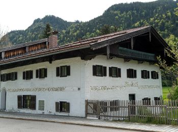
![Tour Zu Fuß Aschau im Chiemgau - eon - Trail - Photo](https://media.geolcdn.com/t/350/260/03e4afa5-6c80-4d0e-bf45-ff28d20e6848.jpeg&format=jpg&maxdim=2)
![Zu Fuß Zu Fuß](https://static1.geolcdn.com/sitytour/trail-icons/100.png)
Km
Zu Fuß
![](/images/other/stat-length.png)
![](https://static1.geolcdn.com/siteimages/upload/files/1508320355ic_sort_den_pos_24dp.png)
![](https://static1.geolcdn.com/siteimages/upload/files/1508320355ic_sort_den_neg_24dp.png)
![](https://static1.geolcdn.com/siteimages/upload/files/16400158638029165_repeat_loop_refresh_sync_direction_icon.png)
• Trail created by DSV nordic aktiv Ausbildungszentrum. Symbol: Rotes Schild mit weißem Pfeil
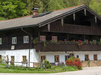
![Tour Zu Fuß Aschau im Chiemgau - HAAS - Trail - Photo](https://media.geolcdn.com/t/350/260/935e2a07-3630-4907-8559-8a3c1a75911e.jpeg&format=jpg&maxdim=2)
![Zu Fuß Zu Fuß](https://static1.geolcdn.com/sitytour/trail-icons/100.png)
Km
Zu Fuß
![](/images/other/stat-length.png)
![](https://static1.geolcdn.com/siteimages/upload/files/1508320355ic_sort_den_pos_24dp.png)
![](https://static1.geolcdn.com/siteimages/upload/files/1508320355ic_sort_den_neg_24dp.png)
![](https://static1.geolcdn.com/siteimages/upload/files/16400158638029165_repeat_loop_refresh_sync_direction_icon.png)
• Trail created by DSV nordic aktiv Ausbildungszentrum. Symbol: Schwarzes Schild mit weißem Pfeil
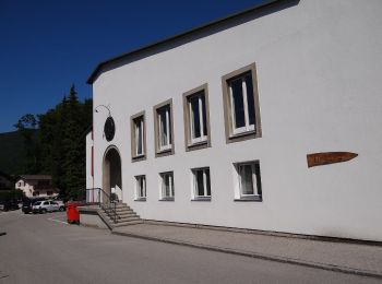
![Tour Zu Fuß Aschau im Chiemgau - Wanderweg 21 - Über`s Wasserthal Schwarzenstein - Photo](https://media.geolcdn.com/t/350/260/a6e2f5e1-bb40-47e0-90ab-fe675dcca2e5.jpeg&format=jpg&maxdim=2)
![Zu Fuß Zu Fuß](https://static1.geolcdn.com/sitytour/trail-icons/100.png)
Km
Zu Fuß
![](/images/other/stat-length.png)
![](https://static1.geolcdn.com/siteimages/upload/files/1508320355ic_sort_den_pos_24dp.png)
![](https://static1.geolcdn.com/siteimages/upload/files/1508320355ic_sort_den_neg_24dp.png)
![](https://static1.geolcdn.com/siteimages/upload/files/16400158638029165_repeat_loop_refresh_sync_direction_icon.png)
• Trail created by Tourist Info Aschau i.Ch.. Symbol: Rote Schilder mit weißer Schrift
![Tour Zu Fuß Aschau im Chiemgau - Wanderweg 25 - Über die](https://media.geolcdn.com/t/350/260/aba6f84b-accb-486d-947b-138be826fd24.jpeg&format=jpg&maxdim=2)
![Zu Fuß Zu Fuß](https://static1.geolcdn.com/sitytour/trail-icons/100.png)
Km
Zu Fuß
![](/images/other/stat-length.png)
![](https://static1.geolcdn.com/siteimages/upload/files/1508320355ic_sort_den_pos_24dp.png)
![](https://static1.geolcdn.com/siteimages/upload/files/1508320355ic_sort_den_neg_24dp.png)
![](https://static1.geolcdn.com/siteimages/upload/files/16400158638029165_repeat_loop_refresh_sync_direction_icon.png)
• Trail created by Tourist Info Aschau i.Ch.. Symbol: Grünes Schild mit weißer Schrift
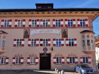
![Tour Zu Fuß Aschau im Chiemgau - Wanderweg 22 - Von Aschau auf die Kampenwand - Photo](https://media.geolcdn.com/t/350/260/91dd6ae7-5cb4-4c2a-9b84-027f8d411b81.jpeg&format=jpg&maxdim=2)
![Zu Fuß Zu Fuß](https://static1.geolcdn.com/sitytour/trail-icons/100.png)
Km
Zu Fuß
![](/images/other/stat-length.png)
![](https://static1.geolcdn.com/siteimages/upload/files/1508320355ic_sort_den_pos_24dp.png)
![](https://static1.geolcdn.com/siteimages/upload/files/1508320355ic_sort_den_neg_24dp.png)
![](https://static1.geolcdn.com/siteimages/upload/files/16400158638029165_repeat_loop_refresh_sync_direction_icon.png)
• Trail created by Tourist Info Aschau i.Ch.. Symbol: Orange Schilder mit weißer Schrift
![Tour Zu Fuß Aschau im Chiemgau - Wanderweg 26 - Auf die Hochries - Photo](https://media.geolcdn.com/t/350/260/fcc7757d-af57-462e-bab3-9bd6edac92a2.jpeg&format=jpg&maxdim=2)
![Zu Fuß Zu Fuß](https://static1.geolcdn.com/sitytour/trail-icons/100.png)
Km
Zu Fuß
![](/images/other/stat-length.png)
![](https://static1.geolcdn.com/siteimages/upload/files/1508320355ic_sort_den_pos_24dp.png)
![](https://static1.geolcdn.com/siteimages/upload/files/1508320355ic_sort_den_neg_24dp.png)
![](https://static1.geolcdn.com/siteimages/upload/files/16400158638029165_repeat_loop_refresh_sync_direction_icon.png)
• Trail created by Tourist Info Aschau i.Ch..
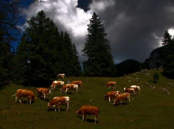
![Tour Zu Fuß Aschau im Chiemgau - Wanderweg 20 - Über die Kampenwand zum Geigelstein - Photo](https://media.geolcdn.com/t/350/260/69036ba4-3fc6-46b7-89d0-2f41c420192c.jpeg&format=jpg&maxdim=2)
![Zu Fuß Zu Fuß](https://static1.geolcdn.com/sitytour/trail-icons/100.png)
Km
Zu Fuß
![](/images/other/stat-length.png)
![](https://static1.geolcdn.com/siteimages/upload/files/1508320355ic_sort_den_pos_24dp.png)
![](https://static1.geolcdn.com/siteimages/upload/files/1508320355ic_sort_den_neg_24dp.png)
![](https://static1.geolcdn.com/siteimages/upload/files/16400158638029165_repeat_loop_refresh_sync_direction_icon.png)
• Trail created by Tourist Info Aschau i.Ch.. Symbol: Orange Schilder mit weißer Schrift
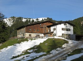
![Tour Zu Fuß Aschau im Chiemgau - Wanderweg 3 - Von Sachrang zum Geigelstein - Photo](https://media.geolcdn.com/t/350/260/5ec9d0f0-d307-4335-b7ef-61782e26c4fb.jpeg&format=jpg&maxdim=2)
![Zu Fuß Zu Fuß](https://static1.geolcdn.com/sitytour/trail-icons/100.png)
Km
Zu Fuß
![](/images/other/stat-length.png)
![](https://static1.geolcdn.com/siteimages/upload/files/1508320355ic_sort_den_pos_24dp.png)
![](https://static1.geolcdn.com/siteimages/upload/files/1508320355ic_sort_den_neg_24dp.png)
![](https://static1.geolcdn.com/siteimages/upload/files/16400158638029165_repeat_loop_refresh_sync_direction_icon.png)
• Trail created by Tourist Info Aschau i.Ch.. Symbol: Orange Schilder mit weißer Schrift
![Tour Zu Fuß Aschau im Chiemgau - Wanderweg 24 - Rund um den Bärnsee - Photo](https://media.geolcdn.com/t/350/260/a5698fd7-ec09-415c-8c68-e6c9afe0a1f0.jpeg&format=jpg&maxdim=2)
![Zu Fuß Zu Fuß](https://static1.geolcdn.com/sitytour/trail-icons/100.png)
Km
Zu Fuß
![](/images/other/stat-length.png)
![](https://static1.geolcdn.com/siteimages/upload/files/1508320355ic_sort_den_pos_24dp.png)
![](https://static1.geolcdn.com/siteimages/upload/files/1508320355ic_sort_den_neg_24dp.png)
![](https://static1.geolcdn.com/siteimages/upload/files/16400158638029165_repeat_loop_refresh_sync_direction_icon.png)
• Trail created by Tourist Info Aschau i.Ch.. Symbol: Grünes Schild mit weißer Schrift
![Tour Zu Fuß Aschau im Chiemgau - Wanderweg 6 - Von Sachrang zum Spitzstein - Photo](https://media.geolcdn.com/t/350/260/d0aba310-1364-491c-a5a9-de0387879306.jpeg&format=jpg&maxdim=2)
![Zu Fuß Zu Fuß](https://static1.geolcdn.com/sitytour/trail-icons/100.png)
Km
Zu Fuß
![](/images/other/stat-length.png)
![](https://static1.geolcdn.com/siteimages/upload/files/1508320355ic_sort_den_pos_24dp.png)
![](https://static1.geolcdn.com/siteimages/upload/files/1508320355ic_sort_den_neg_24dp.png)
![](https://static1.geolcdn.com/siteimages/upload/files/16400158638029165_repeat_loop_refresh_sync_direction_icon.png)
![Tour Zu Fuß Aschau im Chiemgau - Wanderweg 4 - Bernau - Photo](https://media.geolcdn.com/t/350/260/ea58d7b3-4c97-4aa7-a11c-c16ea0157d03.jpeg&format=jpg&maxdim=2)
![Zu Fuß Zu Fuß](https://static1.geolcdn.com/sitytour/trail-icons/100.png)
Km
Zu Fuß
![](/images/other/stat-length.png)
![](https://static1.geolcdn.com/siteimages/upload/files/1508320355ic_sort_den_pos_24dp.png)
![](https://static1.geolcdn.com/siteimages/upload/files/1508320355ic_sort_den_neg_24dp.png)
![](https://static1.geolcdn.com/siteimages/upload/files/16400158638029165_repeat_loop_refresh_sync_direction_icon.png)
• Symbol: Roter Kreis mit Zahl
![Tour Zu Fuß Aschau im Chiemgau - Wanderweg 23 - Rund um den Haindorfer Berg - Photo](https://media.geolcdn.com/t/350/260/18d9f56f-4e08-414f-88fd-25b10d84ff43.jpeg&format=jpg&maxdim=2)
![Zu Fuß Zu Fuß](https://static1.geolcdn.com/sitytour/trail-icons/100.png)
Km
Zu Fuß
![](/images/other/stat-length.png)
![](https://static1.geolcdn.com/siteimages/upload/files/1508320355ic_sort_den_pos_24dp.png)
![](https://static1.geolcdn.com/siteimages/upload/files/1508320355ic_sort_den_neg_24dp.png)
![](https://static1.geolcdn.com/siteimages/upload/files/16400158638029165_repeat_loop_refresh_sync_direction_icon.png)
• Trail created by Tourist Info Aschau i.Ch..
![Tour Zu Fuß Aschau im Chiemgau - Salzsalinenweg - Photo](https://media.geolcdn.com/t/350/260/ext.jpg?maxdim=2&url=https%3A%2F%2Fstatic1.geolcdn.com%2Fsiteimages%2Fupload%2Ffiles%2F1545311037marcheuse_200dpi.jpg)
![Zu Fuß Zu Fuß](https://static1.geolcdn.com/sitytour/trail-icons/100.png)
Km
Zu Fuß
![](/images/other/stat-length.png)
![](https://static1.geolcdn.com/siteimages/upload/files/1508320355ic_sort_den_pos_24dp.png)
![](https://static1.geolcdn.com/siteimages/upload/files/1508320355ic_sort_den_neg_24dp.png)
![](https://static1.geolcdn.com/siteimages/upload/files/16400158638029165_repeat_loop_refresh_sync_direction_icon.png)
• Symbol: Weiße Schilder mit blauem Schriftzug "Salzsalinenweg"
![Tour Zu Fuß Aschau im Chiemgau - Wanderweg 12 - Prientalwanderweg - Photo](https://media.geolcdn.com/t/350/260/ext.jpg?maxdim=2&url=https%3A%2F%2Fstatic1.geolcdn.com%2Fsiteimages%2Fupload%2Ffiles%2F1545311037marcheuse_200dpi.jpg)
![Zu Fuß Zu Fuß](https://static1.geolcdn.com/sitytour/trail-icons/100.png)
Km
Zu Fuß
![](/images/other/stat-length.png)
![](https://static1.geolcdn.com/siteimages/upload/files/1508320355ic_sort_den_pos_24dp.png)
![](https://static1.geolcdn.com/siteimages/upload/files/1508320355ic_sort_den_neg_24dp.png)
![](https://static1.geolcdn.com/siteimages/upload/files/16400158638029165_repeat_loop_refresh_sync_direction_icon.png)
• Trail created by Tourist Info Aschau i.Ch.. Symbol: Grüne Schilder mit weißer Schrift
20 Angezeigte Touren bei 21
Kostenlosegpshiking-Anwendung