![](/images/other/stat-length.png)
Landkreis Wunsiedel im Fichtelgebirge, Bayern, Zu Fuß: Die besten Touren, Trails, Trecks und Wanderungen
Landkreis Wunsiedel im Fichtelgebirge : Entdecken Sie die besten Touren : 105 zu fuß und 1 wandern. Alle diese Touren, Trails, Routen und Outdoor-Aktivitäten sind in unseren SityTrail-Apps für Smartphones und Tablets verfügbar.
Die besten Spuren (106)
![Tour Zu Fuß Tröstau - Wanderweg 9 Tröstau - Photo](https://media.geolcdn.com/t/350/260/bfda46df-7274-43fa-a2bf-f4e1ced78cd6.jpeg&format=jpg&maxdim=2)
![Zu Fuß Zu Fuß](https://static1.geolcdn.com/sitytour/trail-icons/100.png)
Km
Zu Fuß
![](/images/other/stat-length.png)
![](https://static1.geolcdn.com/siteimages/upload/files/1508320355ic_sort_den_pos_24dp.png)
![](https://static1.geolcdn.com/siteimages/upload/files/1508320355ic_sort_den_neg_24dp.png)
![](https://static1.geolcdn.com/siteimages/upload/files/16400158638029165_repeat_loop_refresh_sync_direction_icon.png)
• Trail created by FGV.
![Tour Zu Fuß Tröstau - Wanderweg 10 Tröstau - Photo](https://media.geolcdn.com/t/350/260/2d7578bf-fa9e-45a2-8d80-9ae0341eac21.jpeg&format=jpg&maxdim=2)
![Zu Fuß Zu Fuß](https://static1.geolcdn.com/sitytour/trail-icons/100.png)
Km
Zu Fuß
![](/images/other/stat-length.png)
![](https://static1.geolcdn.com/siteimages/upload/files/1508320355ic_sort_den_pos_24dp.png)
![](https://static1.geolcdn.com/siteimages/upload/files/1508320355ic_sort_den_neg_24dp.png)
![](https://static1.geolcdn.com/siteimages/upload/files/16400158638029165_repeat_loop_refresh_sync_direction_icon.png)
• Trail created by FGV.
![Tour Zu Fuß Marktredwitz - Wanderweg 7 Marktredwitz - Photo](https://media.geolcdn.com/t/350/260/0f5f95b5-d30c-4dc0-a4ca-d7ae4d879d11.jpeg&format=jpg&maxdim=2)
![Zu Fuß Zu Fuß](https://static1.geolcdn.com/sitytour/trail-icons/100.png)
Km
Zu Fuß
![](/images/other/stat-length.png)
![](https://static1.geolcdn.com/siteimages/upload/files/1508320355ic_sort_den_pos_24dp.png)
![](https://static1.geolcdn.com/siteimages/upload/files/1508320355ic_sort_den_neg_24dp.png)
![](https://static1.geolcdn.com/siteimages/upload/files/16400158638029165_repeat_loop_refresh_sync_direction_icon.png)
• Trail created by FGV.
![Tour Zu Fuß Tröstauer Forst-West - Zubringer Fränkischer Gebirgsweg (Tröstau) - Photo](https://media.geolcdn.com/t/350/260/bfda46df-7274-43fa-a2bf-f4e1ced78cd6.jpeg&format=jpg&maxdim=2)
![Zu Fuß Zu Fuß](https://static1.geolcdn.com/sitytour/trail-icons/100.png)
Km
Zu Fuß
![](/images/other/stat-length.png)
![](https://static1.geolcdn.com/siteimages/upload/files/1508320355ic_sort_den_pos_24dp.png)
![](https://static1.geolcdn.com/siteimages/upload/files/1508320355ic_sort_den_neg_24dp.png)
![](https://static1.geolcdn.com/siteimages/upload/files/16400158638029165_repeat_loop_refresh_sync_direction_icon.png)
• Trail created by FGV.
![Tour Zu Fuß Tröstauer Forst-West - Wanderweg 7 Tröstau - Photo](https://media.geolcdn.com/t/350/260/4b984cdc-d834-4886-ac53-c6c678377be5.jpeg&format=jpg&maxdim=2)
![Zu Fuß Zu Fuß](https://static1.geolcdn.com/sitytour/trail-icons/100.png)
Km
Zu Fuß
![](/images/other/stat-length.png)
![](https://static1.geolcdn.com/siteimages/upload/files/1508320355ic_sort_den_pos_24dp.png)
![](https://static1.geolcdn.com/siteimages/upload/files/1508320355ic_sort_den_neg_24dp.png)
![](https://static1.geolcdn.com/siteimages/upload/files/16400158638029165_repeat_loop_refresh_sync_direction_icon.png)
• Trail created by FGV.
![Tour Zu Fuß Thierstein - Wanderweg Selb-Thierstein - Photo](https://media.geolcdn.com/t/350/260/52a3cb25-0e9c-44f3-8a65-56e4d4a9269d.jpeg&format=jpg&maxdim=2)
![Zu Fuß Zu Fuß](https://static1.geolcdn.com/sitytour/trail-icons/100.png)
Km
Zu Fuß
![](/images/other/stat-length.png)
![](https://static1.geolcdn.com/siteimages/upload/files/1508320355ic_sort_den_pos_24dp.png)
![](https://static1.geolcdn.com/siteimages/upload/files/1508320355ic_sort_den_neg_24dp.png)
![](https://static1.geolcdn.com/siteimages/upload/files/16400158638029165_repeat_loop_refresh_sync_direction_icon.png)
• Trail created by FGV. Symbol: Blauer Punkt auf weißem Grund
![Tour Zu Fuß Marktleuthen - Wanderroute 6 (Marktleuthen) - Photo](https://media.geolcdn.com/t/350/260/9ca0677f-98a6-414e-8c2b-fc564e498257.jpeg&format=jpg&maxdim=2)
![Zu Fuß Zu Fuß](https://static1.geolcdn.com/sitytour/trail-icons/100.png)
Km
Zu Fuß
![](/images/other/stat-length.png)
![](https://static1.geolcdn.com/siteimages/upload/files/1508320355ic_sort_den_pos_24dp.png)
![](https://static1.geolcdn.com/siteimages/upload/files/1508320355ic_sort_den_neg_24dp.png)
![](https://static1.geolcdn.com/siteimages/upload/files/16400158638029165_repeat_loop_refresh_sync_direction_icon.png)
• Trail created by FGV.
![Tour Zu Fuß Marktleuthen - Wanderroute Marktleuthen - Großwendern - Photo](https://media.geolcdn.com/t/350/260/9ca0677f-98a6-414e-8c2b-fc564e498257.jpeg&format=jpg&maxdim=2)
![Zu Fuß Zu Fuß](https://static1.geolcdn.com/sitytour/trail-icons/100.png)
Km
Zu Fuß
![](/images/other/stat-length.png)
![](https://static1.geolcdn.com/siteimages/upload/files/1508320355ic_sort_den_pos_24dp.png)
![](https://static1.geolcdn.com/siteimages/upload/files/1508320355ic_sort_den_neg_24dp.png)
![](https://static1.geolcdn.com/siteimages/upload/files/16400158638029165_repeat_loop_refresh_sync_direction_icon.png)
• Trail created by FGV.
![Tour Zu Fuß Marktleuthen - Wanderroute 1 (Marktleuthen) - Photo](https://media.geolcdn.com/t/350/260/9ca0677f-98a6-414e-8c2b-fc564e498257.jpeg&format=jpg&maxdim=2)
![Zu Fuß Zu Fuß](https://static1.geolcdn.com/sitytour/trail-icons/100.png)
Km
Zu Fuß
![](/images/other/stat-length.png)
![](https://static1.geolcdn.com/siteimages/upload/files/1508320355ic_sort_den_pos_24dp.png)
![](https://static1.geolcdn.com/siteimages/upload/files/1508320355ic_sort_den_neg_24dp.png)
![](https://static1.geolcdn.com/siteimages/upload/files/16400158638029165_repeat_loop_refresh_sync_direction_icon.png)
• Trail created by FGV.
![Tour Zu Fuß Thiersheim - Mühlenweg - Photo](https://media.geolcdn.com/t/350/260/01720f9c-a96f-46fd-a209-317713a1cbaa.jpeg&format=jpg&maxdim=2)
![Zu Fuß Zu Fuß](https://static1.geolcdn.com/sitytour/trail-icons/100.png)
Km
Zu Fuß
![](/images/other/stat-length.png)
![](https://static1.geolcdn.com/siteimages/upload/files/1508320355ic_sort_den_pos_24dp.png)
![](https://static1.geolcdn.com/siteimages/upload/files/1508320355ic_sort_den_neg_24dp.png)
![](https://static1.geolcdn.com/siteimages/upload/files/16400158638029165_repeat_loop_refresh_sync_direction_icon.png)
• Trail created by Fichtelgebirgsverein. Symbol: blaue Raute auf weißem Grund
![Tour Zu Fuß Tröstau - Rund um die Kösseine - Photo](https://media.geolcdn.com/t/350/260/a7ec7ef5-b583-4faa-9d8e-0e1fd919f531.jpeg&format=jpg&maxdim=2)
![Zu Fuß Zu Fuß](https://static1.geolcdn.com/sitytour/trail-icons/100.png)
Km
Zu Fuß
![](/images/other/stat-length.png)
![](https://static1.geolcdn.com/siteimages/upload/files/1508320355ic_sort_den_pos_24dp.png)
![](https://static1.geolcdn.com/siteimages/upload/files/1508320355ic_sort_den_neg_24dp.png)
![](https://static1.geolcdn.com/siteimages/upload/files/16400158638029165_repeat_loop_refresh_sync_direction_icon.png)
• Trail created by Fichtelgebirgsverein. Symbol: Gelber Ring
![Tour Zu Fuß Tröstauer Forst-West - Tröstau - Hohe Matze - Photo](https://media.geolcdn.com/t/350/260/d845b88c-f31e-4262-a106-1fd7d2307d93.jpeg&format=jpg&maxdim=2)
![Zu Fuß Zu Fuß](https://static1.geolcdn.com/sitytour/trail-icons/100.png)
Km
Zu Fuß
![](/images/other/stat-length.png)
![](https://static1.geolcdn.com/siteimages/upload/files/1508320355ic_sort_den_pos_24dp.png)
![](https://static1.geolcdn.com/siteimages/upload/files/1508320355ic_sort_den_neg_24dp.png)
![](https://static1.geolcdn.com/siteimages/upload/files/16400158638029165_repeat_loop_refresh_sync_direction_icon.png)
• Trail created by Fichtelgebirgsverein. Symbol: blauer Punkt auf weißem Rechteck
![Tour Zu Fuß Hohenberg an der Eger - Wanderweg 2 Hohenberg a.d. Eger - Photo](https://media.geolcdn.com/t/350/260/f63c0798-986c-4da6-8859-647a7ebe631c.jpeg&format=jpg&maxdim=2)
![Zu Fuß Zu Fuß](https://static1.geolcdn.com/sitytour/trail-icons/100.png)
Km
Zu Fuß
![](/images/other/stat-length.png)
![](https://static1.geolcdn.com/siteimages/upload/files/1508320355ic_sort_den_pos_24dp.png)
![](https://static1.geolcdn.com/siteimages/upload/files/1508320355ic_sort_den_neg_24dp.png)
![](https://static1.geolcdn.com/siteimages/upload/files/16400158638029165_repeat_loop_refresh_sync_direction_icon.png)
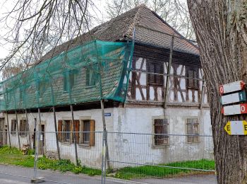
• Symbol: weiße 2 auf grünem Grund
![Tour Zu Fuß Hohenberg an der Eger - Wanderweg 1 Hohenberg a.d. Eger - Photo](https://media.geolcdn.com/t/350/260/dc15ae97-3c51-40b0-b17d-17e5cbcabf43.jpeg&format=jpg&maxdim=2)
![Zu Fuß Zu Fuß](https://static1.geolcdn.com/sitytour/trail-icons/100.png)
Km
Zu Fuß
![](/images/other/stat-length.png)
![](https://static1.geolcdn.com/siteimages/upload/files/1508320355ic_sort_den_pos_24dp.png)
![](https://static1.geolcdn.com/siteimages/upload/files/1508320355ic_sort_den_neg_24dp.png)
![](https://static1.geolcdn.com/siteimages/upload/files/16400158638029165_repeat_loop_refresh_sync_direction_icon.png)
• Symbol: Weiße 1 auf grünem Grund
![Tour Zu Fuß Nagel - DE-5 - Photo](https://media.geolcdn.com/t/350/260/e92ae428-47fc-47ca-8275-4bf7e9e06e81.jpeg&format=jpg&maxdim=2)
![Zu Fuß Zu Fuß](https://static1.geolcdn.com/sitytour/trail-icons/100.png)
Km
Zu Fuß
![](/images/other/stat-length.png)
![](https://static1.geolcdn.com/siteimages/upload/files/1508320355ic_sort_den_pos_24dp.png)
![](https://static1.geolcdn.com/siteimages/upload/files/1508320355ic_sort_den_neg_24dp.png)
![](https://static1.geolcdn.com/siteimages/upload/files/16400158638029165_repeat_loop_refresh_sync_direction_icon.png)
• Trail created by Fichtelgebirgsverein.
![Tour Zu Fuß Wunsiedel - Bad Alexandersbad - Rundwanderweg Nr. 6 - - Photo](https://media.geolcdn.com/t/350/260/672c5ddc-ce2f-40e9-bed9-755a232c3128.jpeg&format=jpg&maxdim=2)
![Zu Fuß Zu Fuß](https://static1.geolcdn.com/sitytour/trail-icons/100.png)
Km
Zu Fuß
![](/images/other/stat-length.png)
![](https://static1.geolcdn.com/siteimages/upload/files/1508320355ic_sort_den_pos_24dp.png)
![](https://static1.geolcdn.com/siteimages/upload/files/1508320355ic_sort_den_neg_24dp.png)
![](https://static1.geolcdn.com/siteimages/upload/files/16400158638029165_repeat_loop_refresh_sync_direction_icon.png)
• Symbol: rote 6 auf weißem Grund
![Tour Zu Fuß Hohenberg an der Eger - Hohenberg 3 - Photo](https://media.geolcdn.com/t/350/260/175e67bc-1377-44a3-95b9-ce0dcc591fa1.jpeg&format=jpg&maxdim=2)
![Zu Fuß Zu Fuß](https://static1.geolcdn.com/sitytour/trail-icons/100.png)
Km
Zu Fuß
![](/images/other/stat-length.png)
![](https://static1.geolcdn.com/siteimages/upload/files/1508320355ic_sort_den_pos_24dp.png)
![](https://static1.geolcdn.com/siteimages/upload/files/1508320355ic_sort_den_neg_24dp.png)
![](https://static1.geolcdn.com/siteimages/upload/files/16400158638029165_repeat_loop_refresh_sync_direction_icon.png)
• Symbol: weiße 3 auf grünem Grund
![Tour Zu Fuß Wunsiedel - Landschaftslehrpfad Wunsiedel - Photo](https://media.geolcdn.com/t/350/260/3b951211-e7cc-42d9-be8d-c47590a45769.jpeg&format=jpg&maxdim=2)
![Zu Fuß Zu Fuß](https://static1.geolcdn.com/sitytour/trail-icons/100.png)
Km
Zu Fuß
![](/images/other/stat-length.png)
![](https://static1.geolcdn.com/siteimages/upload/files/1508320355ic_sort_den_pos_24dp.png)
![](https://static1.geolcdn.com/siteimages/upload/files/1508320355ic_sort_den_neg_24dp.png)
![](https://static1.geolcdn.com/siteimages/upload/files/16400158638029165_repeat_loop_refresh_sync_direction_icon.png)
• Symbol: grüner Ring auf weißem Grund
![Tour Zu Fuß Arzberg - Arzberg [6] Humboldweg - Photo](https://media.geolcdn.com/t/350/260/e6596be1-2cee-4ec3-8879-4b964cf9e914.jpeg&format=jpg&maxdim=2)
![Zu Fuß Zu Fuß](https://static1.geolcdn.com/sitytour/trail-icons/100.png)
Km
Zu Fuß
![](/images/other/stat-length.png)
![](https://static1.geolcdn.com/siteimages/upload/files/1508320355ic_sort_den_pos_24dp.png)
![](https://static1.geolcdn.com/siteimages/upload/files/1508320355ic_sort_den_neg_24dp.png)
![](https://static1.geolcdn.com/siteimages/upload/files/16400158638029165_repeat_loop_refresh_sync_direction_icon.png)
• Trail created by Fichtelgebirgsverein. Symbol: Weiße 6 auf rechteckigen, grünen Grund
![Tour Zu Fuß Arzberg - Arzberg [5] Museumsweg - Photo](https://media.geolcdn.com/t/350/260/e6596be1-2cee-4ec3-8879-4b964cf9e914.jpeg&format=jpg&maxdim=2)
![Zu Fuß Zu Fuß](https://static1.geolcdn.com/sitytour/trail-icons/100.png)
Km
Zu Fuß
![](/images/other/stat-length.png)
![](https://static1.geolcdn.com/siteimages/upload/files/1508320355ic_sort_den_pos_24dp.png)
![](https://static1.geolcdn.com/siteimages/upload/files/1508320355ic_sort_den_neg_24dp.png)
![](https://static1.geolcdn.com/siteimages/upload/files/16400158638029165_repeat_loop_refresh_sync_direction_icon.png)
• Trail created by Fichtelgebirgsverein. Symbol: Weiße 5 auf rundem/rechteckigen grünen Grund
20 Angezeigte Touren bei 106
Kostenlosegpshiking-Anwendung