![](/images/other/stat-length.png)
- Touren
- Zu Fuß
- Czech Republic
- Nordwesten
- Aussiger Region
Aussiger Region, Nordwesten, Zu Fuß: Die besten Touren, Trails, Trecks und Wanderungen
Aussiger Region : Entdecken Sie die besten Touren : 89 zu fuß und 4 wandern. Alle diese Touren, Trails, Routen und Outdoor-Aktivitäten sind in unseren SityTrail-Apps für Smartphones und Tablets verfügbar.
Die besten Spuren (93)
![Tour Zu Fuß Tissa - [Z] Tisá (bus) – Ostrov - Photo](https://media.geolcdn.com/t/350/260/78f4b062-24a7-4483-95d6-be239bd66196.jpeg&format=jpg&maxdim=2)
![Zu Fuß Zu Fuß](https://static1.geolcdn.com/sitytour/trail-icons/100.png)
Km
Zu Fuß
![](/images/other/stat-length.png)
![](https://static1.geolcdn.com/siteimages/upload/files/1508320355ic_sort_den_pos_24dp.png)
![](https://static1.geolcdn.com/siteimages/upload/files/1508320355ic_sort_den_neg_24dp.png)
![](https://static1.geolcdn.com/siteimages/upload/files/16400158638029165_repeat_loop_refresh_sync_direction_icon.png)
• Tour erstellt von cz:KČT.
![Tour Zu Fuß Wegstädtl - NS Loupežníka Štětky - Photo](https://media.geolcdn.com/t/350/260/51ee37d2-ab1d-4d8a-8573-145cb4c1f798.jpeg&format=jpg&maxdim=2)
![Zu Fuß Zu Fuß](https://static1.geolcdn.com/sitytour/trail-icons/100.png)
Km
Zu Fuß
![](/images/other/stat-length.png)
![](https://static1.geolcdn.com/siteimages/upload/files/1508320355ic_sort_den_pos_24dp.png)
![](https://static1.geolcdn.com/siteimages/upload/files/1508320355ic_sort_den_neg_24dp.png)
![](https://static1.geolcdn.com/siteimages/upload/files/16400158638029165_repeat_loop_refresh_sync_direction_icon.png)
• Tour erstellt von cz:KČT.
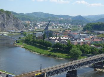
![Tour Zu Fuß Aussig - [Z] Sebuzín - Litoměřice - Photo](https://media.geolcdn.com/t/350/260/167dfb07-9404-4e35-a708-f0ca52d05b8b.jpeg&format=jpg&maxdim=2)
![Zu Fuß Zu Fuß](https://static1.geolcdn.com/sitytour/trail-icons/100.png)
Km
Zu Fuß
![](/images/other/stat-length.png)
![](https://static1.geolcdn.com/siteimages/upload/files/1508320355ic_sort_den_pos_24dp.png)
![](https://static1.geolcdn.com/siteimages/upload/files/1508320355ic_sort_den_neg_24dp.png)
![](https://static1.geolcdn.com/siteimages/upload/files/16400158638029165_repeat_loop_refresh_sync_direction_icon.png)
• Tour erstellt von cz:KČT.
![Tour Zu Fuß Hainspach - Kirchsteig - Photo](https://media.geolcdn.com/t/350/260/a598bad9-45e8-43ba-b178-6c26761dd1d3.jpeg&format=jpg&maxdim=2)
![Zu Fuß Zu Fuß](https://static1.geolcdn.com/sitytour/trail-icons/100.png)
Km
Zu Fuß
![](/images/other/stat-length.png)
![](https://static1.geolcdn.com/siteimages/upload/files/1508320355ic_sort_den_pos_24dp.png)
![](https://static1.geolcdn.com/siteimages/upload/files/1508320355ic_sort_den_neg_24dp.png)
![](https://static1.geolcdn.com/siteimages/upload/files/16400158638029165_repeat_loop_refresh_sync_direction_icon.png)
• vom Erbgericht bis Kirche Wehrsdorf fehlt noch ein Stück Symbol: white church
![Tour Zu Fuß Schönlinde - [M] Brtnický okruh - Photo](https://media.geolcdn.com/t/350/260/2c25ed32-bc80-4d66-bfb8-31499feb073b.jpeg&format=jpg&maxdim=2)
![Zu Fuß Zu Fuß](https://static1.geolcdn.com/sitytour/trail-icons/100.png)
Km
Zu Fuß
![](/images/other/stat-length.png)
![](https://static1.geolcdn.com/siteimages/upload/files/1508320355ic_sort_den_pos_24dp.png)
![](https://static1.geolcdn.com/siteimages/upload/files/1508320355ic_sort_den_neg_24dp.png)
![](https://static1.geolcdn.com/siteimages/upload/files/16400158638029165_repeat_loop_refresh_sync_direction_icon.png)
• Tour erstellt von cz:KČT.
![Tour Zu Fuß Kreschitz - [M] Horní Řepčice - Křešice - Photo](https://media.geolcdn.com/t/350/260/17abcfa0-1fb4-49f5-9ce4-d3fc27610efa.jpeg&format=jpg&maxdim=2)
![Zu Fuß Zu Fuß](https://static1.geolcdn.com/sitytour/trail-icons/100.png)
Km
Zu Fuß
![](/images/other/stat-length.png)
![](https://static1.geolcdn.com/siteimages/upload/files/1508320355ic_sort_den_pos_24dp.png)
![](https://static1.geolcdn.com/siteimages/upload/files/1508320355ic_sort_den_neg_24dp.png)
![](https://static1.geolcdn.com/siteimages/upload/files/16400158638029165_repeat_loop_refresh_sync_direction_icon.png)
• Tour erstellt von cz:KČT.
![Tour Zu Fuß Schluckenau - NS Šluknov - Rožany - Královka - Photo](https://media.geolcdn.com/t/350/260/b1e44d18-3351-4729-9b7f-d48e8ddfd66f.jpeg&format=jpg&maxdim=2)
![Zu Fuß Zu Fuß](https://static1.geolcdn.com/sitytour/trail-icons/100.png)
Km
Zu Fuß
![](/images/other/stat-length.png)
![](https://static1.geolcdn.com/siteimages/upload/files/1508320355ic_sort_den_pos_24dp.png)
![](https://static1.geolcdn.com/siteimages/upload/files/1508320355ic_sort_den_neg_24dp.png)
![](https://static1.geolcdn.com/siteimages/upload/files/16400158638029165_repeat_loop_refresh_sync_direction_icon.png)
• Tour erstellt von SŠ lesnická, Šluknov. zakresleno podle cedule s mapou NS umístěnou pod Šluknovským zámkem
![Tour Zu Fuß Niedergrund - Hornícká NS Údolí Milířky - Photo](https://media.geolcdn.com/t/350/260/19b06cf1-f78e-4613-a2f2-e9ab759b0997.jpeg&format=jpg&maxdim=2)
![Zu Fuß Zu Fuß](https://static1.geolcdn.com/sitytour/trail-icons/100.png)
Km
Zu Fuß
![](/images/other/stat-length.png)
![](https://static1.geolcdn.com/siteimages/upload/files/1508320355ic_sort_den_pos_24dp.png)
![](https://static1.geolcdn.com/siteimages/upload/files/1508320355ic_sort_den_neg_24dp.png)
![](https://static1.geolcdn.com/siteimages/upload/files/16400158638029165_repeat_loop_refresh_sync_direction_icon.png)
• Tour erstellt von cz:KČT.
![Tour Zu Fuß Aussig - NS Větruše - Vrkoč - Photo](https://media.geolcdn.com/t/350/260/250088a6-b70f-4cc7-991c-bc5c16d5177e.jpeg&format=jpg&maxdim=2)
![Zu Fuß Zu Fuß](https://static1.geolcdn.com/sitytour/trail-icons/100.png)
Km
Zu Fuß
![](/images/other/stat-length.png)
![](https://static1.geolcdn.com/siteimages/upload/files/1508320355ic_sort_den_pos_24dp.png)
![](https://static1.geolcdn.com/siteimages/upload/files/1508320355ic_sort_den_neg_24dp.png)
![](https://static1.geolcdn.com/siteimages/upload/files/16400158638029165_repeat_loop_refresh_sync_direction_icon.png)
• Tour erstellt von cz:KČT.
![Tour Zu Fuß Niklasberg - Sklářská NS - Photo](https://media.geolcdn.com/t/350/260/b7c25c96-f53a-4e8a-b4e4-c4dbddd64bdc.jpeg&format=jpg&maxdim=2)
![Zu Fuß Zu Fuß](https://static1.geolcdn.com/sitytour/trail-icons/100.png)
Km
Zu Fuß
![](/images/other/stat-length.png)
![](https://static1.geolcdn.com/siteimages/upload/files/1508320355ic_sort_den_pos_24dp.png)
![](https://static1.geolcdn.com/siteimages/upload/files/1508320355ic_sort_den_neg_24dp.png)
![](https://static1.geolcdn.com/siteimages/upload/files/16400158638029165_repeat_loop_refresh_sync_direction_icon.png)
• Tour erstellt von cz:KČT.
![Tour Zu Fuß Dittersbach - [Z] Dolský mlýn - Pod Borovinou - Photo](https://media.geolcdn.com/t/350/260/cc7734bc-a1cb-44c1-a579-3999a7e367e8.jpeg&format=jpg&maxdim=2)
![Zu Fuß Zu Fuß](https://static1.geolcdn.com/sitytour/trail-icons/100.png)
Km
Zu Fuß
![](/images/other/stat-length.png)
![](https://static1.geolcdn.com/siteimages/upload/files/1508320355ic_sort_den_pos_24dp.png)
![](https://static1.geolcdn.com/siteimages/upload/files/1508320355ic_sort_den_neg_24dp.png)
![](https://static1.geolcdn.com/siteimages/upload/files/16400158638029165_repeat_loop_refresh_sync_direction_icon.png)
• Tour erstellt von cz:KČT.
![Tour Zu Fuß Pömmerle - CZ-7044 - Photo](https://media.geolcdn.com/t/350/260/f0d5583d-de2b-4558-b8cc-423fe7624603.jpeg&format=jpg&maxdim=2)
![Zu Fuß Zu Fuß](https://static1.geolcdn.com/sitytour/trail-icons/100.png)
Km
Zu Fuß
![](/images/other/stat-length.png)
![](https://static1.geolcdn.com/siteimages/upload/files/1508320355ic_sort_den_pos_24dp.png)
![](https://static1.geolcdn.com/siteimages/upload/files/1508320355ic_sort_den_neg_24dp.png)
![](https://static1.geolcdn.com/siteimages/upload/files/16400158638029165_repeat_loop_refresh_sync_direction_icon.png)
• Tour erstellt von cz:KČT.
![Tour Zu Fuß Kriegern - [M] Nepomyšl - Kryry - Photo](https://media.geolcdn.com/t/350/260/a2408f13-d402-4160-be99-95020e040a2f.jpeg&format=jpg&maxdim=2)
![Zu Fuß Zu Fuß](https://static1.geolcdn.com/sitytour/trail-icons/100.png)
Km
Zu Fuß
![](/images/other/stat-length.png)
![](https://static1.geolcdn.com/siteimages/upload/files/1508320355ic_sort_den_pos_24dp.png)
![](https://static1.geolcdn.com/siteimages/upload/files/1508320355ic_sort_den_neg_24dp.png)
![](https://static1.geolcdn.com/siteimages/upload/files/16400158638029165_repeat_loop_refresh_sync_direction_icon.png)
• Tour erstellt von cz:KČT.
![Tour Zu Fuß Eywan - [Z] Poplze - Horka - Photo](https://media.geolcdn.com/t/350/260/58b6020a-01a4-4926-b083-ab4b33d6a3be.jpeg&format=jpg&maxdim=2)
![Zu Fuß Zu Fuß](https://static1.geolcdn.com/sitytour/trail-icons/100.png)
Km
Zu Fuß
![](/images/other/stat-length.png)
![](https://static1.geolcdn.com/siteimages/upload/files/1508320355ic_sort_den_pos_24dp.png)
![](https://static1.geolcdn.com/siteimages/upload/files/1508320355ic_sort_den_neg_24dp.png)
![](https://static1.geolcdn.com/siteimages/upload/files/16400158638029165_repeat_loop_refresh_sync_direction_icon.png)
• Tour erstellt von cz:KČT.
![Tour Zu Fuß Klein Tschernosek - NS Brána Čech - Photo](https://media.geolcdn.com/t/350/260/01ba7aae-79f0-4028-9750-4bcd786203bb.jpeg&format=jpg&maxdim=2)
![Zu Fuß Zu Fuß](https://static1.geolcdn.com/sitytour/trail-icons/100.png)
Km
Zu Fuß
![](/images/other/stat-length.png)
![](https://static1.geolcdn.com/siteimages/upload/files/1508320355ic_sort_den_pos_24dp.png)
![](https://static1.geolcdn.com/siteimages/upload/files/1508320355ic_sort_den_neg_24dp.png)
![](https://static1.geolcdn.com/siteimages/upload/files/16400158638029165_repeat_loop_refresh_sync_direction_icon.png)
• Tour erstellt von cz:KČT.
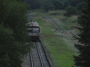
![Tour Zu Fuß Kreibitz - [M] Chřibská - Rybniště (žst) - Photo](https://media.geolcdn.com/t/350/260/ec85bc98-2fdb-4814-b82a-0c53d51cc939.jpeg&format=jpg&maxdim=2)
![Zu Fuß Zu Fuß](https://static1.geolcdn.com/sitytour/trail-icons/100.png)
Km
Zu Fuß
![](/images/other/stat-length.png)
![](https://static1.geolcdn.com/siteimages/upload/files/1508320355ic_sort_den_pos_24dp.png)
![](https://static1.geolcdn.com/siteimages/upload/files/1508320355ic_sort_den_neg_24dp.png)
![](https://static1.geolcdn.com/siteimages/upload/files/16400158638029165_repeat_loop_refresh_sync_direction_icon.png)
• Tour erstellt von cz:KČT.
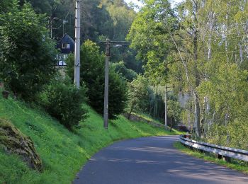
![Tour Zu Fuß Güntersdorf - [Z] Oleška - Srbská Kamenice - Photo](https://media.geolcdn.com/t/350/260/b671590f-17dc-4f55-a338-c89d99bb2f15.jpeg&format=jpg&maxdim=2)
![Zu Fuß Zu Fuß](https://static1.geolcdn.com/sitytour/trail-icons/100.png)
Km
Zu Fuß
![](/images/other/stat-length.png)
![](https://static1.geolcdn.com/siteimages/upload/files/1508320355ic_sort_den_pos_24dp.png)
![](https://static1.geolcdn.com/siteimages/upload/files/1508320355ic_sort_den_neg_24dp.png)
![](https://static1.geolcdn.com/siteimages/upload/files/16400158638029165_repeat_loop_refresh_sync_direction_icon.png)
• Tour erstellt von cz:KČT.
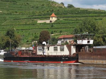
![Tour Zu Fuß Aussig - [Z] Dobětice - Velké Chvojno - Photo](https://media.geolcdn.com/t/350/260/92f062a0-9eab-432b-8d79-33bfa2de2d0d.jpeg&format=jpg&maxdim=2)
![Zu Fuß Zu Fuß](https://static1.geolcdn.com/sitytour/trail-icons/100.png)
Km
Zu Fuß
![](/images/other/stat-length.png)
![](https://static1.geolcdn.com/siteimages/upload/files/1508320355ic_sort_den_pos_24dp.png)
![](https://static1.geolcdn.com/siteimages/upload/files/1508320355ic_sort_den_neg_24dp.png)
![](https://static1.geolcdn.com/siteimages/upload/files/16400158638029165_repeat_loop_refresh_sync_direction_icon.png)
• Tour erstellt von cz:KČT.
![Tour Zu Fuß Kreschitz - NS Křešická výprava - Photo](https://media.geolcdn.com/t/350/260/9f5ac93e-e199-4c35-8b6c-18deb6e92af1.jpeg&format=jpg&maxdim=2)
![Zu Fuß Zu Fuß](https://static1.geolcdn.com/sitytour/trail-icons/100.png)
Km
Zu Fuß
![](/images/other/stat-length.png)
![](https://static1.geolcdn.com/siteimages/upload/files/1508320355ic_sort_den_pos_24dp.png)
![](https://static1.geolcdn.com/siteimages/upload/files/1508320355ic_sort_den_neg_24dp.png)
![](https://static1.geolcdn.com/siteimages/upload/files/16400158638029165_repeat_loop_refresh_sync_direction_icon.png)
• Tour erstellt von cz:KČT.
![Tour Zu Fuß Markersdorf - Soutěskou Olešničky (návrh) - Photo](https://media.geolcdn.com/t/350/260/7541f040-dab6-4470-8230-4b0484cdba6a.jpeg&format=jpg&maxdim=2)
![Zu Fuß Zu Fuß](https://static1.geolcdn.com/sitytour/trail-icons/100.png)
Km
Zu Fuß
![](/images/other/stat-length.png)
![](https://static1.geolcdn.com/siteimages/upload/files/1508320355ic_sort_den_pos_24dp.png)
![](https://static1.geolcdn.com/siteimages/upload/files/1508320355ic_sort_den_neg_24dp.png)
![](https://static1.geolcdn.com/siteimages/upload/files/16400158638029165_repeat_loop_refresh_sync_direction_icon.png)
• Tour erstellt von Triangl Markvartice.
20 Angezeigte Touren bei 93
Kostenlosegpshiking-Anwendung
Aktivitäten
Nahegelegene Regionen
- Auscha
- Aussig
- Bensen
- Bilin
- Böhmisch Wiesenthal
- Brüx
- Christophhammer
- Czalositz
- Dittersbach
- Dobříň
- Domauschitz
- Drabschitz
- Dux
- Eichwald
- Eulau
- Eywan
- Göhren
- Gross-Holetitz
- Groß Tschochau
- Großpriesen
- Güntersdorf
- Hainspach
- Herrnskretschen
- Hrobetz
- Jmling
- Jonsdorf
- Kaaden
- Klein Priesen
- Klein Tschernosek
- Klostergrab
- Klösterle an der Eger
- Komotau
- Kostenblat
- Krabschitz
- Kreibitz
- Kreschitz
- Kriegern
- Kupferberg
- Laun
- Leitmeritz
- Leutensdorf
- Libochowan
- Liboteinitz
- Liebeschitz
- Malschen
- Markersdorf
- Niedergrund
- Niklasberg
- Perutz
- Pflanzendorf
- Pistian
- Pömmerle
- Postelberg
- Priesten
- Ratschitz
- Raudnitz an der Elbe
- Rosendorf
- Rudig
- Sankt Katharinaberg
- Schluckenau
- Schönbach
- Schönhof
- Schönlinde
- Teplitz
- Tetschen
- Theresienstadt
- Tissa
- Trebnitz
- Wchinitz
- Wegstädtl
- Welemin
- Welhota an der Elbe
- Wraschkow
- Záluží