![](/images/other/stat-length.png)
- Touren
- Zu Fuß
- Czech Republic
- Südwesten
- Pilsner Region
Pilsner Region, Südwesten, Zu Fuß: Die besten Touren, Trails, Trecks und Wanderungen
Pilsner Region : Entdecken Sie die besten Touren : 157 zu fuß und 3 wandern. Alle diese Touren, Trails, Routen und Outdoor-Aktivitäten sind in unseren SityTrail-Apps für Smartphones und Tablets verfügbar.
Die besten Spuren (160)
![Tour Zu Fuß Hradiště - Naučná stezka údolím Hradišťského potoka - Photo](https://media.geolcdn.com/t/350/260/cfba48ed-efcf-408d-900f-1d77342522c7.jpeg&format=jpg&maxdim=2)
![Zu Fuß Zu Fuß](https://static1.geolcdn.com/sitytour/trail-icons/100.png)
Km
Zu Fuß
![](/images/other/stat-length.png)
![](https://static1.geolcdn.com/siteimages/upload/files/1508320355ic_sort_den_pos_24dp.png)
![](https://static1.geolcdn.com/siteimages/upload/files/1508320355ic_sort_den_neg_24dp.png)
![](https://static1.geolcdn.com/siteimages/upload/files/16400158638029165_repeat_loop_refresh_sync_direction_icon.png)
• Tour erstellt von local.
![Tour Zu Fuß Strašice - Naučná stezka Okolím Padrťských rybníků - Photo](https://media.geolcdn.com/t/350/260/e147a7f2-eddb-4a26-9a0c-ab5091189530.jpeg&format=jpg&maxdim=2)
![Zu Fuß Zu Fuß](https://static1.geolcdn.com/sitytour/trail-icons/100.png)
Km
Zu Fuß
![](/images/other/stat-length.png)
![](https://static1.geolcdn.com/siteimages/upload/files/1508320355ic_sort_den_pos_24dp.png)
![](https://static1.geolcdn.com/siteimages/upload/files/1508320355ic_sort_den_neg_24dp.png)
![](https://static1.geolcdn.com/siteimages/upload/files/16400158638029165_repeat_loop_refresh_sync_direction_icon.png)
• Tour erstellt von Vojenské lesy a statky ČR.
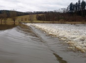
![Tour Zu Fuß Lettin - [Ž] Bzí - Svárkov - Photo](https://media.geolcdn.com/t/350/260/e4fcdbd7-7501-40ad-9c2a-0022772a1930.jpeg&format=jpg&maxdim=2)
![Zu Fuß Zu Fuß](https://static1.geolcdn.com/sitytour/trail-icons/100.png)
Km
Zu Fuß
![](/images/other/stat-length.png)
![](https://static1.geolcdn.com/siteimages/upload/files/1508320355ic_sort_den_pos_24dp.png)
![](https://static1.geolcdn.com/siteimages/upload/files/1508320355ic_sort_den_neg_24dp.png)
![](https://static1.geolcdn.com/siteimages/upload/files/16400158638029165_repeat_loop_refresh_sync_direction_icon.png)
• Tour erstellt von cz:KČT.
![Tour Zu Fuß Rehberg - NS Vchynickotetovský kanál - Photo](https://media.geolcdn.com/t/350/260/f4278703-5248-4266-99fa-1be45fd1e5c4.jpeg&format=jpg&maxdim=2)
![Zu Fuß Zu Fuß](https://static1.geolcdn.com/sitytour/trail-icons/100.png)
Km
Zu Fuß
![](/images/other/stat-length.png)
![](https://static1.geolcdn.com/siteimages/upload/files/1508320355ic_sort_den_pos_24dp.png)
![](https://static1.geolcdn.com/siteimages/upload/files/1508320355ic_sort_den_neg_24dp.png)
![](https://static1.geolcdn.com/siteimages/upload/files/16400158638029165_repeat_loop_refresh_sync_direction_icon.png)
• Tour erstellt von cz:KČT.
![Tour Zu Fuß Klattau - Klatovský vycházkový okruh - Photo](https://media.geolcdn.com/t/350/260/c2bdaf4f-2e51-4ed0-8119-43d147205574.jpeg&format=jpg&maxdim=2)
![Zu Fuß Zu Fuß](https://static1.geolcdn.com/sitytour/trail-icons/100.png)
Km
Zu Fuß
![](/images/other/stat-length.png)
![](https://static1.geolcdn.com/siteimages/upload/files/1508320355ic_sort_den_pos_24dp.png)
![](https://static1.geolcdn.com/siteimages/upload/files/1508320355ic_sort_den_neg_24dp.png)
![](https://static1.geolcdn.com/siteimages/upload/files/16400158638029165_repeat_loop_refresh_sync_direction_icon.png)
• Tour erstellt von cz:KČT.
![Tour Zu Fuß Paschnitz - NS V Zelenovském údolí - Photo](https://media.geolcdn.com/t/350/260/7f53a9ec-191b-4744-9d29-3bda323bc9c5.jpeg&format=jpg&maxdim=2)
![Zu Fuß Zu Fuß](https://static1.geolcdn.com/sitytour/trail-icons/100.png)
Km
Zu Fuß
![](/images/other/stat-length.png)
![](https://static1.geolcdn.com/siteimages/upload/files/1508320355ic_sort_den_pos_24dp.png)
![](https://static1.geolcdn.com/siteimages/upload/files/1508320355ic_sort_den_neg_24dp.png)
![](https://static1.geolcdn.com/siteimages/upload/files/16400158638029165_repeat_loop_refresh_sync_direction_icon.png)
• Tour erstellt von cz:KČT.
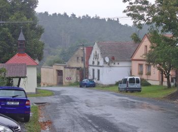
![Tour Zu Fuß Neuern - [Ž]-Vycházkový okruh okolím Nýrska - Photo](https://media.geolcdn.com/t/350/260/b0f51d5c-6d8f-4cc1-a603-97fa4a19a981.jpeg&format=jpg&maxdim=2)
![Zu Fuß Zu Fuß](https://static1.geolcdn.com/sitytour/trail-icons/100.png)
Km
Zu Fuß
![](/images/other/stat-length.png)
![](https://static1.geolcdn.com/siteimages/upload/files/1508320355ic_sort_den_pos_24dp.png)
![](https://static1.geolcdn.com/siteimages/upload/files/1508320355ic_sort_den_neg_24dp.png)
![](https://static1.geolcdn.com/siteimages/upload/files/16400158638029165_repeat_loop_refresh_sync_direction_icon.png)
• Tour erstellt von cz:KČT.
![Tour Zu Fuß Neuern - [Z]-Vycházkový okruh okolím Nýrska - Photo](https://media.geolcdn.com/t/350/260/b0f51d5c-6d8f-4cc1-a603-97fa4a19a981.jpeg&format=jpg&maxdim=2)
![Zu Fuß Zu Fuß](https://static1.geolcdn.com/sitytour/trail-icons/100.png)
Km
Zu Fuß
![](/images/other/stat-length.png)
![](https://static1.geolcdn.com/siteimages/upload/files/1508320355ic_sort_den_pos_24dp.png)
![](https://static1.geolcdn.com/siteimages/upload/files/1508320355ic_sort_den_neg_24dp.png)
![](https://static1.geolcdn.com/siteimages/upload/files/16400158638029165_repeat_loop_refresh_sync_direction_icon.png)
• Tour erstellt von cz:KČT.
![Tour Zu Fuß Dešenice - NS Po stopách formanů - Photo](https://media.geolcdn.com/t/350/260/07ac804b-bc72-4bd0-a5fc-a53a1f3855e1.jpeg&format=jpg&maxdim=2)
![Zu Fuß Zu Fuß](https://static1.geolcdn.com/sitytour/trail-icons/100.png)
Km
Zu Fuß
![](/images/other/stat-length.png)
![](https://static1.geolcdn.com/siteimages/upload/files/1508320355ic_sort_den_pos_24dp.png)
![](https://static1.geolcdn.com/siteimages/upload/files/1508320355ic_sort_den_neg_24dp.png)
![](https://static1.geolcdn.com/siteimages/upload/files/16400158638029165_repeat_loop_refresh_sync_direction_icon.png)
• Tour erstellt von cz:KČT.
![Tour Zu Fuß Altpilsen - NS Skalní stezka - Photo](https://media.geolcdn.com/t/350/260/99fd8888-e9d4-421e-81ba-1b9cee914a52.jpeg&format=jpg&maxdim=2)
![Zu Fuß Zu Fuß](https://static1.geolcdn.com/sitytour/trail-icons/100.png)
Km
Zu Fuß
![](/images/other/stat-length.png)
![](https://static1.geolcdn.com/siteimages/upload/files/1508320355ic_sort_den_pos_24dp.png)
![](https://static1.geolcdn.com/siteimages/upload/files/1508320355ic_sort_den_neg_24dp.png)
![](https://static1.geolcdn.com/siteimages/upload/files/16400158638029165_repeat_loop_refresh_sync_direction_icon.png)
• Tour erstellt von cz:KČT.
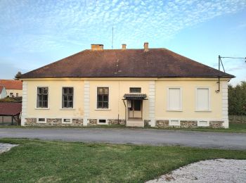
![Tour Zu Fuß Strašice - [Č] Obecnice -Mišov - Photo](https://media.geolcdn.com/t/350/260/e4f8ab1a-681d-4bf3-8056-1f08151308ff.jpeg&format=jpg&maxdim=2)
![Zu Fuß Zu Fuß](https://static1.geolcdn.com/sitytour/trail-icons/100.png)
Km
Zu Fuß
![](/images/other/stat-length.png)
![](https://static1.geolcdn.com/siteimages/upload/files/1508320355ic_sort_den_pos_24dp.png)
![](https://static1.geolcdn.com/siteimages/upload/files/1508320355ic_sort_den_neg_24dp.png)
![](https://static1.geolcdn.com/siteimages/upload/files/16400158638029165_repeat_loop_refresh_sync_direction_icon.png)
• Tour erstellt von cz:KČT.
![Tour Zu Fuß Borovno - CZ-6738 - Photo](https://media.geolcdn.com/t/350/260/767d9bea-975c-4c40-a228-b9b766707864.jpeg&format=jpg&maxdim=2)
![Zu Fuß Zu Fuß](https://static1.geolcdn.com/sitytour/trail-icons/100.png)
Km
Zu Fuß
![](/images/other/stat-length.png)
![](https://static1.geolcdn.com/siteimages/upload/files/1508320355ic_sort_den_pos_24dp.png)
![](https://static1.geolcdn.com/siteimages/upload/files/1508320355ic_sort_den_neg_24dp.png)
![](https://static1.geolcdn.com/siteimages/upload/files/16400158638029165_repeat_loop_refresh_sync_direction_icon.png)
• Tour erstellt von cz:KČT. úsek mezi Maráskem a Borovnem byl přečíslován na trasu
![Tour Zu Fuß Dobschitsch - NS Kaňonem Horní Berounky - Photo](https://media.geolcdn.com/t/350/260/2e6ab8bb-46bd-4085-a6c4-7e3f92c7f9af.jpeg&format=jpg&maxdim=2)
![Zu Fuß Zu Fuß](https://static1.geolcdn.com/sitytour/trail-icons/100.png)
Km
Zu Fuß
![](/images/other/stat-length.png)
![](https://static1.geolcdn.com/siteimages/upload/files/1508320355ic_sort_den_pos_24dp.png)
![](https://static1.geolcdn.com/siteimages/upload/files/1508320355ic_sort_den_neg_24dp.png)
![](https://static1.geolcdn.com/siteimages/upload/files/16400158638029165_repeat_loop_refresh_sync_direction_icon.png)
• marked by wooden guideposts
![Tour Zu Fuß Jarau - Jarovská NS - varianta pro kočárky - Photo](https://media.geolcdn.com/t/350/260/e2c29d8c-0e7c-4a7e-b78b-a4d99d38e0f9.jpeg&format=jpg&maxdim=2)
![Zu Fuß Zu Fuß](https://static1.geolcdn.com/sitytour/trail-icons/100.png)
Km
Zu Fuß
![](/images/other/stat-length.png)
![](https://static1.geolcdn.com/siteimages/upload/files/1508320355ic_sort_den_pos_24dp.png)
![](https://static1.geolcdn.com/siteimages/upload/files/1508320355ic_sort_den_neg_24dp.png)
![](https://static1.geolcdn.com/siteimages/upload/files/16400158638029165_repeat_loop_refresh_sync_direction_icon.png)
• Tour erstellt von cz:KČT.
![Tour Zu Fuß Jarau - Jarovská NS - Photo](https://media.geolcdn.com/t/350/260/0d0f4706-2f6e-402e-8299-9ef4c982f824.jpeg&format=jpg&maxdim=2)
![Zu Fuß Zu Fuß](https://static1.geolcdn.com/sitytour/trail-icons/100.png)
Km
Zu Fuß
![](/images/other/stat-length.png)
![](https://static1.geolcdn.com/siteimages/upload/files/1508320355ic_sort_den_pos_24dp.png)
![](https://static1.geolcdn.com/siteimages/upload/files/1508320355ic_sort_den_neg_24dp.png)
![](https://static1.geolcdn.com/siteimages/upload/files/16400158638029165_repeat_loop_refresh_sync_direction_icon.png)
• Tour erstellt von MÚ Jarov. Website: http://www.oujarov.cz/jarovska-naucna-stezka/
![Tour Zu Fuß Bergreichenstein - Vlastivědný okruh - Photo](https://media.geolcdn.com/t/350/260/9475596a-83f9-4cea-a5e1-6093cac8cb5d.jpeg&format=jpg&maxdim=2)
![Zu Fuß Zu Fuß](https://static1.geolcdn.com/sitytour/trail-icons/100.png)
Km
Zu Fuß
![](/images/other/stat-length.png)
![](https://static1.geolcdn.com/siteimages/upload/files/1508320355ic_sort_den_pos_24dp.png)
![](https://static1.geolcdn.com/siteimages/upload/files/1508320355ic_sort_den_neg_24dp.png)
![](https://static1.geolcdn.com/siteimages/upload/files/16400158638029165_repeat_loop_refresh_sync_direction_icon.png)
• Tour erstellt von Město Kašperské Hory.
![Tour Zu Fuß Bergreichenstein - Kolem Pranýře za výhledy - Photo](https://media.geolcdn.com/t/350/260/256a2caf-9170-4ee7-afb3-8d96d391db52.jpeg&format=jpg&maxdim=2)
![Zu Fuß Zu Fuß](https://static1.geolcdn.com/sitytour/trail-icons/100.png)
Km
Zu Fuß
![](/images/other/stat-length.png)
![](https://static1.geolcdn.com/siteimages/upload/files/1508320355ic_sort_den_pos_24dp.png)
![](https://static1.geolcdn.com/siteimages/upload/files/1508320355ic_sort_den_neg_24dp.png)
![](https://static1.geolcdn.com/siteimages/upload/files/16400158638029165_repeat_loop_refresh_sync_direction_icon.png)
• Tour erstellt von Město Kašperské Hory.
![Tour Zu Fuß Bergreichenstein - Na Kašperk jinak - Photo](https://media.geolcdn.com/t/350/260/096ea59a-8df0-48b9-9969-419696918763.jpeg&format=jpg&maxdim=2)
![Zu Fuß Zu Fuß](https://static1.geolcdn.com/sitytour/trail-icons/100.png)
Km
Zu Fuß
![](/images/other/stat-length.png)
![](https://static1.geolcdn.com/siteimages/upload/files/1508320355ic_sort_den_pos_24dp.png)
![](https://static1.geolcdn.com/siteimages/upload/files/1508320355ic_sort_den_neg_24dp.png)
![](https://static1.geolcdn.com/siteimages/upload/files/16400158638029165_repeat_loop_refresh_sync_direction_icon.png)
• Tour erstellt von Město Kašperské Hory.
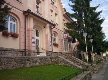
![Tour Zu Fuß Strašice - [Ž] Dobřív - Tři trubky - Photo](https://media.geolcdn.com/t/350/260/6916b645-e778-44ae-8f83-434d0f7692f1.jpeg&format=jpg&maxdim=2)
![Zu Fuß Zu Fuß](https://static1.geolcdn.com/sitytour/trail-icons/100.png)
Km
Zu Fuß
![](/images/other/stat-length.png)
![](https://static1.geolcdn.com/siteimages/upload/files/1508320355ic_sort_den_pos_24dp.png)
![](https://static1.geolcdn.com/siteimages/upload/files/1508320355ic_sort_den_neg_24dp.png)
![](https://static1.geolcdn.com/siteimages/upload/files/16400158638029165_repeat_loop_refresh_sync_direction_icon.png)
• Tour erstellt von cz:KČT.
![Tour Zu Fuß Haid - NS Stráž - Souměř - Photo](https://media.geolcdn.com/t/350/260/82ae4c6d-8bda-4e77-8c25-044aef2bf619.jpeg&format=jpg&maxdim=2)
![Zu Fuß Zu Fuß](https://static1.geolcdn.com/sitytour/trail-icons/100.png)
Km
Zu Fuß
![](/images/other/stat-length.png)
![](https://static1.geolcdn.com/siteimages/upload/files/1508320355ic_sort_den_pos_24dp.png)
![](https://static1.geolcdn.com/siteimages/upload/files/1508320355ic_sort_den_neg_24dp.png)
![](https://static1.geolcdn.com/siteimages/upload/files/16400158638029165_repeat_loop_refresh_sync_direction_icon.png)
• Tour erstellt von cz:KČT.
20 Angezeigte Touren bei 160
Kostenlosegpshiking-Anwendung
Aktivitäten
Nahegelegene Regionen
- Altpilsen
- Babilon
- Bergreichenstein
- Běšiny
- Bezděkov
- Böhmisch Kubitzen
- Borovno
- Brennporitschen
- Buschowitz
- Čachrov
- Černíkov
- Chotieschau
- Chrast
- Chrastavice
- Čížkov
- Dešenice
- Dobřív
- Dobschitsch
- Dollan
- Eipowitz
- Groß Bor
- Haid
- Heiligenkreuz
- Hesselsdorf
- Hnačov
- Holeischen
- Hradec
- Hradiště
- Hromitz
- Jarau
- Kladrau
- Klášter
- Klattau
- Klein Bor
- Klentsch
- Kokaschitz
- Konstantinsbad
- Koschlan
- Ledetz
- Lettin
- Lichtenstein
- Líně
- Lužany
- Manetin
- Markt Eisenstein
- Mauth
- Meigelshof
- Merklín
- Mířkov
- Mirošov
- Nebílovy
- Netschetin
- Neuern
- Neugedein
- Neumark
- Neustadtl
- Ober Birken
- Ober Kamenzen
- Oschelin
- Osserhammer
- Paschnitz
- Petrovice u Sušice
- Pfraumberg
- Pilsen
- Piwana
- Plan
- Plass
- Pocinovice
- Possigkau
- Pschestitz
- Pschiwietitz
- Ptenin
- Radnitz
- Rehberg
- Rokitzan
- Ronsperg
- Roßhaupt
- Schönwald
- Schüttenhofen
- Skorschitz
- Slatina
- Srby
- Srutsch
- Staab
- Stankau
- Stiahlau
- Strašice
- Swikowetz
- Taus
- Thiergarten
- Trasenau
- Tschemoschna
- Tschernoschin
- Unterreichenstein
- Úsilov
- Velhartice
- Vrčeň
- Vřeskovice
- Waier
- Weißensulz
- Weseritz
- Zemschen