![](/images/other/stat-length.png)
- Touren
- Zu Fuß
- Austria
- Niederösterreich
- Bezirk Gmünd
- Gemeinde Gmünd
Gemeinde Gmünd, Bezirk Gmünd, Zu Fuß: Die besten Touren, Trails, Trecks und Wanderungen
Gemeinde Gmünd : Entdecken Sie die besten Touren : 6 zu fuß. Alle diese Touren, Trails, Routen und Outdoor-Aktivitäten sind in unseren SityTrail-Apps für Smartphones und Tablets verfügbar.
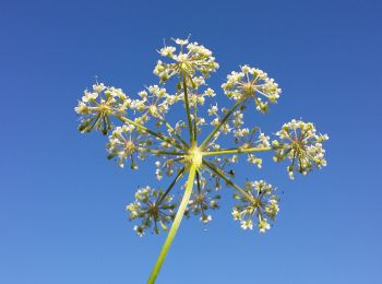
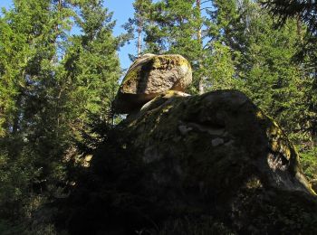
Die besten Spuren (6)
![Tour Zu Fuß Gemeinde Gmünd - Habsburg-Lothringen-Route (blau) - Photo](https://media.geolcdn.com/t/350/260/e60f98a8-b031-40b1-8777-bc976393c16b.jpeg&format=jpg&maxdim=2)
![Zu Fuß Zu Fuß](https://static1.geolcdn.com/sitytour/trail-icons/100.png)
Km
Zu Fuß
![](/images/other/stat-length.png)
![](https://static1.geolcdn.com/siteimages/upload/files/1508320355ic_sort_den_pos_24dp.png)
![](https://static1.geolcdn.com/siteimages/upload/files/1508320355ic_sort_den_neg_24dp.png)
![](https://static1.geolcdn.com/siteimages/upload/files/16400158638029165_repeat_loop_refresh_sync_direction_icon.png)
• Symbol: Schild mit blauem Rand, blauer Pfeil
![Tour Zu Fuß Gemeinde Gmünd - NatURknallweg - Photo](https://media.geolcdn.com/t/350/260/650a68fd-5d7c-4cc2-8f42-706be784110b.jpeg&format=jpg&maxdim=2)
![Zu Fuß Zu Fuß](https://static1.geolcdn.com/sitytour/trail-icons/100.png)
Km
Zu Fuß
![](/images/other/stat-length.png)
![](https://static1.geolcdn.com/siteimages/upload/files/1508320355ic_sort_den_pos_24dp.png)
![](https://static1.geolcdn.com/siteimages/upload/files/1508320355ic_sort_den_neg_24dp.png)
![](https://static1.geolcdn.com/siteimages/upload/files/16400158638029165_repeat_loop_refresh_sync_direction_icon.png)
• Symbol: orangenes Schild
![Tour Zu Fuß Gemeinde Gmünd - Habsburg-Lothringen-Route (rot) - Photo](https://media.geolcdn.com/t/350/260/9535cbb0-a54d-4d57-9751-528926a398db.jpeg&format=jpg&maxdim=2)
![Zu Fuß Zu Fuß](https://static1.geolcdn.com/sitytour/trail-icons/100.png)
Km
Zu Fuß
![](/images/other/stat-length.png)
![](https://static1.geolcdn.com/siteimages/upload/files/1508320355ic_sort_den_pos_24dp.png)
![](https://static1.geolcdn.com/siteimages/upload/files/1508320355ic_sort_den_neg_24dp.png)
![](https://static1.geolcdn.com/siteimages/upload/files/16400158638029165_repeat_loop_refresh_sync_direction_icon.png)
• Symbol: Schild mit blauem Rand, roter Pfeil
![Tour Zu Fuß Gemeinde Gmünd - Teichkettenweg - Photo](https://media.geolcdn.com/t/350/260/f1629015-09b8-47b9-b3a9-f2be56e9ac0f.jpeg&format=jpg&maxdim=2)
![Zu Fuß Zu Fuß](https://static1.geolcdn.com/sitytour/trail-icons/100.png)
Km
Zu Fuß
![](/images/other/stat-length.png)
![](https://static1.geolcdn.com/siteimages/upload/files/1508320355ic_sort_den_pos_24dp.png)
![](https://static1.geolcdn.com/siteimages/upload/files/1508320355ic_sort_den_neg_24dp.png)
![](https://static1.geolcdn.com/siteimages/upload/files/16400158638029165_repeat_loop_refresh_sync_direction_icon.png)
• Symbol: weiß-rot-weiß
![Tour Zu Fuß Gemeinde Gmünd - Themenweg MYTHOlogieTOUR - Photo](https://media.geolcdn.com/t/350/260/0782f960-a75f-4791-baea-b74de1e3f1d7.jpeg&format=jpg&maxdim=2)
![Zu Fuß Zu Fuß](https://static1.geolcdn.com/sitytour/trail-icons/100.png)
Km
Zu Fuß
![](/images/other/stat-length.png)
![](https://static1.geolcdn.com/siteimages/upload/files/1508320355ic_sort_den_pos_24dp.png)
![](https://static1.geolcdn.com/siteimages/upload/files/1508320355ic_sort_den_neg_24dp.png)
![](https://static1.geolcdn.com/siteimages/upload/files/16400158638029165_repeat_loop_refresh_sync_direction_icon.png)
• Symbol: blaue Schilder
![Tour Zu Fuß Gemeinde Gmünd - Themenweg MARIENkäferWEG - Photo](https://media.geolcdn.com/t/350/260/2b477ee3-b637-4767-8acd-afc5b27f3459.jpeg&format=jpg&maxdim=2)
![Zu Fuß Zu Fuß](https://static1.geolcdn.com/sitytour/trail-icons/100.png)
Km
Zu Fuß
![](/images/other/stat-length.png)
![](https://static1.geolcdn.com/siteimages/upload/files/1508320355ic_sort_den_pos_24dp.png)
![](https://static1.geolcdn.com/siteimages/upload/files/1508320355ic_sort_den_neg_24dp.png)
![](https://static1.geolcdn.com/siteimages/upload/files/16400158638029165_repeat_loop_refresh_sync_direction_icon.png)
• Symbol: gelbes Schild bzw. gelber Strich
6 Angezeigte Touren bei 6
Kostenlosegpshiking-Anwendung