![](/images/other/stat-length.png)
- Touren
- Zu Fuß
- Austria
- Niederösterreich
- Bezirk Baden
- Gemeinde Altenmarkt an der Triesting
Gemeinde Altenmarkt an der Triesting, Bezirk Baden, Zu Fuß: Die besten Touren, Trails, Trecks und Wanderungen
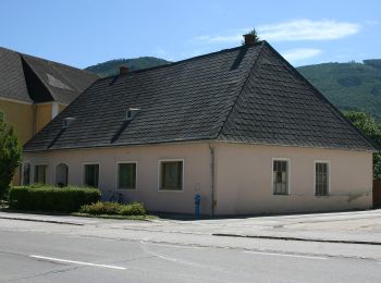
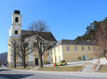
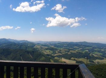
Gemeinde Altenmarkt an der Triesting : Entdecken Sie die besten Touren : 8 zu fuß. Alle diese Touren, Trails, Routen und Outdoor-Aktivitäten sind in unseren SityTrail-Apps für Smartphones und Tablets verfügbar.
Die besten Spuren (8)
![Tour Zu Fuß Gemeinde Altenmarkt an der Triesting - Thenneberg - Reisberg Rundwanderweg - Photo](https://media.geolcdn.com/t/350/260/1ad92151-cc4a-4f0d-b9fe-57564231e71d.jpeg&format=jpg&maxdim=2)
![Zu Fuß Zu Fuß](https://static1.geolcdn.com/sitytour/trail-icons/100.png)
Km
Zu Fuß
![](/images/other/stat-length.png)
![](https://static1.geolcdn.com/siteimages/upload/files/1508320355ic_sort_den_pos_24dp.png)
![](https://static1.geolcdn.com/siteimages/upload/files/1508320355ic_sort_den_neg_24dp.png)
![](https://static1.geolcdn.com/siteimages/upload/files/16400158638029165_repeat_loop_refresh_sync_direction_icon.png)
• Symbol: gelbes Schild mit Pilger-Skizze
![Tour Zu Fuß Gemeinde Altenmarkt an der Triesting - Tamberg Rundwanderweg (Hafnerberg) - Photo](https://media.geolcdn.com/t/350/260/b71028cb-5307-4e05-a1d3-35f1d58006b7.jpeg&format=jpg&maxdim=2)
![Zu Fuß Zu Fuß](https://static1.geolcdn.com/sitytour/trail-icons/100.png)
Km
Zu Fuß
![](/images/other/stat-length.png)
![](https://static1.geolcdn.com/siteimages/upload/files/1508320355ic_sort_den_pos_24dp.png)
![](https://static1.geolcdn.com/siteimages/upload/files/1508320355ic_sort_den_neg_24dp.png)
![](https://static1.geolcdn.com/siteimages/upload/files/16400158638029165_repeat_loop_refresh_sync_direction_icon.png)
• Symbol: gelbes Schild mit Pilger-Skizze
![Tour Zu Fuß Gemeinde Altenmarkt an der Triesting - Panorama Rundwanderweg (Hafnerberg) - Photo](https://media.geolcdn.com/t/350/260/b71028cb-5307-4e05-a1d3-35f1d58006b7.jpeg&format=jpg&maxdim=2)
![Zu Fuß Zu Fuß](https://static1.geolcdn.com/sitytour/trail-icons/100.png)
Km
Zu Fuß
![](/images/other/stat-length.png)
![](https://static1.geolcdn.com/siteimages/upload/files/1508320355ic_sort_den_pos_24dp.png)
![](https://static1.geolcdn.com/siteimages/upload/files/1508320355ic_sort_den_neg_24dp.png)
![](https://static1.geolcdn.com/siteimages/upload/files/16400158638029165_repeat_loop_refresh_sync_direction_icon.png)
• Symbol: gelbes Schild mit Pilger-Skizze
![Tour Zu Fuß Gemeinde Altenmarkt an der Triesting - Dreikirchen Rundwanderweg (Hafnerberg) - Photo](https://media.geolcdn.com/t/350/260/0a54caf2-8e44-4c9b-951c-ba429550a053.jpeg&format=jpg&maxdim=2)
![Zu Fuß Zu Fuß](https://static1.geolcdn.com/sitytour/trail-icons/100.png)
Km
Zu Fuß
![](/images/other/stat-length.png)
![](https://static1.geolcdn.com/siteimages/upload/files/1508320355ic_sort_den_pos_24dp.png)
![](https://static1.geolcdn.com/siteimages/upload/files/1508320355ic_sort_den_neg_24dp.png)
![](https://static1.geolcdn.com/siteimages/upload/files/16400158638029165_repeat_loop_refresh_sync_direction_icon.png)
• Symbol: gelbes Schild mit Pilger-Skizze
![Tour Zu Fuß Gemeinde Altenmarkt an der Triesting - Allander Wanderweg 6 - Photo](https://media.geolcdn.com/t/350/260/bfc0a543-7030-4f5f-9144-2ab131551c9e.jpeg&format=jpg&maxdim=2)
![Zu Fuß Zu Fuß](https://static1.geolcdn.com/sitytour/trail-icons/100.png)
Km
Zu Fuß
![](/images/other/stat-length.png)
![](https://static1.geolcdn.com/siteimages/upload/files/1508320355ic_sort_den_pos_24dp.png)
![](https://static1.geolcdn.com/siteimages/upload/files/1508320355ic_sort_den_neg_24dp.png)
![](https://static1.geolcdn.com/siteimages/upload/files/16400158638029165_repeat_loop_refresh_sync_direction_icon.png)
• Trail created by Fremdenverkehrs- und Ortsverschönerungsverein der Großgemeinde Alland. Symbol: 6 in orangen Punkt
![Tour Zu Fuß Gemeinde Altenmarkt an der Triesting - Thenneberg (Dornau) - Hocheck Schutzhaus - Photo](https://media.geolcdn.com/t/350/260/c808bb6d-9627-4023-b126-ca8736b9d9d1.jpeg&format=jpg&maxdim=2)
![Zu Fuß Zu Fuß](https://static1.geolcdn.com/sitytour/trail-icons/100.png)
Km
Zu Fuß
![](/images/other/stat-length.png)
![](https://static1.geolcdn.com/siteimages/upload/files/1508320355ic_sort_den_pos_24dp.png)
![](https://static1.geolcdn.com/siteimages/upload/files/1508320355ic_sort_den_neg_24dp.png)
![](https://static1.geolcdn.com/siteimages/upload/files/16400158638029165_repeat_loop_refresh_sync_direction_icon.png)
• Trail created by Österreichischer Touristenklub, Sektion Triestingtal. Symbol: blauer, waagrechter Balken
![Tour Zu Fuß Gemeinde Altenmarkt an der Triesting - Taßhof - Hocheck - Photo](https://media.geolcdn.com/t/350/260/9a0e0e8d-bfba-43e3-b725-ddafce3b4cb4.jpeg&format=jpg&maxdim=2)
![Zu Fuß Zu Fuß](https://static1.geolcdn.com/sitytour/trail-icons/100.png)
Km
Zu Fuß
![](/images/other/stat-length.png)
![](https://static1.geolcdn.com/siteimages/upload/files/1508320355ic_sort_den_pos_24dp.png)
![](https://static1.geolcdn.com/siteimages/upload/files/1508320355ic_sort_den_neg_24dp.png)
![](https://static1.geolcdn.com/siteimages/upload/files/16400158638029165_repeat_loop_refresh_sync_direction_icon.png)
• Symbol: gelber, waagerechter Balken
![Tour Zu Fuß Gemeinde Altenmarkt an der Triesting - Via Sacra Rundwanderwege Altenmarkt - Photo](https://media.geolcdn.com/t/350/260/61cd49ce-145c-4ddf-ad6e-8fbd8394f0a8.jpeg&format=jpg&maxdim=2)
![Zu Fuß Zu Fuß](https://static1.geolcdn.com/sitytour/trail-icons/100.png)
Km
Zu Fuß
![](/images/other/stat-length.png)
![](https://static1.geolcdn.com/siteimages/upload/files/1508320355ic_sort_den_pos_24dp.png)
![](https://static1.geolcdn.com/siteimages/upload/files/1508320355ic_sort_den_neg_24dp.png)
![](https://static1.geolcdn.com/siteimages/upload/files/16400158638029165_repeat_loop_refresh_sync_direction_icon.png)
• Symbol: gelbes Schild mit Aufschrift "Via Sacra"
8 Angezeigte Touren bei 8
Kostenlosegpshiking-Anwendung