![](/images/other/stat-length.png)
- Touren
- Zu Fuß
- Austria
- Salzburg
- Bezirk St. Johann im Pongau
- Sankt Veit im Pongau
Sankt Veit im Pongau, Bezirk St. Johann im Pongau, Zu Fuß: Die besten Touren, Trails, Trecks und Wanderungen
Sankt Veit im Pongau : Entdecken Sie die besten Touren : 10 zu fuß. Alle diese Touren, Trails, Routen und Outdoor-Aktivitäten sind in unseren SityTrail-Apps für Smartphones und Tablets verfügbar.
Die besten Spuren (10)
![Tour Zu Fuß Sankt Veit im Pongau - Schwarzach Höhenweg - Photo](https://media.geolcdn.com/t/350/260/c021223c-b274-4996-9acf-64cf6390d87d.jpeg&format=jpg&maxdim=2)
![Zu Fuß Zu Fuß](https://static1.geolcdn.com/sitytour/trail-icons/100.png)
Km
Zu Fuß
![](/images/other/stat-length.png)
![](https://static1.geolcdn.com/siteimages/upload/files/1508320355ic_sort_den_pos_24dp.png)
![](https://static1.geolcdn.com/siteimages/upload/files/1508320355ic_sort_den_neg_24dp.png)
![](https://static1.geolcdn.com/siteimages/upload/files/16400158638029165_repeat_loop_refresh_sync_direction_icon.png)
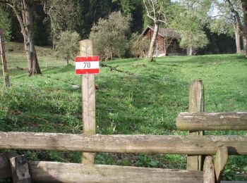
• Trail created by TVB St. Veit - Schwarzach. Symbol: rot-weiss-rot 43
![Tour Zu Fuß Sankt Veit im Pongau - Bräualm-Untere Thennalm - Photo](https://media.geolcdn.com/t/350/260/045d8b49-3fa8-4724-9e50-4e90050906cb.jpeg&format=jpg&maxdim=2)
![Zu Fuß Zu Fuß](https://static1.geolcdn.com/sitytour/trail-icons/100.png)
Km
Zu Fuß
![](/images/other/stat-length.png)
![](https://static1.geolcdn.com/siteimages/upload/files/1508320355ic_sort_den_pos_24dp.png)
![](https://static1.geolcdn.com/siteimages/upload/files/1508320355ic_sort_den_neg_24dp.png)
![](https://static1.geolcdn.com/siteimages/upload/files/16400158638029165_repeat_loop_refresh_sync_direction_icon.png)
• Trail created by TVB St. Veit - Schwarzach. Symbol: rot-weiss-rot 45
![Tour Zu Fuß Sankt Veit im Pongau - Thomas Bernhard Wanderweg - Photo](https://media.geolcdn.com/t/350/260/67af7073-618d-4c3b-835e-32a5933fb619.jpeg&format=jpg&maxdim=2)
![Zu Fuß Zu Fuß](https://static1.geolcdn.com/sitytour/trail-icons/100.png)
Km
Zu Fuß
![](/images/other/stat-length.png)
![](https://static1.geolcdn.com/siteimages/upload/files/1508320355ic_sort_den_pos_24dp.png)
![](https://static1.geolcdn.com/siteimages/upload/files/1508320355ic_sort_den_neg_24dp.png)
![](https://static1.geolcdn.com/siteimages/upload/files/16400158638029165_repeat_loop_refresh_sync_direction_icon.png)
• Trail created by Seelackenmuseum. Symbol: braune Tafeln mit weißer Schrift
![Tour Zu Fuß Sankt Veit im Pongau - St. Veit-Hochglocker (Alternative) - Photo](https://media.geolcdn.com/t/350/260/899c8403-0f99-4ac0-827f-f9449fad44c5.jpeg&format=jpg&maxdim=2)
![Zu Fuß Zu Fuß](https://static1.geolcdn.com/sitytour/trail-icons/100.png)
Km
Zu Fuß
![](/images/other/stat-length.png)
![](https://static1.geolcdn.com/siteimages/upload/files/1508320355ic_sort_den_pos_24dp.png)
![](https://static1.geolcdn.com/siteimages/upload/files/1508320355ic_sort_den_neg_24dp.png)
![](https://static1.geolcdn.com/siteimages/upload/files/16400158638029165_repeat_loop_refresh_sync_direction_icon.png)
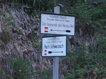
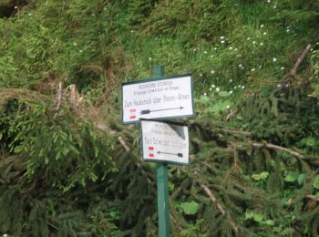
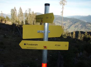
• Trail created by TVB St. Veit - Schwarzach. Symbol: rot-weiss-rot 23c
![Tour Zu Fuß Sankt Veit im Pongau - Urpass-Stötzlbergalm-Hochegg - Photo](https://media.geolcdn.com/t/350/260/f152401a-509f-4bfe-a58c-1d9ef65d8bd4.jpeg&format=jpg&maxdim=2)
![Zu Fuß Zu Fuß](https://static1.geolcdn.com/sitytour/trail-icons/100.png)
Km
Zu Fuß
![](/images/other/stat-length.png)
![](https://static1.geolcdn.com/siteimages/upload/files/1508320355ic_sort_den_pos_24dp.png)
![](https://static1.geolcdn.com/siteimages/upload/files/1508320355ic_sort_den_neg_24dp.png)
![](https://static1.geolcdn.com/siteimages/upload/files/16400158638029165_repeat_loop_refresh_sync_direction_icon.png)
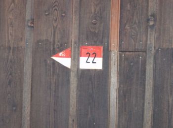
• Trail created by TVB St. Veit - Schwarzach. Symbol: rot-weiss-rot 27a
![Tour Zu Fuß Sankt Veit im Pongau - Urpass-Gamskögerl-Hochegg - Photo](https://media.geolcdn.com/t/350/260/f152401a-509f-4bfe-a58c-1d9ef65d8bd4.jpeg&format=jpg&maxdim=2)
![Zu Fuß Zu Fuß](https://static1.geolcdn.com/sitytour/trail-icons/100.png)
Km
Zu Fuß
![](/images/other/stat-length.png)
![](https://static1.geolcdn.com/siteimages/upload/files/1508320355ic_sort_den_pos_24dp.png)
![](https://static1.geolcdn.com/siteimages/upload/files/1508320355ic_sort_den_neg_24dp.png)
![](https://static1.geolcdn.com/siteimages/upload/files/16400158638029165_repeat_loop_refresh_sync_direction_icon.png)
• Trail created by TVB St. Veit - Schwarzach. Symbol: rot-weiss-rot 27
![Tour Zu Fuß Sankt Veit im Pongau - St. Veit-Schneeberg - Photo](https://media.geolcdn.com/t/350/260/87693ea7-0607-4be9-9af3-5f09f26add33.jpeg&format=jpg&maxdim=2)
![Zu Fuß Zu Fuß](https://static1.geolcdn.com/sitytour/trail-icons/100.png)
Km
Zu Fuß
![](/images/other/stat-length.png)
![](https://static1.geolcdn.com/siteimages/upload/files/1508320355ic_sort_den_pos_24dp.png)
![](https://static1.geolcdn.com/siteimages/upload/files/1508320355ic_sort_den_neg_24dp.png)
![](https://static1.geolcdn.com/siteimages/upload/files/16400158638029165_repeat_loop_refresh_sync_direction_icon.png)
• Trail created by TVB St. Veit - Schwarzach. Symbol: rot-weiss-rot 24
![Tour Zu Fuß Sankt Veit im Pongau - St. Veit-Kinderalm über Seelacken - Photo](https://media.geolcdn.com/t/350/260/876af22c-ddea-40c2-a09a-e0eb6c463c3c.jpeg&format=jpg&maxdim=2)
![Zu Fuß Zu Fuß](https://static1.geolcdn.com/sitytour/trail-icons/100.png)
Km
Zu Fuß
![](/images/other/stat-length.png)
![](https://static1.geolcdn.com/siteimages/upload/files/1508320355ic_sort_den_pos_24dp.png)
![](https://static1.geolcdn.com/siteimages/upload/files/1508320355ic_sort_den_neg_24dp.png)
![](https://static1.geolcdn.com/siteimages/upload/files/16400158638029165_repeat_loop_refresh_sync_direction_icon.png)
• Trail created by TVB St. Veit - Schwarzach. Symbol: rot-weiss-rot 23b
![Tour Zu Fuß Sankt Veit im Pongau - St. Veit-Hochglocker über Kinderalm - Photo](https://media.geolcdn.com/t/350/260/85503fc7-c1c6-42f0-bb4b-9a0988de790b.jpeg&format=jpg&maxdim=2)
![Zu Fuß Zu Fuß](https://static1.geolcdn.com/sitytour/trail-icons/100.png)
Km
Zu Fuß
![](/images/other/stat-length.png)
![](https://static1.geolcdn.com/siteimages/upload/files/1508320355ic_sort_den_pos_24dp.png)
![](https://static1.geolcdn.com/siteimages/upload/files/1508320355ic_sort_den_neg_24dp.png)
![](https://static1.geolcdn.com/siteimages/upload/files/16400158638029165_repeat_loop_refresh_sync_direction_icon.png)
• Trail created by TVB St. Veit - Schwarzach. Symbol: rot-weiss-rot 23
![Tour Zu Fuß Sankt Veit im Pongau - St. Veit-Hochglocker über Hochstein - Photo](https://media.geolcdn.com/t/350/260/ext.jpg?maxdim=2&url=https%3A%2F%2Fstatic1.geolcdn.com%2Fsiteimages%2Fupload%2Ffiles%2F1545311037marcheuse_200dpi.jpg)
![Zu Fuß Zu Fuß](https://static1.geolcdn.com/sitytour/trail-icons/100.png)
Km
Zu Fuß
![](/images/other/stat-length.png)
![](https://static1.geolcdn.com/siteimages/upload/files/1508320355ic_sort_den_pos_24dp.png)
![](https://static1.geolcdn.com/siteimages/upload/files/1508320355ic_sort_den_neg_24dp.png)
![](https://static1.geolcdn.com/siteimages/upload/files/16400158638029165_repeat_loop_refresh_sync_direction_icon.png)
• Trail created by TVB St. Veit - Schwarzach. Symbol: rot-weiss-rot 23a
10 Angezeigte Touren bei 10
Kostenlosegpshiking-Anwendung