


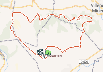

18,2 km | 26 km-effort


Gebruiker


Gratisgps-wandelapplicatie
 SityTrail
IGN / Geografische instituten
SityTrail World
De wereld gaat voor u open
Tocht Stappen van 13,9 km beschikbaar op Occitanië, Aude, Villegly. Deze tocht wordt voorgesteld door JMBocuse.
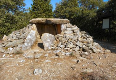
Beaucoup de possibilités, mais attention de ne pas se perdre ,c'est un véritable labyrinthe
Stappen
Mountainbike
Stappen

Te voet

Stappen
Te voet

Stappen

Stappen
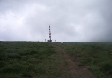
attention, il y a des passages qui ne sont plus praticables. il faut contourner