Tocht Stappen Écrouves - Ecrouves 16 700m +323m - Photo
 DanielROLLET
DanielROLLET

Gebruiker

© OpenStreetMap contributors
Lengte
Lengte
16,8 km
Max. hoogte
Max. hoogte
371 m
Positief hoogteverschil
324 m
Km-Effort
Km-Effort  
21 km
Min. hoogte
Min. hoogte
237 m
Negatief hoogteverschil
324 m
Boucle
Boucle
Ja
Datum van aanmaak :
2019-09-20 06:56:55.285
Laatste wijziging :
2019-09-22 08:05:37.999

(0 Bericht)

Stappen
Stappen
5h41
Moeilijkheid : Gemakkelijk

Scan deze QR-code om de tocht te openen in de SityTrail-applicatie

Gratisgps-wandelapplicatie

Logo SityTrail SityTrail

IGN / Geografische instituten

SityTrail uit de App Store downloaden SityTrail uit Google Play downloaden

Logo SityTrail SityTrail World

De wereld gaat voor u open

SityTrail uit de App Store downloaden SityTrail uit Google Play downloaden SityTrail op Huawei AppGallery downloaden

Over ons

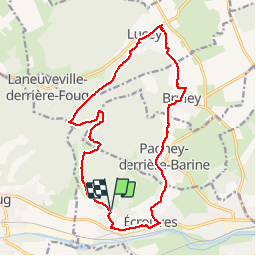
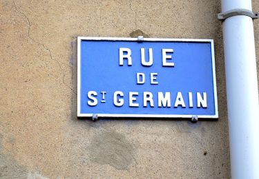
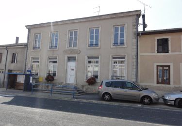
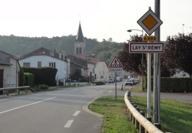
Tocht Stappen van 16,8 km beschikbaar op Grand Est, Meurthe-et-Moselle, Écrouves. Deze tocht wordt voorgesteld door DanielROLLET.

Beschrijving

2019 09 20 avec Marie  8:55 à 14:25
Départ/arrivée :  Grandménil
Arrêts pressoir Lelièvre et resto Ecrouves "La Table de Saint-Martin.

Hoogteprofiel

Foto's

Plaatsbepaling

Land:
France
Regio :
Grand Est
Departement/Provincie :
Meurthe-et-Moselle
Gemeente :
Écrouves
Locatie:
Unknown
Vertrek:(UTM)
708044 ; 5395967 (31U) N.

Wandeltochten in de omgeving

Tocht Te voet Bruley - Circuit de la Petite Linotte - Photo
Te voet
PRO

Te voet

Gemakkelijk
Bruley, Grand Est, Meurthe-et-Moselle, France
9,2 km | 12 km-effort
2h 43min
Neen
Tocht Mountainbike Toul - Côtes de Toul 50k 2012 - Photo
Mountainbike
virginieHurpeau

Mountainbike

Moeilijk
(2)
Toul, Grand Est, Meurthe-et-Moselle, France
59 km | 75 km-effort
5h 15min
Ja
Tocht Mountainbike Écrouves - 1 ère rando VTT - Photo
Mountainbike
ericsnoopy

Mountainbike

Heel gemakkelijk
(1)
Écrouves, Grand Est, Meurthe-et-Moselle, France
7,5 km | 9,5 km-effort
Onbekend
Ja
Tocht Te voet Laneuveville-derrière-Foug - Circuit de Domfontaine - Photo
Te voet
PRO

Te voet

Gemakkelijk
Laneuveville-derrière-Foug, Grand Est, Meurthe-et-Moselle, France
9,5 km | 12,6 km-effort
2h 51min
Ja
Tocht Te voet Trondes - Circuit du Romont - Photo
Te voet
PRO

Te voet

Gemakkelijk
Trondes, Grand Est, Meurthe-et-Moselle, France
6,8 km | 8,1 km-effort
1h 50min
Ja
Tocht Te voet Foug - Circuit de Grammont - Photo
Te voet
PRO

Te voet

Gemakkelijk
Foug, Grand Est, Meurthe-et-Moselle, France
15,6 km | 19,3 km-effort
4h 23min
Neen
Tocht Te voet Choloy-Ménillot - Boucle des Sources - Photo
Te voet
PRO

Te voet

Gemakkelijk
Choloy-Ménillot, Grand Est, Meurthe-et-Moselle, France
10,4 km | 11,9 km-effort
2h 42min
Neen
Tocht Te voet Lucey - Circuit des Vignes - Photo
Te voet
PRO

Te voet

Gemakkelijk
Lucey, Grand Est, Meurthe-et-Moselle, France
4,2 km | 5,2 km-effort
1h 11min
Ja
Tocht Te voet Lay-Saint-Remy - Circuit des Tunnels - Photo
Te voet
PRO

Te voet

Gemakkelijk
Lay-Saint-Remy, Grand Est, Meurthe-et-Moselle, France
11,1 km | 14,2 km-effort
3h 14min
Neen


Sluiten
Mijn abonnementen