Tocht Stappen Saint-Gilles - St Gilles Château de Canisy - Photo

St Gilles Château de Canisy

 guy50880
guy50880

Gebruiker

© OpenStreetMap contributors
Lengte
Lengte
9 km
Max. hoogte
Max. hoogte
99 m
Positief hoogteverschil
126 m
Km-Effort
Km-Effort  
10,7 km
Min. hoogte
Min. hoogte
39 m
Negatief hoogteverschil
127 m
Boucle
Boucle
Ja
Datum van aanmaak :
2019-05-16 12:24:05.915
Laatste wijziging :
2019-05-16 15:35:29.919

(0 Bericht)

Stappen
Stappen
2h26
Moeilijkheid : Heel gemakkelijk

Scan deze QR-code om de tocht te openen in de SityTrail-applicatie

Gratisgps-wandelapplicatie

Logo SityTrail SityTrail

IGN / Geografische instituten

SityTrail uit de App Store downloaden SityTrail uit Google Play downloaden

Logo SityTrail SityTrail World

De wereld gaat voor u open

SityTrail uit de App Store downloaden SityTrail uit Google Play downloaden SityTrail op Huawei AppGallery downloaden

Over ons

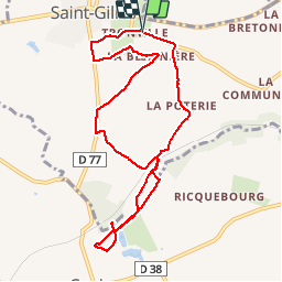
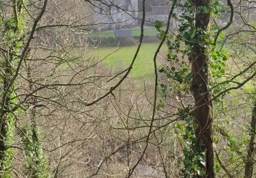
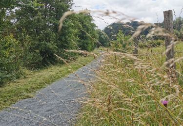
Tocht Stappen van 9 km beschikbaar op Normandië, Manche, Saint-Gilles. Deze tocht wordt voorgesteld door guy50880.

Beschrijving

Facile

Hoogteprofiel

Foto's

Plaatsbepaling

Land:
France
Regio :
Normandië
Departement/Provincie :
Manche
Gemeente :
Saint-Gilles
Locatie:
Unknown
Vertrek:(UTM)
633753 ; 5440438 (30U) N.

Wandeltochten in de omgeving

Tocht Mountainbike Saint-Gilles - Balade St-Gillaise - St-Gilles - Photo
Mountainbike
tracegps

Mountainbike

Medium
(1)
Saint-Gilles, Normandië, Manche, France
23 km | 28 km-effort
2h 30min
Ja
Tocht Mountainbike Agneaux - L'Agnelaise 2014 - Agneaux - Photo
Mountainbike
tracegps

Mountainbike

Moeilijk
Agneaux, Normandië, Manche, France
44 km | 52 km-effort
3h 0min
Ja
Tocht Stappen Canisy - Le circuit Jean Follain - Canisy - Photo
Stappen
tracegps

Stappen

Medium
Canisy, Normandië, Manche, France
9,2 km | 10,9 km-effort
2h 19min
Ja
Tocht Stappen Saint-Lô - Saint-Lô - La Vire et le Falaise - Photo
Stappen
PatRando

Stappen

Gemakkelijk
Saint-Lô, Normandië, Manche, France
5,4 km | 6,6 km-effort
1h 20min
Ja
Tocht Fietstoerisme Saint-Lô - Vélomaritime_Cherbourg_Caen_#J4_20210708_Saint-Lô_-_Courson - Photo
Fietstoerisme
BureauChris

Fietstoerisme

Heel gemakkelijk
Saint-Lô, Normandië, Manche, France
44 km | 51 km-effort
Onbekend
Neen
Tocht Andere activiteiten Saint-Lô - Basse Normandie - Ligne 414 - Saint-Lô - Guilberville - Photo
Andere activiteiten
mich54

Andere activiteiten

Heel gemakkelijk
Saint-Lô, Normandië, Manche, France
25 km | 29 km-effort
5min
Neen
Tocht Fiets Saint-Lô - 2016-Vélofrancette n° 9 - Photo
Fiets
mimi53

Fiets

Gemakkelijk
Saint-Lô, Normandië, Manche, France
34 km | 37 km-effort
2h 11min
Neen
Tocht Mountainbike Agneaux - Marathon Saint Lois -Agneaux - Photo
Mountainbike
tracegps

Mountainbike

Zeer moeilijk
Agneaux, Normandië, Manche, France
75 km | 92 km-effort
5h 0min
Ja
Tocht Lopen Saint-Lô - Le pays Saint-Lois - chemin de halage - Photo
Lopen
tracegps

Lopen

Medium
Saint-Lô, Normandië, Manche, France
16,4 km | 19 km-effort
1h 25min
Ja


Sluiten
Mijn abonnementen