


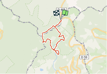

10,5 km | 17,7 km-effort

Gebruiker


Gratisgps-wandelapplicatie
 SityTrail
IGN / Geografische instituten
SityTrail World
De wereld gaat voor u open
Tocht Sneeuwschoenen van 5,8 km beschikbaar op Grand Est, Vogezen, Saint-Maurice-sur-Moselle. Deze tocht wordt voorgesteld door tracegps.
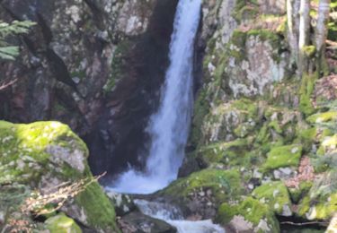
Au départ du ballon d'Alsace, une randonnée au fil des cascades qui vous emporte jusqu'au Lac au cœur de la forêt.


Stappen
Stappen

Stappen

Stappen

Mountainbike
Stappen
Stappen

Stappen
Stappen