Fors, Deux-Sèvres: Top van de beste wandelroutes, trajecten, tochten en wandelingen

Fors: Ontdek de beste tochten: 4 te voet. Al deze tochten, trajecten, routes en outdoor activiteiten zijn beschikbaar in onze SityTrail-apps voor smartphones en tablets.


De beste trajecten (4)

Tocht Stappen Fors - Les Sanguinières circuit  7Km - Photo
Stappen 8.914
Km

Stappen

Gemakkelijk
Fors, Nieuw-Aquitanië, Deux-Sèvres, France
8,9 km | 9,4 km-effort
1h 40min
40 m
41 m
Ja
olaze

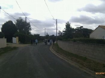
• Promenade départ & retour Les Sanguinières, dans campagne

Tocht Stappen Fors - Fors 9,7 km - Photo
Stappen 9.739
Km

Stappen

Gemakkelijk
Fors, Nieuw-Aquitanië, Deux-Sèvres, France
9,7 km | 10,5 km-effort
2h 19min
59 m
59 m
Ja
olaze

• Randonnée autour de Fors.sur chemins et petites routes . Campagne .Club rando Bessines 12/2016. Départ parking mairie...

Tocht Stappen Fors - Les Sanguinières circuit 2 - Photo
Stappen 8.913
Km

Stappen

Gemakkelijk
Fors, Nieuw-Aquitanië, Deux-Sèvres, France
8,9 km | 9,5 km-effort
2h 6min
41 m
41 m
Ja
olaze

Tocht Stappen Fors - Les Sanguinières - Photo
Stappen 6.954
Km

Stappen

Heel gemakkelijk
Fors, Nieuw-Aquitanië, Deux-Sèvres, France
7 km | 7,3 km-effort
1h 38min
23 m
23 m
Ja
olaze

4 tochten weergegeven op 4

Gratisgps-wandelapplicatie

Logo SityTrail SityTrail

IGN / Geografische instituten

SityTrail uit de App Store downloaden SityTrail uit Google Play downloaden

Logo SityTrail SityTrail World

De wereld gaat voor u open

SityTrail uit de App Store downloaden SityTrail uit Google Play downloaden SityTrail op Huawei AppGallery downloaden

Activiteiten

Sluiten
Mijn abonnementen