Trail Mountain bike Saint-Antoine-du-Rocher - St.Antoine-Croix Renard-Neuillé-Haras du Soleil-Bois et Etangs-Semblancay-Caves Buard-St.Antoine-25,5 km-Le 31 Octobre 20146-Auteur tintin37 - Photo

St.Antoine-Croix Renard-Neuillé-Haras du Soleil-Bois et Etangs-Semblancay-Caves Buard-St.Antoine-25,5 km-Le 31 Octobre 20146-Auteur tintin37

© OpenStreetMap contributors
Length
Length
25 km
Max alt
Max alt
135 m
Uphill gradient
Uphill gradient
203 m
Km-Effort
Km-Effort  
28 km
Min alt
Min alt
87 m
Downhill gradient
Downhill gradient
203 m
Boucle
Boucle
Yes
Creation date :
2014-12-10 00:00:00.0
Updated on :
2014-12-10 00:00:00.0

(0 Reviews)

Mountain bike
Mountain bike
1h12
Difficulty : Easy

Scan this QR Code to open this trail in the SityTrail application

FREE GPS app for hiking

Logo SityTrail SityTrail

IGN / Geographical institutes

Download SityTrail from the App Store Download SityTrail from Google Play

Logo SityTrail SityTrail World

The world is yours!

Download SityTrail from the App Store Download SityTrail from Google Play Download SityTrail on Huawei AppGallery

About

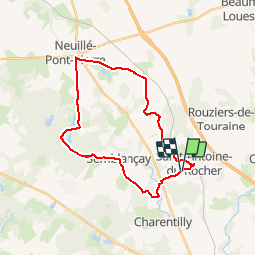
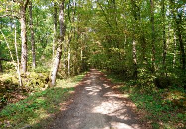
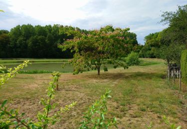
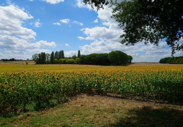
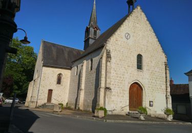
Trail Mountain bike of 25 km to be discovered at Centre-Loire Valley, Indre-et-Loire, Saint-Antoine-du-Rocher. This trail is proposed by Martinjeanclaude.

Elevation profile

Positioning

Country:
France
Region :
Centre-Loire Valley
Department/Province :
Indre-et-Loire
Municipality :
Saint-Antoine-du-Rocher
Location:
Unknown
Start:(UTM)
320886 ; 5262734 (31T) N.

Trails nearby

Trail Walking Cerelles - Cerelles - Photo
Walking
LEMENIO

Walking

Easy
(1)
Cerelles, Centre-Loire Valley, Indre-et-Loire, France
10.5 km | 12.5 km-effort
2h 42min
Yes
Trail Walking Rouziers-de-Touraine - bois  bourdeil beaumont variante - Photo
Walking
dporcher

Walking

Easy
(1)
Rouziers-de-Touraine, Centre-Loire Valley, Indre-et-Loire, France
12.6 km | 14.6 km-effort
2h 38min
Yes
Trail Walking Rouziers-de-Touraine - Rouziers-de-Touraine - Circuit 3 - 21km 175m 5h00 (35mn) - 2023 05 21 - Photo
Walking
Orcal37

Walking

Easy
Rouziers-de-Touraine, Centre-Loire Valley, Indre-et-Loire, France
21 km | 23 km-effort
5h 0min
Yes
Trail Walking Saint-Antoine-du-Rocher - Saint-Antoine-du-Rocher - Rouziers-de-Touraine - 21.4km 165m 4h55 - 2022 04 03 - Photo
Walking
Orcal37

Walking

Easy
Saint-Antoine-du-Rocher, Centre-Loire Valley, Indre-et-Loire, France
21 km | 24 km-effort
4h 55min
Yes
Trail Walking Charentilly - Charentilly - PR la Choisillette avec variante - 9km 100m 1h50 - 2020 11 28 - Photo
Walking
Orcal37

Walking

Easy
Charentilly, Centre-Loire Valley, Indre-et-Loire, France
9 km | 10.4 km-effort
1h 50min
Yes
Trail Walking Cerelles - Cérelles - Circuits 2 puis 1 - 18.9km 255m 4h05 - 2020 09 11 - Photo
Walking
Orcal37

Walking

Medium
Cerelles, Centre-Loire Valley, Indre-et-Loire, France
18.9 km | 22 km-effort
4h 5min
Yes
Trail Walking Charentilly - Charentilly - Circuit 2 avec variante - 14.8km 135m 3h05 - 2020 08 15 - Photo
Walking
Orcal37

Walking

Easy
Charentilly, Centre-Loire Valley, Indre-et-Loire, France
14.8 km | 16.6 km-effort
3h 5min
Yes
Trail Walking Mettray - Mettray - Dolmen - 12.9km 160m 2h40 - 2020 07 26 - Photo
Walking
Orcal37

Walking

Easy
Mettray, Centre-Loire Valley, Indre-et-Loire, France
12.9 km | 15 km-effort
2h 40min
Yes
Trail Walking Rouziers-de-Touraine - Rouziers-de-Touraine - Circuit 2 - 14.1km 160m 3h10 - 2020 05 12 - Photo
Walking
Orcal37

Walking

Very easy
Rouziers-de-Touraine, Centre-Loire Valley, Indre-et-Loire, France
14.1 km | 16.3 km-effort
3h 10min
Yes


Close
My subscriptions