Trail Walking Thorame-Basse - pic de mal-ubac  - Photo
© OpenStreetMap contributors
Length
Length
24 km
Max alt
Max alt
2070 m
Uphill gradient
Uphill gradient
1277 m
Km-Effort
Km-Effort  
41 km
Min alt
Min alt
1138 m
Downhill gradient
Downhill gradient
1278 m
Boucle
Boucle
Yes
Creation date :
2016-10-21 00:00:00.0
Updated on :
2016-10-21 00:00:00.0

(0 Reviews)

Walking
Walking
5h09
Difficulty : Medium

Scan this QR Code to open this trail in the SityTrail application

FREE GPS app for hiking

Logo SityTrail SityTrail

IGN / Geographical institutes

Download SityTrail from the App Store Download SityTrail from Google Play

Logo SityTrail SityTrail World

The world is yours!

Download SityTrail from the App Store Download SityTrail from Google Play Download SityTrail on Huawei AppGallery

About

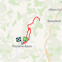
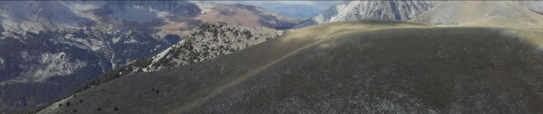
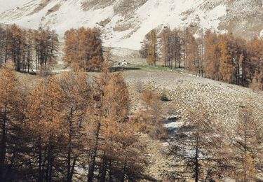
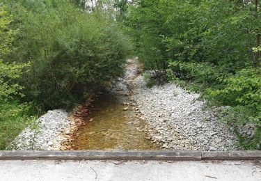
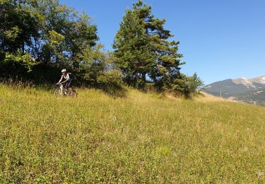
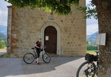
Trail Walking of 24 km to be discovered at Provence-Alpes-Côte d'Azur, Alpes-de-Haute-Provence, Thorame-Basse. This trail is proposed by daniel256.

Description

pic de mal-ubac par la valette, départ piste après thorame-basse

Elevation profile

Photos

Positioning

Country:
France
Region :
Provence-Alpes-Côte d'Azur
Department/Province :
Alpes-de-Haute-Provence
Municipality :
Thorame-Basse
Location:
Unknown
Start:(UTM)
299968 ; 4885411 (32T) N.

Trails nearby

Trail Walking Thorame-Basse - 2023-11-24 Château Garnier - Cabane du Cheval  Blanc - Photo
Walking
GUIDE
Kargil

Walking

Difficult
Thorame-Basse, Provence-Alpes-Côte d'Azur, Alpes-de-Haute-Provence, France
15.5 km | 26 km-effort
5h 53min
Yes
Trail Mountain bike Thorame-Basse - Camping petit cordeil Argens - Photo
Mountain bike
GUIDE
harydh

Mountain bike

Medium
Thorame-Basse, Provence-Alpes-Côte d'Azur, Alpes-de-Haute-Provence, France
27 km | 39 km-effort
4h 58min
Yes
Trail Walking La Mure-Argens - Montagne de Maurel - Photo
Walking
Marchopier

Walking

Very difficult
La Mure-Argens, Provence-Alpes-Côte d'Azur, Alpes-de-Haute-Provence, France
13.6 km | 20 km-effort
4h 32min
Yes
Trail Mountain bike Thorame-Basse - Le Tour des Villages - Photo
Mountain bike
GUIDE
harydh

Mountain bike

Medium
Thorame-Basse, Provence-Alpes-Côte d'Azur, Alpes-de-Haute-Provence, France
30 km | 37 km-effort
5h 0min
Yes
Trail Walking Thorame-Basse - Cheval Blanc - Photo
Walking
GUIDE
harydh

Walking

Easy
Thorame-Basse, Provence-Alpes-Côte d'Azur, Alpes-de-Haute-Provence, France
11.7 km | 23 km-effort
4h 21min
Yes
Trail Mountain bike Thorame-Basse - Col de Seoune Lambruisse - Photo
Mountain bike
GUIDE
harydh

Mountain bike

Medium
Thorame-Basse, Provence-Alpes-Côte d'Azur, Alpes-de-Haute-Provence, France
26 km | 33 km-effort
3h 31min
Yes
Trail Mountain bike Thorame-Basse - Repérage Château Garnier - Photo
Mountain bike
GUIDE
harydh

Mountain bike

Very easy
Thorame-Basse, Provence-Alpes-Côte d'Azur, Alpes-de-Haute-Provence, France
10 km | 12 km-effort
1h 14min
Yes
Trail Mountain bike La Mure-Argens - Grande Traversée des PréAlpes à VTT : Argens - St André les Alpes - Photo
Mountain bike
tracegps

Mountain bike

Medium
La Mure-Argens, Provence-Alpes-Côte d'Azur, Alpes-de-Haute-Provence, France
19.3 km | 27 km-effort
1h 30min
No
Trail Walking Thorame-Basse - Boules chalufy 25-06-2023 - Photo
Walking
BLAIVE

Walking

Difficult
Thorame-Basse, Provence-Alpes-Côte d'Azur, Alpes-de-Haute-Provence, France
15.9 km | 29 km-effort
5h 30min
Yes


Close
My subscriptions