Randonnée Marche Baillestavy - DeLaLentillaAPaloumere - Photo
 force
force

Utilisateur

© OpenStreetMap contributors
Longueur
Longueur
12,4 km
Altitude max
Altitude max
1167 m
Dénivelé positif
Dénivelé positif
681 m
Km-Effort
Km-Effort  
21 km
Altitude min
Altitude min
584 m
Dénivelé négatif
Dénivelé négatif
681 m
Boucle
Boucle
Oui
Date de création :
2018-06-26 14:32:18.248
Dernière modification :
2018-06-26 14:32:18.248

(0 Avis)

Marche
Marche
4h34
Difficulté : Moyen

Scannez ce code QR pour ouvrir la randonnée dans l'application SityTrail

Application GPS de randonnée GRATUITE

Logo SityTrail SityTrail

IGN / Instituts géographiques

Télécharger SityTrail sur l'App Store Télécharger SityTrail sur Google Play

Logo SityTrail SityTrail World

Le monde est à vous

Télécharger SityTrail sur l'App Store Télécharger SityTrail sur Google Play Télécharger SityTrail sur Huawei AppGallery

À propos

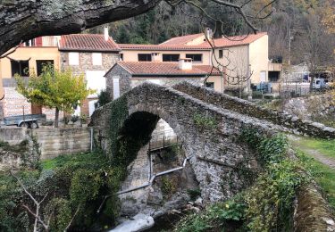
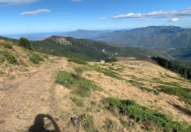
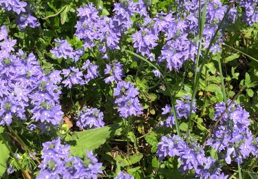
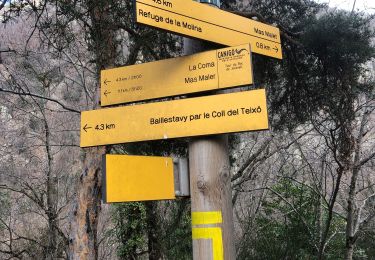
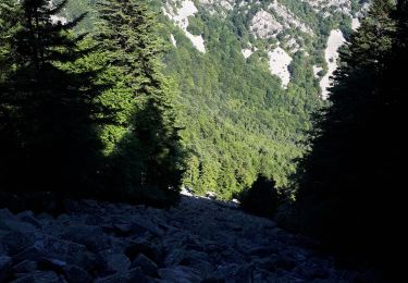
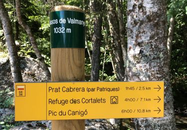
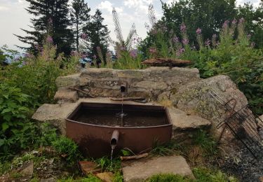
Randonnée Marche de 12,4 km à découvrir à Occitanie, Pyrénées-Orientales, Baillestavy. Cette randonnée est proposée par force.

Description

Independant 2017 Page 40

Profil altimétrique

Localisation

Pays :
France
Région :
Occitanie
Département/Province :
Pyrénées-Orientales
Commune :
Baillestavy
Localité :
Unknown
Départ:(Dec)
Départ:(UTM)
461109 ; 4712628 (31T) N.

Randonnées à proximité

Randonnée Marche Baillestavy - 20221127 Baillestavy- Valmanya - - Prat Mitja - Photo
Marche
ThonyM

Marche

Difficile
Baillestavy, Occitanie, Pyrénées-Orientales, France
16,8 km | 30 km-effort
5h 2min
Oui
Randonnée Marche Taurinya - 2022 TRANSPYRÉNÉENNE : refuge les Mariales le Canigou - les Cortalets - Refuge  Bardera - Photo
Marche
LEGUE

Marche

Très difficile
Taurinya, Occitanie, Pyrénées-Orientales, France
18,1 km | 27 km-effort
4h 5min
Non
Randonnée Marche Baillestavy - 20220519 Ballestavy - Photo
Marche
ThonyM

Marche

Moyen
Baillestavy, Occitanie, Pyrénées-Orientales, France
12,6 km | 21 km-effort
3h 28min
Oui
Randonnée Marche Estoher - 20220227 Mas Maler- Mines de la Coume - Photo
Marche
ThonyM

Marche

Difficile
Estoher, Occitanie, Pyrénées-Orientales, France
15,2 km | 30 km-effort
5h 35min
Oui
Randonnée Marche Valmanya - Los Masos Prat Cabrera - Photo
Marche
oscar1

Marche

Très difficile
Valmanya, Occitanie, Pyrénées-Orientales, France
12,6 km | 23 km-effort
3h 37min
Oui
Randonnée Marche Valmanya - 20210705 Pic du Canigou par L’os Masos de Valmanya - Photo
Marche
ThonyM

Marche

Difficile
Valmanya, Occitanie, Pyrénées-Orientales, France
23 km | 49 km-effort
7h 12min
Oui
Randonnée Marche Estoher - 20201025 tour du Jocavell depuis Mas Malet  - Photo
Marche
ThonyM

Marche

Moyen
Estoher, Occitanie, Pyrénées-Orientales, France
15,2 km | 30 km-effort
5h 55min
Oui
Randonnée Marche Valmanya - 20200815 Los Masos - Pinatell - Photo
Marche
ThonyM

Marche

Moyen
Valmanya, Occitanie, Pyrénées-Orientales, France
12,6 km | 23 km-effort
3h 47min
Oui
Randonnée Marche Valmanya - Balcon du Canigou - Photo
Marche
MarieFrancoise

Marche

Moyen
Valmanya, Occitanie, Pyrénées-Orientales, France
19,1 km | 32 km-effort
7h 17min
Non


Fermer
Mes abonnements