Randonnée Marche Villefranche-de-Panat - Villefranche de Panat - Photo
 christiane01
christiane01

Utilisateur

© OpenStreetMap contributors
Longueur
Longueur
10,4 km
Altitude max
Altitude max
749 m
Dénivelé positif
Dénivelé positif
113 m
Km-Effort
Km-Effort  
11,9 km
Altitude min
Altitude min
725 m
Dénivelé négatif
Dénivelé négatif
116 m
Boucle
Boucle
Oui
Date de création :
2017-05-16 00:00:00.0
Dernière modification :
2017-05-16 00:00:00.0

(2 Avis)

Marche
Marche
2h42
Difficulté : Facile

Scannez ce code QR pour ouvrir la randonnée dans l'application SityTrail

Application GPS de randonnée GRATUITE

Logo SityTrail SityTrail

IGN / Instituts géographiques

Télécharger SityTrail sur l'App Store Télécharger SityTrail sur Google Play

Logo SityTrail SityTrail World

Le monde est à vous

Télécharger SityTrail sur l'App Store Télécharger SityTrail sur Google Play Télécharger SityTrail sur Huawei AppGallery

À propos

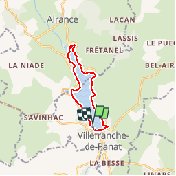
Randonnée Marche de 10,4 km à découvrir à Occitanie, Aveyron, Villefranche-de-Panat. Cette randonnée est proposée par christiane01.
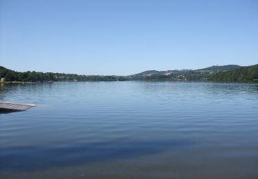
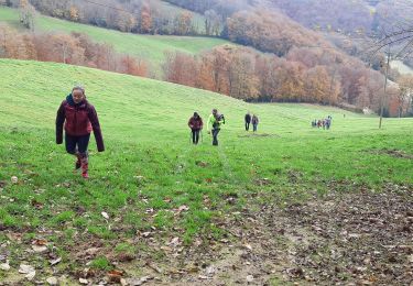
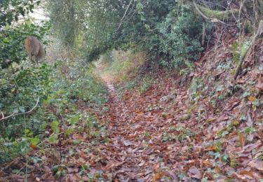
Description

le tour de lac

Profil altimétrique

Photos

Localisation

Pays :
France
Région :
Occitanie
Département/Province :
Aveyron
Commune :
Villefranche-de-Panat
Localité :
Unknown
Départ:(Dec)
Départ:(UTM)
475876 ; 4882200 (31T) N.

Commentaires

Veuillez vous connecter pour laisser un commentaire ou une note


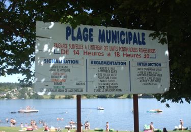
Circuit bien aménagé et instructif.( pouvant être suivi avec une poussette).
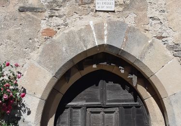
  

belle randonnée


Randonnées à proximité

Randonnée A pied Auriac-Lagast - Ronde des lacs du Levezou - Photo
A pied
GUIDE+

A pied

Très difficile
Auriac-Lagast, Occitanie, Aveyron, France
103 km | 135 km-effort
30h 36min
Oui
Randonnée A pied Alrance - Circumlacustre Villefranche-de-Panat - Photo
A pied
GUIDE+

A pied

Facile
Alrance, Occitanie, Aveyron, France
10,2 km | 11,7 km-effort
2h 39min
Oui
Randonnée Marche Villefranche-de-Panat - Villefranche de Panat à Salles Curan  - Photo
Marche
yvesmonteillet

Marche

Très difficile
Villefranche-de-Panat, Occitanie, Aveyron, France
24 km | 31 km-effort
4h 53min
Non
Randonnée Marche Lestrade-et-Thouels - Randonnée Téléthon  - Photo
Marche
yvesmonteillet

Marche

Difficile
Lestrade-et-Thouels, Occitanie, Aveyron, France
8,9 km | 13,6 km-effort
3h 4min
Oui
Randonnée Marche Villefranche-de-Panat - randonnée Villefranche de panat  - Photo
Marche
Pascal Lemaire

Marche

Difficile
Villefranche-de-Panat, Occitanie, Aveyron, France
10,2 km | 12,7 km-effort
3h 10min
Oui
Randonnée Marche Lestrade-et-Thouels - randonnée l'estrade et thouesl  - Photo
Marche
Pascal Lemaire

Marche

Moyen
Lestrade-et-Thouels, Occitanie, Aveyron, France
9,4 km | 12 km-effort
2h 30min
Oui
Randonnée Marche Alrance - rafo ho - Photo
Marche
machafla

Marche

Moyen
Alrance, Occitanie, Aveyron, France
17,4 km | 23 km-effort
4h 10min
Oui
Randonnée Marche Le Truel - costecalde - Photo
Marche
Pascal Lemaire

Marche

Moyen
Le Truel, Occitanie, Aveyron, France
8,7 km | 12,7 km-effort
2h 54min
Oui
Randonnée Marche Villefranche-de-Panat - lac de Villefranche de panat  - Photo
Marche
yvesmonteillet

Marche

Moyen
(1)
Villefranche-de-Panat, Occitanie, Aveyron, France
10,3 km | 11,8 km-effort
1h 46min
Oui


Fermer
Mes abonnements