Randonnée Marche Saint-Estève - 66 ST-ESTEVE, à PERPIGNAN-Bas Vernet par Le centre ville, la Colomina et l'espace St-Mamet - Photo

66 ST-ESTEVE, à PERPIGNAN-Bas Vernet par Le centre ville, la Colomina et l'espace St-Mamet

 jeff66
jeff66

Utilisateur

© OpenStreetMap contributors
Longueur
Longueur
14,2 km
Altitude max
Altitude max
49 m
Dénivelé positif
Dénivelé positif
76 m
Km-Effort
Km-Effort  
15,2 km
Altitude min
Altitude min
26 m
Dénivelé négatif
Dénivelé négatif
77 m
Boucle
Boucle
Oui
Date de création :
2015-12-18 00:00:00.0
Dernière modification :
2015-12-18 00:00:00.0

(0 Avis)

Marche
Marche
2h23
Difficulté : Moyen

Scannez ce code QR pour ouvrir la randonnée dans l'application SityTrail

Application GPS de randonnée GRATUITE

Logo SityTrail SityTrail

IGN / Instituts géographiques

Télécharger SityTrail sur l'App Store Télécharger SityTrail sur Google Play

Logo SityTrail SityTrail World

Le monde est à vous

Télécharger SityTrail sur l'App Store Télécharger SityTrail sur Google Play Télécharger SityTrail sur Huawei AppGallery

À propos

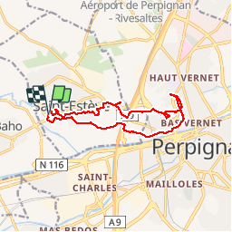
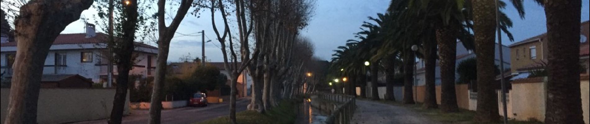
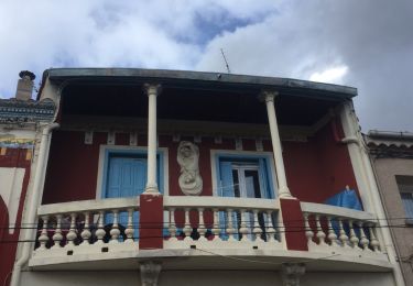
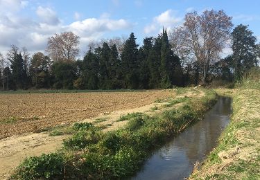
Randonnée Marche de 14,2 km à découvrir à Occitanie, Pyrénées-Orientales, Saint-Estève. Cette randonnée est proposée par jeff66.

Description

66 ST-ESTEVE, à PERPIGNAN-Bas Vernet par Le centre ville, la Colomina et l'espace St-Mamet

Profil altimétrique

Photos

Localisation

Pays :
France
Région :
Occitanie
Département/Province :
Pyrénées-Orientales
Commune :
Saint-Estève
Localité :
Unknown
Départ:(Dec)
Départ:(UTM)
486703 ; 4728332 (31T) N.

Randonnées à proximité

Randonnée Marche Saint-Estève - SAINT-ESTEVE 66 - ballade dans le Vignoble de Rivesaltes  - Photo
Marche
jeff66

Marche

Moyen
(1)
Saint-Estève, Occitanie, Pyrénées-Orientales, France
8 km | 8,8 km-effort
1h 23min
Oui
Randonnée Marche Perpignan - Perpignan 01.10.2017  - Photo
Marche
jeff66

Marche

Facile
(1)
Perpignan, Occitanie, Pyrénées-Orientales, France
6,7 km | 7,5 km-effort
1h 39min
Non
Randonnée Marche Perpignan - canal Perpignan  - Photo
Marche
Fildesir

Marche

Très facile
Perpignan, Occitanie, Pyrénées-Orientales, France
25 km | 27 km-effort
7h 29min
Non
Randonnée Marche Perpignan - 66 Perpignan Panchot centre bas Vernet centre del mon - Photo
Marche
jeff66

Marche

Facile
Perpignan, Occitanie, Pyrénées-Orientales, France
8,6 km | 9,3 km-effort
1h 29min
Oui
Randonnée Marche Perpignan - Xxx - Photo
Marche
jeff66

Marche

Moyen
Perpignan, Occitanie, Pyrénées-Orientales, France
15,1 km | 16,9 km-effort
2h 26min
Oui
Randonnée Marche Perpignan - 66 PERPIGNAN polygone nord au Haut Vernet - Photo
Marche
jeff66

Marche

Moyen
Perpignan, Occitanie, Pyrénées-Orientales, France
10,4 km | 11 km-effort
1h 57min
Oui
Randonnée Marche Perpignan - 66 PERPIGNAN, du sud au Nord Et retour - Photo
Marche
jeff66

Marche

Moyen
Perpignan, Occitanie, Pyrénées-Orientales, France
13,8 km | 15,4 km-effort
2h 40min
Oui
Randonnée Marche Perpignan - 66 PERPIGNAN porte Espagne, les arcades, saint Martin, moulin à vent, vertefeuille, mas Gaffard - Photo
Marche
jeff66

Marche

Moyen
Perpignan, Occitanie, Pyrénées-Orientales, France
10,3 km | 11,7 km-effort
1h 48min
Oui
Randonnée Marche Baho - 66 SAINT-ESTEVE, promenade entre jardins, canaux et centre ville - Photo
Marche
jeff66

Marche

Facile
Baho, Occitanie, Pyrénées-Orientales, France
6,9 km | 7,3 km-effort
1h 16min
Oui


Fermer
Mes abonnements