Randonnée Marche Onhaye - Balade de Sommière à Weillen - Photo

Balade de Sommière à Weillen

 Desrumaux
Desrumaux

Utilisateur GUIDE

© OpenStreetMap contributors
Longueur
Longueur
10,5 km
Altitude max
Altitude max
251 m
Dénivelé positif
Dénivelé positif
164 m
Km-Effort
Km-Effort  
12,7 km
Altitude min
Altitude min
151 m
Dénivelé négatif
Dénivelé négatif
166 m
Boucle
Boucle
Oui
Date de création :
2024-08-30 12:24:26.289
Dernière modification :
2024-08-30 12:37:23.366

(0 Avis)

Marche
Marche
2h53
Difficulté : Difficile

Scannez ce code QR pour ouvrir la randonnée dans l'application SityTrail

Application GPS de randonnée GRATUITE

Logo SityTrail SityTrail

IGN / Instituts géographiques

Télécharger SityTrail sur l'App Store Télécharger SityTrail sur Google Play

Logo SityTrail SityTrail World

Le monde est à vous

Télécharger SityTrail sur l'App Store Télécharger SityTrail sur Google Play Télécharger SityTrail sur Huawei AppGallery

À propos

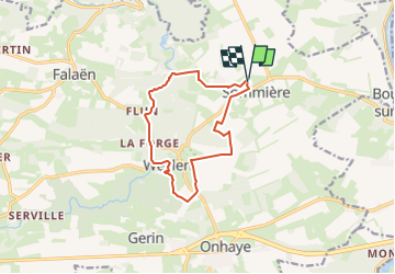
Randonnée Marche de 10,5 km à découvrir à Wallonie, Namur, Onhaye. Cette randonnée est proposée par Desrumaux.

Description

Très jolie balade au départ du village de Sommière vers le village de Weillen dans l'entité d'Onhaye en province de Namur.

Profil altimétrique

Photos

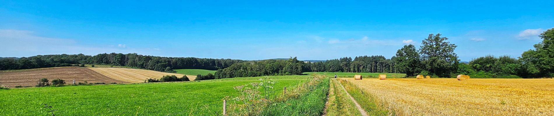
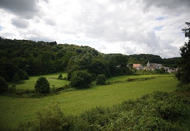
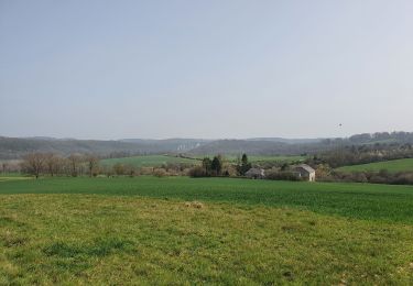
30 photos au total. Cliquez sur une photo pour les afficher toutes dans la galerie.

Localisation

Pays :
Belgique
Région :
Wallonie
Département/Province :
Namur
Commune :
Onhaye
Localité :
Unknown
Départ:(UTM)
631688 ; 5571040 (31U) N.

Randonnées à proximité

Randonnée Marche Dinant - RB-Na-24_Anseremme - Photo
Marche
PRO

Marche

Très difficile
(14)
Dinant, Wallonie, Namur, Belgique
19,3 km | 26 km-effort
5h 57min
Oui
Randonnée Marche Yvoir - RB-Na-03_Houx - Photo
Marche
PRO

Marche

Difficile
(11)
Yvoir, Wallonie, Namur, Belgique
22 km | 30 km-effort
7h 1min
Oui
Randonnée Marche Onhaye - RB-Na-C2 La vallée du Flavion et le château moyenâgeux de Montaigle - complet - Photo
Marche
PRO

Marche

Très difficile
(2)
Onhaye, Wallonie, Namur, Belgique
20 km | 25 km-effort
5h 25min
Oui
Randonnée Marche Dinant - Balade à Dinant - La Réserve Naturelle de Moniat - Photo
Marche
GUIDE
Desrumaux

Marche

Très facile
(1)
Dinant, Wallonie, Namur, Belgique
8,4 km | 10,9 km-effort
3h 54min
Oui
Randonnée Marche Anhée - Sosoye - Circuit Natura 2000, des sites qui valent le détour - Na11 - Photo
Marche
GUIDE+

Marche

Moyen
(5)
Anhée, Wallonie, Namur, Belgique
4,9 km | 6,3 km-effort
1h 21min
Oui
Randonnée Marche Dinant - D'Anseremme à Dinant - Photo
Marche
GUIDE
Desrumaux

Marche

Facile
(3)
Dinant, Wallonie, Namur, Belgique
8,3 km | 11,8 km-effort
2h 34min
Oui
Randonnée Marche Dinant - Balade à Bouvignes - Photo
Marche
GUIDE
Desrumaux

Marche

Facile
(3)
Dinant, Wallonie, Namur, Belgique
4,8 km | 7,2 km-effort
1h 34min
Oui
Randonnée Marche Dinant - Balade en Réserve Naturelle de Devant Bouvignes - Photo
Marche
GUIDE
Desrumaux

Marche

Très facile
(3)
Dinant, Wallonie, Namur, Belgique
4,9 km | 6,9 km-effort
1h 32min
Oui
Randonnée Marche Anhée - rando ornitho haut le wastia 01/04/2021 - Photo
Marche
GUIDE
japy54

Marche

Facile
(2)
Anhée, Wallonie, Namur, Belgique
12,9 km | 16,4 km-effort
4h 44min
Oui


Fermer
Mes abonnements