Randonnée Marche Saint-Benoît - La Réunion - Boucle du Grand Étang par la cascade du Bras d'Annette. - Photo

La Réunion - Boucle du Grand Étang par la cascade du Bras d'Annette.

 olive2b
olive2b

Utilisateur

© OpenStreetMap contributors
Longueur
Longueur
10,3 km
Altitude max
Altitude max
795 m
Dénivelé positif
Dénivelé positif
497 m
Km-Effort
Km-Effort  
17 km
Altitude min
Altitude min
509 m
Dénivelé négatif
Dénivelé négatif
498 m
Boucle
Boucle
Oui
Date de création :
2016-03-09 00:00:00.0
Dernière modification :
2016-03-09 00:00:00.0

(0 Avis)

Marche
Marche
4h56
Difficulté : Facile

Scannez ce code QR pour ouvrir la randonnée dans l'application SityTrail

Application GPS de randonnée GRATUITE

Logo SityTrail SityTrail

IGN / Instituts géographiques

Télécharger SityTrail sur l'App Store Télécharger SityTrail sur Google Play

Logo SityTrail SityTrail World

Le monde est à vous

Télécharger SityTrail sur l'App Store Télécharger SityTrail sur Google Play Télécharger SityTrail sur Huawei AppGallery

À propos

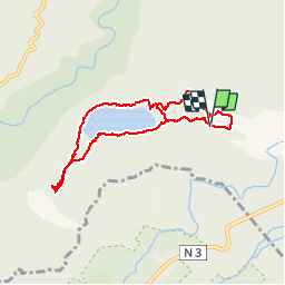
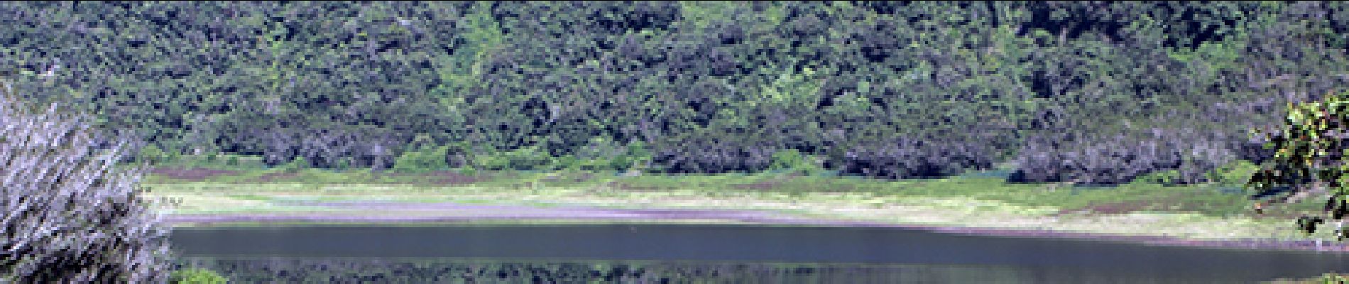
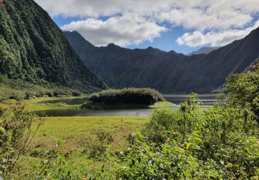
Randonnée Marche de 10,3 km à découvrir à La Réunion, Inconnu, Saint-Benoît. Cette randonnée est proposée par olive2b.

Description

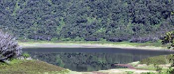
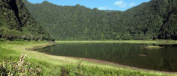
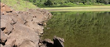
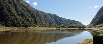
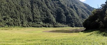
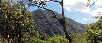
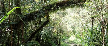
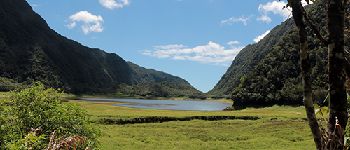
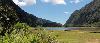
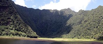
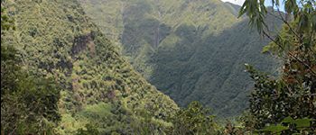
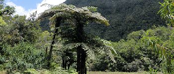
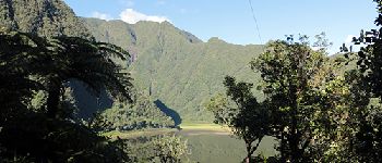
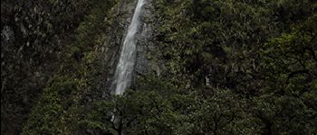
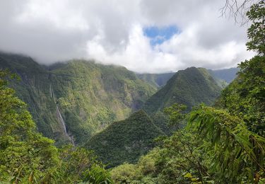
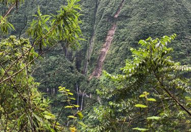
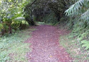
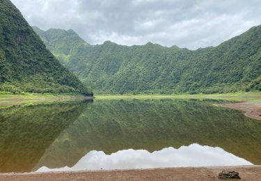
Boucle du Grand Étang en passant par la cascade du Bras d'Annette.
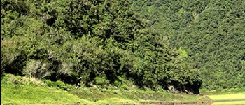
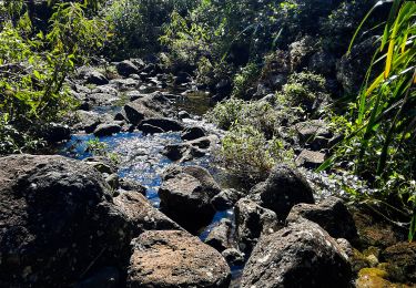
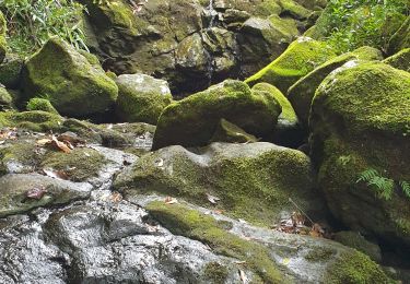
Circuit assez boueux comme beaucoup de circuit de ce secteur. On croise beaucoup de grenouilles, voir un papangue (un peu plus dur à apercevoir). Retour a été fait par le sentier Puy de l’Étang.

Profil altimétrique

Photos

Points d'intérêt

Point d'intérêt Saint-Benoît - L'étang - Photo
olive2b
SAINT-BENOÎT 
Point d'intérêt Saint-Benoît - Létang - Photo
olive2b
SAINT-BENOÎT 
Point d'intérêt Saint-Benoît - L'étang - Photo
olive2b
SAINT-BENOÎT 
Point d'intérêt Saint-Benoît - Souche dans l'étang - Photo
olive2b
SAINT-BENOÎT 
Point d'intérêt Saint-Benoît - On longe la berge - Photo
olive2b
SAINT-BENOÎT 
Point d'intérêt Saint-Benoît - Le tour de l'étang - Photo
olive2b
SAINT-BENOÎT 
Point d'intérêt Saint-Benoît - Arbre à l'embranchement - Photo
olive2b
Point d'intérêt Saint-Benoît - Arbre touffu - Photo
olive2b
SAINT-BENOÎT 
Point d'intérêt Saint-Benoît - L'étang sur le retour - Photo
olive2b
SAINT-BENOÎT 
Point d'intérêt Saint-Benoît - Etang - Photo
olive2b
SAINT-BENOÎT 
Point d'intérêt Saint-Benoît - Ettang - Photo
olive2b
SAINT-BENOÎT 
Point d'intérêt Saint-Benoît - Vue des cascades sur le retour - Photo
olive2b
Point d'intérêt Saint-Benoît - Cryptoméria - Photo
olive2b
SAINT-BENOÎT 
Point d'intérêt Saint-Benoît - Pancarte Piste équestre - Photo
olive2b
Point d'intérêt Saint-Benoît - Point de Vue de l'étang - Photo
olive2b
Point d'intérêt Saint-Benoît - Cascade du Bras d'Annette - Photo
olive2b

Localisation

Pays :
France
Région :
La Réunion
Département/Province :
Inconnu
Commune :
Saint-Benoît
Localité :
Unknown
Départ:(UTM)
360167 ; 7666555 (40K) S.

Commentaires

Veuillez vous connecter pour laisser un commentaire ou une note


chouette rando ...mais la boucle n est pas réalisable en saison des pluies...


Randonnées à proximité

Randonnée Marche Saint-Benoît - La Réunion -  Boucle du sentier des Ravenales - Photo
Marche
olive2b

Marche

Facile
Saint-Benoît, La Réunion, Inconnu, France
3,1 km | 4,8 km-effort
1h 32min
Oui
Randonnée Marche Saint-Benoît - Takamaka - Photo
Marche
PascalXLD

Marche

Très difficile
Saint-Benoît, La Réunion, Inconnu, France
12,5 km | 25 km-effort
6h 38min
Oui
Randonnée Marche Saint-Benoît - Grand étang - Cascades du bras d'Annette - Photo
Marche
PascalXLD

Marche

Moyen
Saint-Benoît, La Réunion, Inconnu, France
8,8 km | 16,7 km-effort
2h 34min
Oui
Randonnée Marche La Plaine-des-Palmistes - Rando urbaine Plaine des Palmistes et Cascade Biberon - Photo
Marche
GilbertLP

Marche

Très facile
La Plaine-des-Palmistes, La Réunion, Inconnu, France
6,6 km | 10,4 km-effort
2h 21min
Oui
Randonnée Marche Saint-Benoît - Foret des Ravenales - Photo
Marche
lgmalherbe

Marche

Moyen
Saint-Benoît, La Réunion, Inconnu, France
3,1 km | 4,8 km-effort
1h 11min
Oui
Randonnée Marche Saint-Benoît - Takamaka - Photo
Marche
Olivier Moine

Marche

Saint-Benoît, La Réunion, Inconnu, France
4,7 km | 7,5 km-effort
3h 14min
Oui
Randonnée Marche Saint-Benoît - Foret de ravenales - Photo
Marche
lgmalherbe

Marche

Moyen
Saint-Benoît, La Réunion, Inconnu, France
3,3 km | 5,1 km-effort
2h 2min
Oui
Randonnée Marche Saint-Benoît - Foret de ravenales - Photo
Marche
lgmalherbe

Marche

Moyen
Saint-Benoît, La Réunion, Inconnu, France
3,3 km | 5,1 km-effort
2h 2min
Oui
Randonnée Marche Saint-Benoît - Grand Étang - Photo
Marche
NANE51

Marche

Très facile
Saint-Benoît, La Réunion, Inconnu, France
10 km | 17,9 km-effort
3h 0min
Oui


Fermer
Mes abonnements