Randonnée Marche Bully - Dancé  - Photo
 nolsim
nolsim

Utilisateur

© OpenStreetMap contributors
Longueur
Longueur
14,9 km
Altitude max
Altitude max
543 m
Dénivelé positif
Dénivelé positif
437 m
Km-Effort
Km-Effort  
21 km
Altitude min
Altitude min
315 m
Dénivelé négatif
Dénivelé négatif
375 m
Boucle
Boucle
Non
Date de création :
2022-09-02 06:56:55.065
Dernière modification :
2022-09-02 12:24:09.922

(0 Avis)

Marche
Marche
3h45
Difficulté : Moyen

Scannez ce code QR pour ouvrir la randonnée dans l'application SityTrail

Application GPS de randonnée GRATUITE

Logo SityTrail SityTrail

IGN / Instituts géographiques

Télécharger SityTrail sur l'App Store Télécharger SityTrail sur Google Play

Logo SityTrail SityTrail World

Le monde est à vous

Télécharger SityTrail sur l'App Store Télécharger SityTrail sur Google Play Télécharger SityTrail sur Huawei AppGallery

À propos

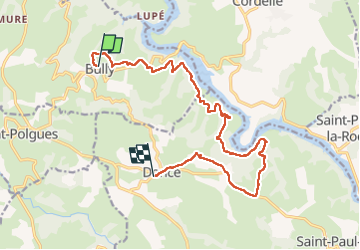
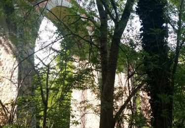
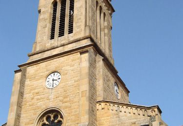
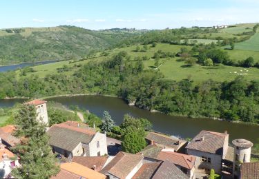
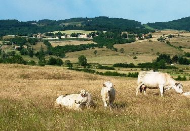
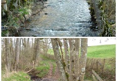
Randonnée Marche de 14,9 km à découvrir à Auvergne-Rhône-Alpes, Loire, Bully. Cette randonnée est proposée par nolsim.

Profil altimétrique

Photos

Localisation

Pays :
France
Région :
Auvergne-Rhône-Alpes
Département/Province :
Loire
Commune :
Bully
Localité :
Unknown
Départ:(UTM)
577976 ; 5086566 (31T) N.

Randonnées à proximité

Randonnée Marche Saint-Jean-Saint-Maurice-sur-Loire - Autour des Gorges de la Loire - PR N° 9 : Sur le pas des pèlerins - Saint-Jean-Saint-Maurice-sur-Loire - Photo
Marche
tracegps

Marche

Très difficile
(1)
Saint-Jean-Saint-Maurice-sur-Loire, Auvergne-Rhône-Alpes, Loire, France
14,2 km | 19,8 km-effort
4h 30min
Oui
Randonnée Marche Saint-Jean-Saint-Maurice-sur-Loire - Saint -Jean Saint -Maurice sur Loire  - Photo
Marche
dudu42

Marche

Moyen
Saint-Jean-Saint-Maurice-sur-Loire, Auvergne-Rhône-Alpes, Loire, France
21 km | 26 km-effort
5h 4min
Oui
Randonnée sport Saint-Jean-Saint-Maurice-sur-Loire - Retour bis - Photo
sport
ophness

sport

Très facile
(1)
Saint-Jean-Saint-Maurice-sur-Loire, Auvergne-Rhône-Alpes, Loire, France
12,6 km | 16,2 km-effort
Inconnu
Non
Randonnée Marche Cordelle - boucle rilly-9.7 km - Photo
Marche
famillerudent

Marche

Difficile
Cordelle, Auvergne-Rhône-Alpes, Loire, France
9,7 km | 13,4 km-effort
2h 44min
Oui
Randonnée Marche Saint-Polgues - St Porgues  - Photo
Marche
mimi69670

Marche

Facile
Saint-Polgues, Auvergne-Rhône-Alpes, Loire, France
13,9 km | 18,6 km-effort
3h 48min
Non
Randonnée Marche Cordelle - Cordelle : Terrenoire et versant sud - Photo
Marche
Jgar

Marche

Moyen
Cordelle, Auvergne-Rhône-Alpes, Loire, France
12,1 km | 15,4 km-effort
3h 43min
Oui
Randonnée Marche Saint-Jean-Saint-Maurice-sur-Loire - St Jean-St Maurice 18km - Photo
Marche
GUIDE
thonyc

Marche

Difficile
Saint-Jean-Saint-Maurice-sur-Loire, Auvergne-Rhône-Alpes, Loire, France
18,3 km | 25 km-effort
5h 55min
Oui
Randonnée V.T.T. Saint-Jean-Saint-Maurice-sur-Loire - 3ème Rando VTT de la Tour (ACLT) - Saint-Jean-Saint-Maurice-sur-Loire - Photo
V.T.T.
tracegps

V.T.T.

Difficile
Saint-Jean-Saint-Maurice-sur-Loire, Auvergne-Rhône-Alpes, Loire, France
28 km | 36 km-effort
3h 0min
Oui
Randonnée V.T.T. Saint-Polgues - Vallée de l'Isable et exploitations agricoles - Saint-Polgues - Photo
V.T.T.
tracegps

V.T.T.

Difficile
Saint-Polgues, Auvergne-Rhône-Alpes, Loire, France
31 km | 40 km-effort
3h 0min
Oui


Fermer
Mes abonnements