Randonnée Marche Saint-Symphorien-de-Lay - St Symphorien de lay, agri rando - Photo
 mimi69670
mimi69670

Utilisateur

© OpenStreetMap contributors
Longueur
Longueur
15,6 km
Altitude max
Altitude max
581 m
Dénivelé positif
Dénivelé positif
389 m
Km-Effort
Km-Effort  
21 km
Altitude min
Altitude min
416 m
Dénivelé négatif
Dénivelé négatif
409 m
Boucle
Boucle
Non
Date de création :
2022-05-29 09:28:03.121
Dernière modification :
2022-05-29 14:42:04.962

(0 Avis)

Marche
Marche
4h06
Difficulté : Facile

Scannez ce code QR pour ouvrir la randonnée dans l'application SityTrail

Application GPS de randonnée GRATUITE

Logo SityTrail SityTrail

IGN / Instituts géographiques

Télécharger SityTrail sur l'App Store Télécharger SityTrail sur Google Play

Logo SityTrail SityTrail World

Le monde est à vous

Télécharger SityTrail sur l'App Store Télécharger SityTrail sur Google Play Télécharger SityTrail sur Huawei AppGallery

À propos

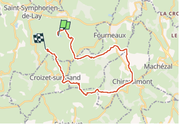
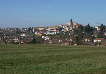
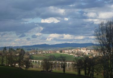
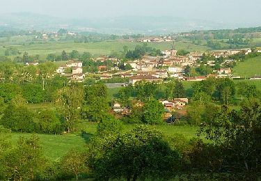
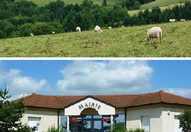
Randonnée Marche de 15,6 km à découvrir à Auvergne-Rhône-Alpes, Loire, Saint-Symphorien-de-Lay. Cette randonnée est proposée par mimi69670.

Description

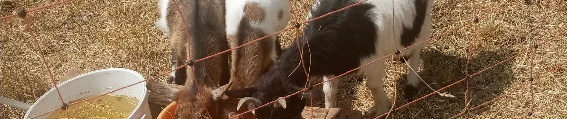
Départ après st symphorien de Lay. Rando à travers champs, relais dans 3 fermes avec dégustation des produits fermiers

Profil altimétrique

Photos

Localisation

Pays :
France
Région :
Auvergne-Rhône-Alpes
Département/Province :
Loire
Commune :
Saint-Symphorien-de-Lay
Localité :
Unknown
Départ:(UTM)
595535 ; 5087687 (31T) N.

Randonnées à proximité

Randonnée Marche Saint-Symphorien-de-Lay - etang st symphorien de lay - Photo
Marche
poterie

Marche

Difficile
(1)
Saint-Symphorien-de-Lay, Auvergne-Rhône-Alpes, Loire, France
10,6 km | 14,5 km-effort
3h 17min
Oui
Randonnée Marche Saint-Just-la-Pendue - St Just la Pendue, départ à la chapelle - Photo
Marche
mimi69670

Marche

Facile
Saint-Just-la-Pendue, Auvergne-Rhône-Alpes, Loire, France
10,1 km | 13,1 km-effort
2h 43min
Oui
Randonnée Marche Saint-Symphorien-de-Lay - Saint Symphorien de Lay - Photo
Marche
jpc42

Marche

Moyen
Saint-Symphorien-de-Lay, Auvergne-Rhône-Alpes, Loire, France
12,1 km | 16,8 km-effort
3h 20min
Oui
Randonnée Marche Saint-Symphorien-de-Lay - St Symphorien de Lay - Photo
Marche
jpc42

Marche

Moyen
Saint-Symphorien-de-Lay, Auvergne-Rhône-Alpes, Loire, France
10,5 km | 14,4 km-effort
3h 3min
Oui
Randonnée V.T.T. Fourneaux - Rando VTT des Crêtes (2014-VTT-50km) - Fourneaux - Photo
V.T.T.
tracegps

V.T.T.

Très difficile
Fourneaux, Auvergne-Rhône-Alpes, Loire, France
48 km | 67 km-effort
4h 30min
Oui
Randonnée V.T.T. Saint-Symphorien-de-Lay - VTT au creux des Vallées du Gand de l''Ecoron et du Rhins - Saint-Symphorien-de-Lay - Photo
V.T.T.
tracegps

V.T.T.

Difficile
Saint-Symphorien-de-Lay, Auvergne-Rhône-Alpes, Loire, France
30 km | 38 km-effort
3h 0min
Oui
Randonnée Course à pied Neaux - La route Napoléon et la Vallée du Gand à VTT - Neaux - Photo
Course à pied
tracegps

Course à pied

Moyen
Neaux, Auvergne-Rhône-Alpes, Loire, France
11,7 km | 14,7 km-effort
2h 0min
Oui
Randonnée V.T.T. Neaux - La route Napoléon et la Vallée du Gand à VTT - Neaux - Photo
V.T.T.
tracegps

V.T.T.

Moyen
Neaux, Auvergne-Rhône-Alpes, Loire, France
11,7 km | 14,7 km-effort
1h 15min
Oui
Randonnée Marche Neaux - La route Napoléon et la Vallée du Gand à VTT - Neaux - Photo
Marche
tracegps

Marche

Moyen
Neaux, Auvergne-Rhône-Alpes, Loire, France
11,7 km | 14,7 km-effort
3h 0min
Oui


Fermer
Mes abonnements