Randonnée Marche Chambray-lès-Tours - Chambray-lès-Tours - de la Vrillonnerie Marsin à Tours Prébendes - 8.8km 55m95 1h50 - 2021 09 03 - Photo

Chambray-lès-Tours - de la Vrillonnerie Marsin à Tours Prébendes - 8.8km 55m95 1h50 - 2021 09 03

 Orcal37
Orcal37

Utilisateur

© OpenStreetMap contributors
Longueur
Longueur
8,6 km
Altitude max
Altitude max
97 m
Dénivelé positif
Dénivelé positif
57 m
Km-Effort
Km-Effort  
9,5 km
Altitude min
Altitude min
46 m
Dénivelé négatif
Dénivelé négatif
93 m
Boucle
Boucle
Non
Date de création :
2021-09-03 14:05:02.754
Dernière modification :
2021-10-12 16:51:29.93

(0 Avis)

Marche
Marche
1h50
Difficulté : Très facile

Scannez ce code QR pour ouvrir la randonnée dans l'application SityTrail

Application GPS de randonnée GRATUITE

Logo SityTrail SityTrail

IGN / Instituts géographiques

Télécharger SityTrail sur l'App Store Télécharger SityTrail sur Google Play

Logo SityTrail SityTrail World

Le monde est à vous

Télécharger SityTrail sur l'App Store Télécharger SityTrail sur Google Play Télécharger SityTrail sur Huawei AppGallery

À propos

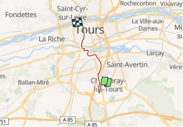
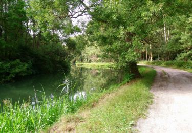
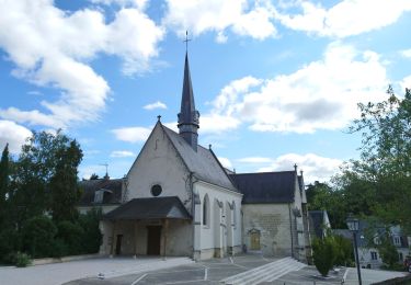
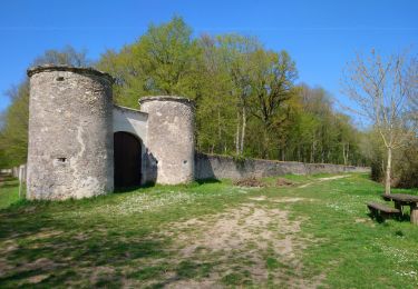
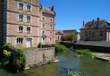
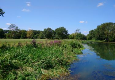
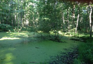
Randonnée Marche de 8,6 km à découvrir à Centre-Val de Loire, Indre-et-Loire, Chambray-lès-Tours. Cette randonnée est proposée par Orcal37.

Description

Chambray-lès-Tours - de la Vrillonnerie Marsin à Tours Prébendes - 8.8km 55m95 1h50 - 2021 09 03

Profil altimétrique

Photos

Localisation

Pays :
France
Région :
Centre-Val de Loire
Département/Province :
Indre-et-Loire
Commune :
Chambray-lès-Tours
Localité :
Unknown
Départ:(UTM)
326412 ; 5244533 (31T) N.

Randonnées à proximité

Randonnée Marche Saint-Avertin - Saint-Avertin - PR Sentier du vieux Cher, Cangé - 9.3km 95m 2h05 (20mn) - 2023 07 12 - Photo
Marche
Orcal37

Marche

Facile
Saint-Avertin, Centre-Val de Loire, Indre-et-Loire, France
9,3 km | 10,5 km-effort
2h 5min
Oui
Randonnée Marche Montbazon - Chemin des pêcheurs  - Photo
Marche
Dalma Chuck

Marche

Facile
Montbazon, Centre-Val de Loire, Indre-et-Loire, France
7,1 km | 7,7 km-effort
1h 30min
Oui
Randonnée Marche Tours - Circuit des passerelles sur le Cher à Tours Sud - Photo
Marche
guydu41

Marche

Moyen
Tours, Centre-Val de Loire, Indre-et-Loire, France
9,1 km | 9,8 km-effort
2h 45min
Oui
Randonnée Marche Monts - Monts - la Horaie Circuit avec routes - 16.6km 130m 3h40 - 2022 06 16 - Photo
Marche
Orcal37

Marche

Facile
Monts, Centre-Val de Loire, Indre-et-Loire, France
16,6 km | 18,3 km-effort
3h 40min
Oui
Randonnée Marche Saint-Avertin - Saint-Avertin - Véretz et Bois des Hâtes de Larçay - 25.3km 180m 5h15 (20mn) - 2021 08 01 - Photo
Marche
Orcal37

Marche

Facile
Saint-Avertin, Centre-Val de Loire, Indre-et-Loire, France
25 km | 28 km-effort
5h 15min
Oui
Randonnée Marche Joué-lès-Tours - Joué-lès-Tours - 12.9km 100m 2h25 - 2021 04 03 - Photo
Marche
Orcal37

Marche

Facile
Joué-lès-Tours, Centre-Val de Loire, Indre-et-Loire, France
12,9 km | 14,2 km-effort
2h 25min
Oui
Randonnée Marche Veigné - Veigné - boucles via GR46A - 19.9km 210m 4h20 - 2020 05 29 - Photo
Marche
Orcal37

Marche

Facile
Veigné, Centre-Val de Loire, Indre-et-Loire, France
19,9 km | 23 km-effort
4h 20min
Oui
Randonnée Marche Montbazon - Montbazon - 10.3km 100m 2h15 - 2018 05 08 - Photo
Marche
Orcal37

Marche

Facile
Montbazon, Centre-Val de Loire, Indre-et-Loire, France
10,3 km | 11,6 km-effort
2h 15min
Oui
Randonnée Marche Chambray-lès-Tours - bois des hâtes  - Photo
Marche
bipsy78

Marche

Facile
(1)
Chambray-lès-Tours, Centre-Val de Loire, Indre-et-Loire, France
11,9 km | 13 km-effort
2h 38min
Oui


Fermer
Mes abonnements