


10,4 km | 17,5 km-effort

Utilisateur


Application GPS de randonnée GRATUITE
 SityTrail
IGN / Instituts géographiques
SityTrail World
Le monde est à vous
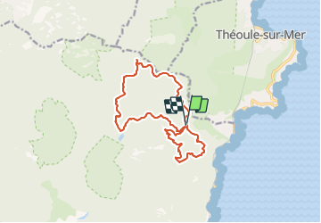
Randonnée Marche de 15,5 km à découvrir à Provence-Alpes-Côte d'Azur, Var, Saint-Raphaël. Cette randonnée est proposée par LtZIP.
IBP:
Orange 70
15 km / 724 m
Col ND - Col de la Cadière: Essayer de prendre GR51 par Petites et Grandes Grues
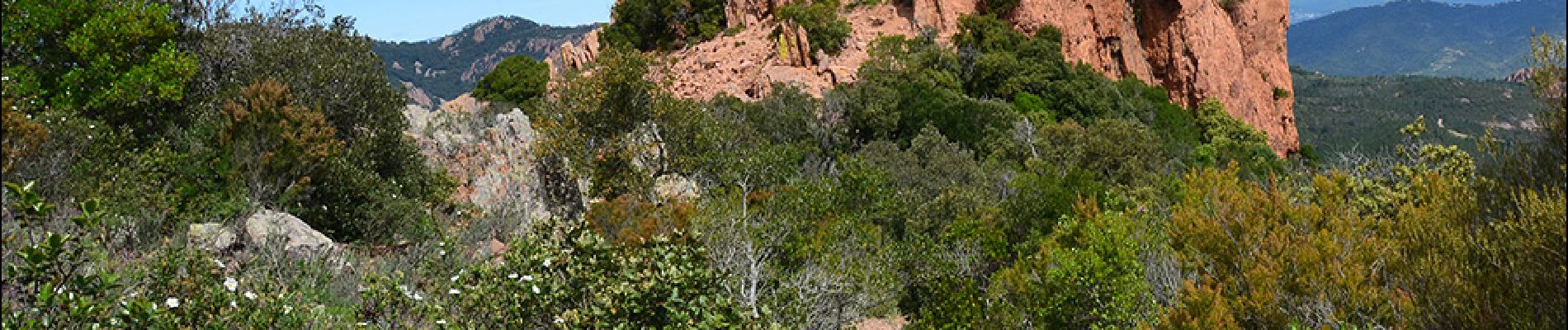
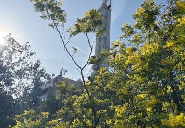
 : Col ND - Col des Lentisques - Pic de l'Ours - Dent de l'Ours - Col ND - Col de la Cadière - Col des Replats - GR 51 - Photo 1")
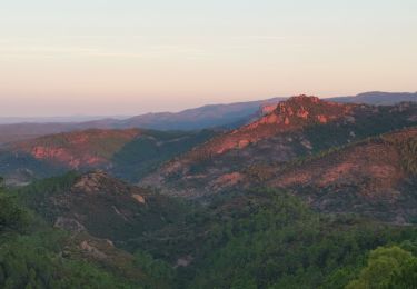
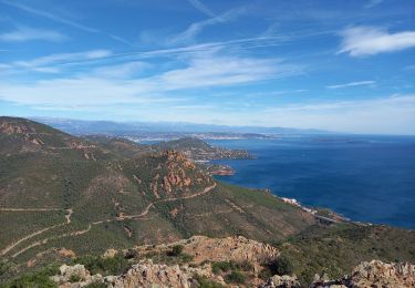
 : Col ND - Col des Lentisques - Pic de l'Ours - Dent de l'Ours - Col ND - Col de la Cadière - Col des Replats - GR 51 - Photo 2")
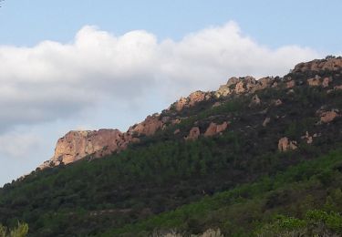
 : Col ND - Col des Lentisques - Pic de l'Ours - Dent de l'Ours - Col ND - Col de la Cadière - Col des Replats - GR 51 - Photo 3")
 : Col ND - Col des Lentisques - Pic de l'Ours - Dent de l'Ours - Col ND - Col de la Cadière - Col des Replats - GR 51 - Photo 4")
 : Col ND - Col des Lentisques - Pic de l'Ours - Dent de l'Ours - Col ND - Col de la Cadière - Col des Replats - GR 51 - Photo 5")
 : Col ND - Col des Lentisques - Pic de l'Ours - Dent de l'Ours - Col ND - Col de la Cadière - Col des Replats - GR 51 - Photo 6")
 : Col ND - Col des Lentisques - Pic de l'Ours - Dent de l'Ours - Col ND - Col de la Cadière - Col des Replats - GR 51 - Photo 7")
 : Col ND - Col des Lentisques - Pic de l'Ours - Dent de l'Ours - Col ND - Col de la Cadière - Col des Replats - GR 51 - Photo 8")
 : Col ND - Col des Lentisques - Pic de l'Ours - Dent de l'Ours - Col ND - Col de la Cadière - Col des Replats - GR 51 - Photo 9")
 : Col ND - Col des Lentisques - Pic de l'Ours - Dent de l'Ours - Col ND - Col de la Cadière - Col des Replats - GR 51 - Photo 10")
 : Col ND - Col des Lentisques - Pic de l'Ours - Dent de l'Ours - Col ND - Col de la Cadière - Col des Replats - GR 51 - Photo 11")
 : Col ND - Col des Lentisques - Pic de l'Ours - Dent de l'Ours - Col ND - Col de la Cadière - Col des Replats - GR 51 - Photo 12")
 : Col ND - Col des Lentisques - Pic de l'Ours - Dent de l'Ours - Col ND - Col de la Cadière - Col des Replats - GR 51 - Photo 13")
 : Col ND - Col des Lentisques - Pic de l'Ours - Dent de l'Ours - Col ND - Col de la Cadière - Col des Replats - GR 51 - Photo 14")
 : Col ND - Col des Lentisques - Pic de l'Ours - Dent de l'Ours - Col ND - Col de la Cadière - Col des Replats - GR 51 - Photo 15")
 : Col ND - Col des Lentisques - Pic de l'Ours - Dent de l'Ours - Col ND - Col de la Cadière - Col des Replats - GR 51 - Photo 16")
 : Col ND - Col des Lentisques - Pic de l'Ours - Dent de l'Ours - Col ND - Col de la Cadière - Col des Replats - GR 51 - Photo 17")
 : Col ND - Col des Lentisques - Pic de l'Ours - Dent de l'Ours - Col ND - Col de la Cadière - Col des Replats - GR 51 - Photo 18")
 : Col ND - Col des Lentisques - Pic de l'Ours - Dent de l'Ours - Col ND - Col de la Cadière - Col des Replats - GR 51 - Photo 19")
Marche

Marche

Marche

Marche

Marche
Marche

Marche
Marche
Marche