Randonnée Marche Dietwiller - JD M2A 11/20 Circuit des collines de Dietwiller - Photo

JD M2A 11/20 Circuit des collines de Dietwiller

 argonneuweg
argonneuweg

Utilisateur

© OpenStreetMap contributors
Longueur
Longueur
6,2 km
Altitude max
Altitude max
281 m
Dénivelé positif
Dénivelé positif
78 m
Km-Effort
Km-Effort  
7,2 km
Altitude min
Altitude min
239 m
Dénivelé négatif
Dénivelé négatif
82 m
Boucle
Boucle
Oui
Date de création :
2021-01-08 13:11:28.0
Dernière modification :
2021-01-08 18:23:14.467

(0 Avis)

Marche
Marche
1h22
Difficulté : Inconnu

Scannez ce code QR pour ouvrir la randonnée dans l'application SityTrail

Application GPS de randonnée GRATUITE

Logo SityTrail SityTrail

IGN / Instituts géographiques

Télécharger SityTrail sur l'App Store Télécharger SityTrail sur Google Play

Logo SityTrail SityTrail World

Le monde est à vous

Télécharger SityTrail sur l'App Store Télécharger SityTrail sur Google Play Télécharger SityTrail sur Huawei AppGallery

À propos

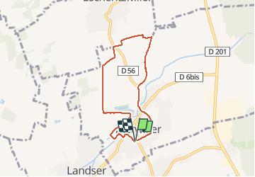
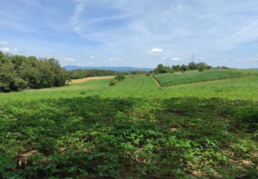
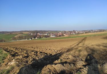
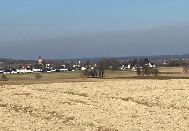
Randonnée Marche de 6,2 km à découvrir à Grand Est, Haut-Rhin, Dietwiller. Cette randonnée est proposée par argonneuweg.

Description

Randonnée très facile avec quelques belles vues, mais une partie du circuit est trop proche de la circulation automobile.
A voir notamment la vieille tour de Dietwiller et son tilleul tricentenaire.
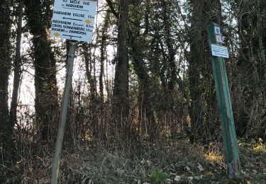
Suivre le balisage du cercle vert.

Profil altimétrique

Localisation

Pays :
France
Région :
Grand Est
Département/Province :
Haut-Rhin
Commune :
Dietwiller
Localité :
Unknown
Départ:(UTM)
380167 ; 5283066 (32T) N.

Randonnées à proximité

Randonnée A pied Mulhouse - Anneau rouge - Photo
A pied
GUIDE+

A pied

Facile
Mulhouse, Grand Est, Haut-Rhin, France
7,4 km | 9,7 km-effort
2h 11min
Oui
Randonnée Marche Rixheim - JD 17/20 Collines de Habsheim - Photo
Marche
argonneuweg

Marche

Rixheim, Grand Est, Haut-Rhin, France
7,7 km | 9,7 km-effort
2h 0min
Oui
Randonnée Marche Mulhouse -
Marche
boubou68

Marche

Facile
Mulhouse, Grand Est, Haut-Rhin, France
3,1 km | 3,7 km-effort
50min
Oui
Randonnée Marche Schlierbach - Schlilierbach  - Photo
Marche
ROPPJP

Marche

Moyen
Schlierbach, Grand Est, Haut-Rhin, France
9,3 km | 11,2 km-effort
3h 7min
Oui
Randonnée Marche Mulhouse - waldeck- tou r du matin - Photo
Marche
chantalwaltzer

Marche

Mulhouse, Grand Est, Haut-Rhin, France
8,3 km | 10,3 km-effort
1h 49min
Oui
Randonnée Geocaching Habsheim - VC 2024 - Photo
Geocaching
bemurix

Geocaching

Facile
Habsheim, Grand Est, Haut-Rhin, France
5,2 km | 6,7 km-effort
2h 30min
Oui
Randonnée Marche Sierentz - Bartenheim  - Photo
Marche
ROPPJP

Marche

Difficile
Sierentz, Grand Est, Haut-Rhin, France
11,5 km | 13,7 km-effort
3h 47min
Oui
Randonnée Marche Kœtzingue - Koetzingue  - Photo
Marche
ROPPJP

Marche

Moyen
Kœtzingue, Grand Est, Haut-Rhin, France
9 km | 10,7 km-effort
2h 53min
Oui
Randonnée Marche Bruebach - 22 03 01. VTM  - Photo
Marche
jmbilger

Marche

Difficile
Bruebach, Grand Est, Haut-Rhin, France
6 km | 7,7 km-effort
2h 34min
Oui


Fermer
Mes abonnements