Randonnée V.T.T. Tonnoy - Découverte Bois Azelot - Photo

Découverte Bois Azelot

 regish54
regish54

Utilisateur

© OpenStreetMap contributors
Longueur
Longueur
15,9 km
Altitude max
Altitude max
339 m
Dénivelé positif
Dénivelé positif
196 m
Km-Effort
Km-Effort  
18,5 km
Altitude min
Altitude min
230 m
Dénivelé négatif
Dénivelé négatif
198 m
Boucle
Boucle
Oui
Date de création :
2020-09-02 13:17:56.351
Dernière modification :
2020-09-05 20:22:44.129

(0 Avis)

V.T.T.
V.T.T.
1h26
Difficulté : Facile

Scannez ce code QR pour ouvrir la randonnée dans l'application SityTrail

Application GPS de randonnée GRATUITE

Logo SityTrail SityTrail

IGN / Instituts géographiques

Télécharger SityTrail sur l'App Store Télécharger SityTrail sur Google Play

Logo SityTrail SityTrail World

Le monde est à vous

Télécharger SityTrail sur l'App Store Télécharger SityTrail sur Google Play Télécharger SityTrail sur Huawei AppGallery

À propos

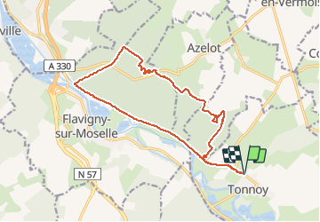
Randonnée V.T.T. de 15,9 km à découvrir à Grand Est, Meurthe-et-Moselle, Tonnoy. Cette randonnée est proposée par regish54.

Description

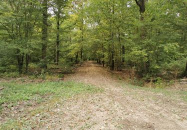
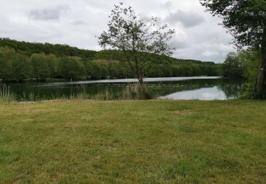
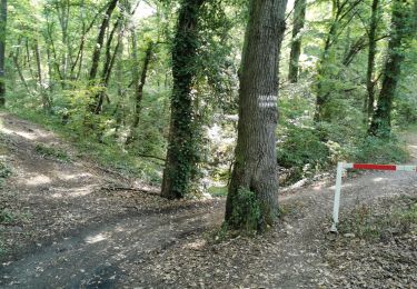
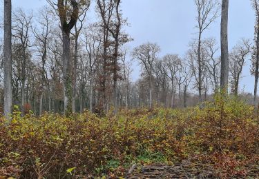
Petit circuit sympa pour découvrir les bois de Burthecourt, Azelot et Flavigny avec un retour tranquille vers Tonnoy. Un petit peu de cross au début du parcours en forêt avant la montée tout droit vers le plateau, un petit parcours sympa entre les arbres avant le retour tout droit vers Tonnoy.

Profil altimétrique

Localisation

Pays :
France
Région :
Grand Est
Département/Province :
Meurthe-et-Moselle
Commune :
Tonnoy
Localité :
Unknown
Départ:(UTM)
296999 ; 5381659 (32U) N.

Randonnées à proximité

Randonnée V.T.T. Crévéchamps - Crevechamp-Benney-Menil - Photo
V.T.T.
regish54

V.T.T.

Facile
Crévéchamps, Grand Est, Meurthe-et-Moselle, France
11,7 km | 14,9 km-effort
1h 10min
Non
Randonnée V.T.T. Tonnoy - Menil-Benney - Photo
V.T.T.
regish54

V.T.T.

Facile
Tonnoy, Grand Est, Meurthe-et-Moselle, France
13,1 km | 16,9 km-effort
1h 11min
Non
Randonnée Marche Flavigny-sur-Moselle - Flavigny sur moselle - Photo
Marche
Jacques-WIRTH

Marche

Très facile
Flavigny-sur-Moselle, Grand Est, Meurthe-et-Moselle, France
10,1 km | 11 km-effort
3h 1min
Oui
Randonnée Marche Flavigny-sur-Moselle - Flavigny 2  12 100m + 197m  - Photo
Marche
DanielROLLET

Marche

Très facile
Flavigny-sur-Moselle, Grand Est, Meurthe-et-Moselle, France
11,9 km | 14,1 km-effort
3h 13min
Oui
Randonnée V.T.T. Flavigny-sur-Moselle - FLAVIGNY 2015-10-12 - Photo
V.T.T.
DENOMME

V.T.T.

Moyen
(2)
Flavigny-sur-Moselle, Grand Est, Meurthe-et-Moselle, France
28 km | 34 km-effort
2h 37min
Non
Randonnée V.T.T. Flavigny-sur-Moselle - 16km-decouverte - Photo
V.T.T.
regish54

V.T.T.

Facile
Flavigny-sur-Moselle, Grand Est, Meurthe-et-Moselle, France
12,2 km | 16,2 km-effort
1h 17min
Non
Randonnée Marche Flavigny-sur-Moselle - Flavgny - la boucle verte - Photo
Marche
jean-marie.parachini

Marche

Facile
Flavigny-sur-Moselle, Grand Est, Meurthe-et-Moselle, France
9,5 km | 11,5 km-effort
4h 51min
Oui
Randonnée Marche Flavigny-sur-Moselle - FLAVIGNY SUR MOSELLE - LA BOUCLE VERTE - Photo
Marche
jean-marie.parachini

Marche

Facile
Flavigny-sur-Moselle, Grand Est, Meurthe-et-Moselle, France
9,6 km | 11,6 km-effort
4h 35min
Oui
Randonnée Marche Flavigny-sur-Moselle - Flavigny 13 010m +205m - Photo
Marche
DanielROLLET

Marche

Difficile
Flavigny-sur-Moselle, Grand Est, Meurthe-et-Moselle, France
13 km | 15,7 km-effort
3h 5min
Oui


Fermer
Mes abonnements