Randonnée Marche Schweigen-Rechtenbach - RIF 02-11-2019 - Photo
 bene_dictus77
bene_dictus77

Utilisateur

© OpenStreetMap contributors
Longueur
Longueur
19,2 km
Altitude max
Altitude max
494 m
Dénivelé positif
Dénivelé positif
505 m
Km-Effort
Km-Effort  
26 km
Altitude min
Altitude min
173 m
Dénivelé négatif
Dénivelé négatif
507 m
Boucle
Boucle
Non
Date de création :
2019-11-11 08:27:51.389
Dernière modification :
2019-11-11 16:33:51.118

(0 Avis)

Marche
Marche
7h26
Difficulté : Très facile

Scannez ce code QR pour ouvrir la randonnée dans l'application SityTrail

Application GPS de randonnée GRATUITE

Logo SityTrail SityTrail

IGN / Instituts géographiques

Télécharger SityTrail sur l'App Store Télécharger SityTrail sur Google Play

Logo SityTrail SityTrail World

Le monde est à vous

Télécharger SityTrail sur l'App Store Télécharger SityTrail sur Google Play Télécharger SityTrail sur Huawei AppGallery

À propos

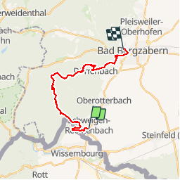
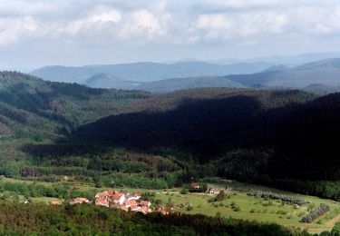
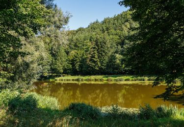
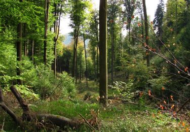
Randonnée Marche de 19,2 km à découvrir à Rhénanie-Palatinat, Landkreis Südliche Weinstraße, Schweigen-Rechtenbach. Cette randonnée est proposée par bene_dictus77.

Description

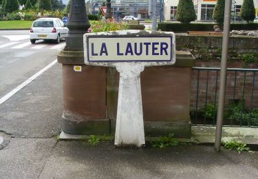
de Schweigen à Bad -Bergzabern

Profil altimétrique

Localisation

Pays :
Allemagne
Région :
Rhénanie-Palatinat
Département/Province :
Landkreis Südliche Weinstraße
Commune :
Schweigen-Rechtenbach
Localité :
Unknown
Départ:(UTM)
423698 ; 5433785 (32U) N.

Randonnées à proximité

Randonnée A pied Wissembourg - Rotes Kreuz - Photo
A pied
GUIDE+

A pied

Facile
Wissembourg, Grand Est, Bas-Rhin, France
6,5 km | 9,6 km-effort
2h 11min
Non
Randonnée A pied Wissembourg - Disque vert - Photo
A pied
GUIDE+

A pied

Facile
Wissembourg, Grand Est, Bas-Rhin, France
8,9 km | 12,9 km-effort
2h 56min
Non
Randonnée A pied Wissembourg - Anneau rouge - Photo
A pied
GUIDE+

A pied

Facile
Wissembourg, Grand Est, Bas-Rhin, France
7,4 km | 9,6 km-effort
2h 11min
Oui
Randonnée A pied Wissembourg - Anneau vert - Photo
A pied
GUIDE+

A pied

Facile
Wissembourg, Grand Est, Bas-Rhin, France
13,5 km | 18,3 km-effort
4h 9min
Oui
Randonnée A pied Dörrenbach - Weg der Aussichten, Dörrenbach - Photo
A pied
GUIDE+

A pied

Facile
Dörrenbach, Rhénanie-Palatinat, Landkreis Südliche Weinstraße, Allemagne
5,3 km | 7,9 km-effort
1h 47min
Non
Randonnée A pied Schweigen-Rechtenbach - Rund ums Steinbühl Schweigen-Rechtenbach - Photo
A pied
GUIDE+

A pied

Facile
Schweigen-Rechtenbach, Rhénanie-Palatinat, Landkreis Südliche Weinstraße, Allemagne
7,8 km | 11,1 km-effort
2h 31min
Non
Randonnée A pied Schweigen-Rechtenbach - Ruine Guttenberg Tour Schweigen-Rechtenbach - Photo
A pied
GUIDE+

A pied

Facile
Schweigen-Rechtenbach, Rhénanie-Palatinat, Landkreis Südliche Weinstraße, Allemagne
10,2 km | 14,2 km-effort
3h 13min
Oui
Randonnée A pied Wissembourg - Grenzland Tour Schweigen-Rechtenbach - Photo
A pied
GUIDE+

A pied

Facile
Wissembourg, Grand Est, Bas-Rhin, France
11,3 km | 15,5 km-effort
3h 30min
Oui
Randonnée A pied Oberotterbach - Weg der Geschichte, Oberotterbach - Photo
A pied
GUIDE+

A pied

Facile
Oberotterbach, Rhénanie-Palatinat, Landkreis Südliche Weinstraße, Allemagne
11,4 km | 15,6 km-effort
3h 32min
Oui


Fermer
Mes abonnements