Randonnée Marche Cravencères - ferme du Hage-Lanne Soubiran  - Photo

ferme du Hage-Lanne Soubiran

 cutter
cutter

Utilisateur

© OpenStreetMap contributors
Longueur
Longueur
15 km
Altitude max
Altitude max
151 m
Dénivelé positif
Dénivelé positif
244 m
Km-Effort
Km-Effort  
18,3 km
Altitude min
Altitude min
92 m
Dénivelé négatif
Dénivelé négatif
257 m
Boucle
Boucle
Non
Date de création :
2019-05-04 09:34:04.595
Dernière modification :
2019-05-04 15:43:56.561

(0 Avis)

Marche
Marche
6h08
Difficulté : Facile

Scannez ce code QR pour ouvrir la randonnée dans l'application SityTrail

Application GPS de randonnée GRATUITE

Logo SityTrail SityTrail

IGN / Instituts géographiques

Télécharger SityTrail sur l'App Store Télécharger SityTrail sur Google Play

Logo SityTrail SityTrail World

Le monde est à vous

Télécharger SityTrail sur l'App Store Télécharger SityTrail sur Google Play Télécharger SityTrail sur Huawei AppGallery

À propos

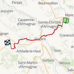
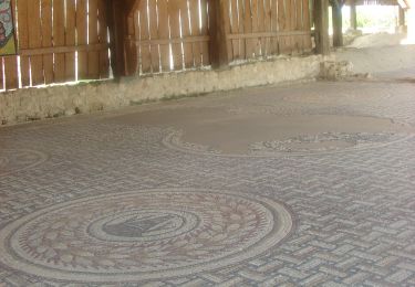
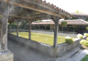
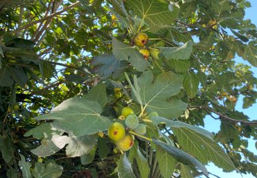
Randonnée Marche de 15 km à découvrir à Occitanie, Gers, Cravencères. Cette randonnée est proposée par cutter.

Description

Saint Jacques de Compostelle

Profil altimétrique

Localisation

Pays :
France
Région :
Occitanie
Département/Province :
Gers
Commune :
Cravencères
Localité :
Unknown
Départ:(UTM)
260147 ; 4851699 (31T) N.

Randonnées à proximité

Randonnée Marche Manciet - CC_Velay_EG_23_Manciet_Lanne-Soubiran_20080823 - Photo
Marche
patrickdanilo

Marche

Facile
Manciet, Occitanie, Gers, France
18,1 km | 22 km-effort
4h 15min
Non
Randonnée Marche Cravencères - mon Compostelle douzième étape - Photo
Marche
Ardeiserois

Marche

Moyen
Cravencères, Occitanie, Gers, France
35 km | 40 km-effort
7h 28min
Non
Randonnée Marche Nogaro - GR 65 Nogaro > Aire sur Adour - Photo
Marche
choubaka77

Marche

Difficile
Nogaro, Occitanie, Gers, France
26 km | 30 km-effort
6h 57min
Non
Randonnée Marche Nogaro - 3 Nogaro - Photo
Marche
GUIDE
thonyc

Marche

Difficile
Nogaro, Occitanie, Gers, France
28 km | 33 km-effort
8h 1min
Non
Randonnée Randonnée équestre Manciet - Boucle EquiVolt - Photo
Randonnée équestre
kikiumer

Randonnée équestre

Facile
Manciet, Occitanie, Gers, France
11,4 km | 13,6 km-effort
2h 41min
Oui
Randonnée Marche Nogaro - Camino 1 étape 25 du 20.08.2023 - Photo
Marche
bene_dictus77

Marche

Moyen
Nogaro, Occitanie, Gers, France
29 km | 34 km-effort
7h 44min
Non
Randonnée Marche Nogaro - StJ-J38-Nogaro-Aire sur l'Adour - Photo
Marche
Bonsaicd

Marche

Très difficile
Nogaro, Occitanie, Gers, France
28 km | 32 km-effort
6h 52min
Non
Randonnée Marche Nogaro - OR-6947751--Nogaro:Nogaro-Lelin-Lapujolle-arblade le bas-7 - Photo
Marche
Compostel61

Marche

Très facile
(1)
Nogaro, Occitanie, Gers, France
21 km | 25 km-effort
5h 25min
Non
Randonnée Marche Nogaro - Compostelle 26 - Nogaro -> Aire-sur-l'Adour - Photo
Marche
uru2010

Marche

Moyen
Nogaro, Occitanie, Gers, France
29 km | 33 km-effort
7h 5min
Non


Fermer
Mes abonnements