Houthalen-Helchteren, Limbourg : Les meilleures randonnées, itinéraires, parcours, balades et promenades

3 commentaires

Houthalen-Helchteren : découvrez les meilleures randonnées : 19 pédestres et 5 à vélo ou VTT. Tous ces circuits, parcours, itinéraires et activités en plein air sont disponibles dans nos applications SityTrail pour smartphones et tablettes.


Les meilleurs parcours (26)
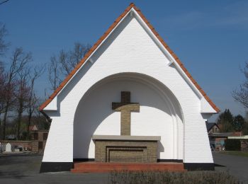
Randonnée A pied Houthalen-Helchteren - Wilgenwandeling Vallei Mangelbeek - Photo
A pied 5.527
Km
PRO

A pied

Facile
Houthalen-Helchteren, Flandre, Limbourg, Belgique
5,5 km | 6,2 km-effort
1h 24min
47 m
53 m
Non
SityTrail - itinéraires balisés pédestres

• Symbole: Rode driehoek met pijl

Randonnée A pied Houthalen-Helchteren - Het land van bier, melk en honing Rode driehoek - Photo
A pied 13.868
Km
PRO

A pied

Facile
Houthalen-Helchteren, Flandre, Limbourg, Belgique
13,9 km | 15,2 km-effort
3h 27min
103 m
100 m
Oui
SityTrail - itinéraires balisés pédestres

• Symbole: triangle

Randonnée A pied Houthalen-Helchteren - Het land van bier, melk en honing Gele zeshoek - Photo
A pied 7.6
Km
PRO

A pied

Facile
Houthalen-Helchteren, Flandre, Limbourg, Belgique
7,6 km | 8,3 km-effort
1h 53min
55 m
55 m
Oui
SityTrail - itinéraires balisés pédestres

• Symbole: hexagon

Randonnée A pied Houthalen-Helchteren - Kelchterhoef Blauwe ruit - Photo
A pied 3.844
Km
PRO

A pied

Facile
Houthalen-Helchteren, Flandre, Limbourg, Belgique
3,8 km | 4,3 km-effort
58min
35 m
34 m
Oui
SityTrail - itinéraires balisés pédestres

• Randonnée créée par Regionaal Landschap Lage Kempen. Symbole: diamond
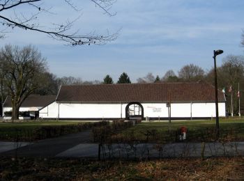
Randonnée A pied Houthalen-Helchteren - Kelchterhoef Gele zeshoek - Photo
A pied 9.21
Km
PRO

A pied

Facile
Houthalen-Helchteren, Flandre, Limbourg, Belgique
9,2 km | 10,3 km-effort
2h 21min
85 m
86 m
Oui
SityTrail - itinéraires balisés pédestres

• Randonnée créée par Regionaal Landschap Lage Kempen. Symbole: hexagon
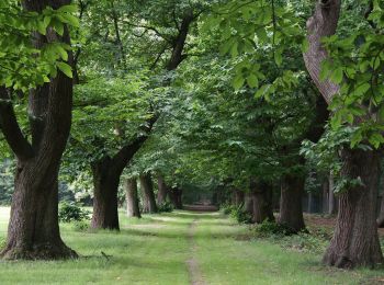
Randonnée A pied Houthalen-Helchteren - Kelchterhoef Oranje bol - Photo
A pied 6.364
Km
PRO

A pied

Facile
Houthalen-Helchteren, Flandre, Limbourg, Belgique
6,4 km | 7,1 km-effort
1h 36min
55 m
57 m
Oui
SityTrail - itinéraires balisés pédestres

• Randonnée créée par Regionaal Landschap Lage Kempen. Symbole: dot
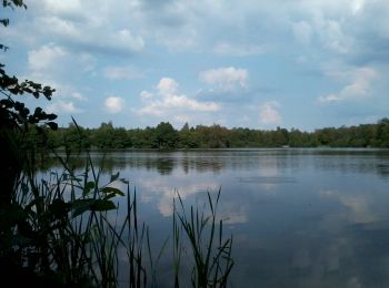
Randonnée A pied Houthalen-Helchteren - Hengelhoef Blauwe ruit - Photo
A pied 7.167
Km
PRO

A pied

Facile
Houthalen-Helchteren, Flandre, Limbourg, Belgique
7,2 km | 8,1 km-effort
1h 50min
71 m
71 m
Oui
SityTrail - itinéraires balisés pédestres

• Randonnée créée par Regionaal Landschap Lage Kempen. Symbole: diamond

Randonnée Marche Houthalen-Helchteren - hengelhoef vakantiepark - Photo
Marche 6.034
Km

Marche

Très facile
(1)
Houthalen-Helchteren, Flandre, Limbourg, Belgique
6 km | 6,6 km-effort
1h 18min
46 m
46 m
Oui
Evasaegerman

Randonnée sport Houthalen-Helchteren - De vijvers - Photo
sport 26.175
Km

sport

Très facile
Houthalen-Helchteren, Flandre, Limbourg, Belgique
26 km | 29 km-effort
Inconnu
220 m
218 m
Oui
ducatichristian

• Randonnée en partant du camping de binnenvaard à Kelchterhoef

Randonnée A pied Houthalen-Helchteren - Hengelhoef Oranje bol - Photo
A pied 4.049
Km
PRO

A pied

Facile
Houthalen-Helchteren, Flandre, Limbourg, Belgique
4 km | 4,4 km-effort
1h 0min
28 m
28 m
Oui
SityTrail - itinéraires balisés pédestres

• Randonnée créée par Regionaal Landschap Lage Kempen. Symbole: dot
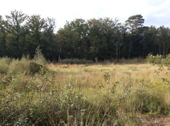
Randonnée Marche Houthalen-Helchteren - patit tout en campine - Photo
Marche 8.741
Km

Marche

Très facile
Houthalen-Helchteren, Flandre, Limbourg, Belgique
8,7 km | 9,8 km-effort
2h 11min
76 m
76 m
Oui
stef789

Randonnée Marche Houthalen-Helchteren - petit tour dans la réserve naturelle du Hengelhoef  - Photo
Marche 4.838
Km

Marche

Très facile
Houthalen-Helchteren, Flandre, Limbourg, Belgique
4,8 km | 5,4 km-effort
1h 24min
45 m
43 m
Oui
stef789

Randonnée V.T.T. Houthalen-Helchteren - B.Houthalen63C59.216VTT1 - Photo
V.T.T. 59.093
Km

V.T.T.

Facile
(1)
Houthalen-Helchteren, Flandre, Limbourg, Belgique
59 km | 65 km-effort
4h 15min
428 m
428 m
Oui
francois58

• Belle boucle variée dans les landes de bruyères et les étangs de Wijers. Passage étonnant au ras de l'eau à Bokrij, b...

Randonnée V.T.T. Houthalen-Helchteren - B.Houthalen63C59.216VTT1POI - Photo
V.T.T. 59.093
Km

V.T.T.

Facile
(1)
Houthalen-Helchteren, Flandre, Limbourg, Belgique
59 km | 65 km-effort
4h 15min
428 m
428 m
Oui
francois58

• Belle boucle variée dans les landes de bruyères et les étangs de Wijers. Passage étonnant au ras de l'eau à Bokrij, b...

Randonnée V.T.T. Houthalen-Helchteren - B.Houthalen63A53.226VTT1 - Photo
V.T.T. 53.256
Km

V.T.T.

Facile
Houthalen-Helchteren, Flandre, Limbourg, Belgique
53 km | 59 km-effort
3h 51min
401 m
402 m
Non
francois58

• Belle boucle variée dans les landes de bruyères et les étangs de Wijers. Passage étonnant au ras de l'eau à Bokrij, b...

Randonnée Marche Houthalen-Helchteren - w-belgie-wandeling-helchteren - Photo
Marche 19.044
Km

Marche

Très facile
Houthalen-Helchteren, Flandre, Limbourg, Belgique
19 km | 22 km-effort
Inconnu
231 m
232 m
Oui
gpstracks

• More information on GPStracks.nl : http://www.gpstracks.nl

Randonnée Marche Houthalen-Helchteren - w-belgie-kelchterhoef-ten-haagdoornheide - Photo
Marche 9.039
Km

Marche

Très facile
Houthalen-Helchteren, Flandre, Limbourg, Belgique
9 km | 10,1 km-effort
Inconnu
79 m
81 m
Oui
gpstracks

• More information on GPStracks.nl : http://www.gpstracks.nl

Randonnée Marche Houthalen-Helchteren - w-belgie-hengelhoef-ter-haagdoornheide - Photo
Marche 13.078
Km

Marche

Très facile
Houthalen-Helchteren, Flandre, Limbourg, Belgique
13,1 km | 14,5 km-effort
Inconnu
108 m
108 m
Oui
gpstracks

• More information on GPStracks.nl : http://www.gpstracks.nl

Randonnée Marche Houthalen-Helchteren - Houthalen-Helchteren Hengelhoef - 8 km RT - Photo
Marche 8.108
Km

Marche

Très facile
Houthalen-Helchteren, Flandre, Limbourg, Belgique
8,1 km | 9,2 km-effort
Inconnu
82 m
83 m
Oui
wandelroutes

• More information on : http://www.wandelroutes.org

Randonnée Marche Houthalen-Helchteren - Helchteren Panorama van Limburg - 12 km RT - Photo
Marche 11.182
Km

Marche

Très facile
Houthalen-Helchteren, Flandre, Limbourg, Belgique
11,2 km | 12,5 km-effort
Inconnu
101 m
98 m
Oui
wandelroutes

• More information on : http://www.wandelroutes.org

20 randonnées affichées sur 26

Application GPS de randonnée GRATUITE

Logo SityTrail SityTrail

IGN / Instituts géographiques

Télécharger SityTrail sur l'App Store Télécharger SityTrail sur Google Play

Logo SityTrail SityTrail World

Le monde est à vous

Télécharger SityTrail sur l'App Store Télécharger SityTrail sur Google Play Télécharger SityTrail sur Huawei AppGallery

Activités

Régions proches

Fermer
Mes abonnements