![](/images/other/stat-length.png)
![Excursión Cheillé - Foret chinon, départ la Herpinière - Photo](https://media.geolcdn.com/t/1900/400/ext.pjpeg?maxdim=2&url=https%3A%2F%2Fsecurestorage.geolives.com%2Fsitytour%2Ftrail-bg%2Fdefault.jpg)
Foret chinon, départ la Herpinière
destrieux
Usuario
![Longitud](/images/other/stat-length.png)
Longitud
16,2 km
![Altitud máxima](https://static1.geolcdn.com/siteimages/upload/files/1508320355ic_sort_altitude_max_24dp.png)
Altitud máxima
129 m
![Desnivel positivo](https://static1.geolcdn.com/siteimages/upload/files/1508320355ic_sort_den_pos_24dp.png)
Desnivel positivo
212 m
![Km-Effort](/images/other/stat-length.png)
Km-Effort
19 km
![Altitud mínima](https://static1.geolcdn.com/siteimages/upload/files/1508320355ic_sort_altitude_min_24dp.png)
Altitud mínima
63 m
![Desnivel negativo](https://static1.geolcdn.com/siteimages/upload/files/1508320355ic_sort_den_neg_24dp.png)
Desnivel negativo
209 m
![Boucle](https://static1.geolcdn.com/siteimages/upload/files/16400158638029165_repeat_loop_refresh_sync_direction_icon.png)
Boucle
Sí
Fecha de creación :
2023-03-12 14:32:00.043
Última modificación :
2023-03-12 14:33:31.89
![Escanee este código QR para abrir la excursión en la aplicación SityTrail](https://capi.geolives.com/qq0zvz2zws4bq2lad0pu/sitytour/trails/3582160/qr.png?size=200)
Aplicación GPS de excursión GRATIS
A propósito
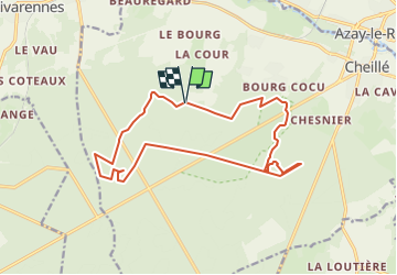
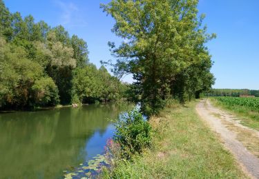
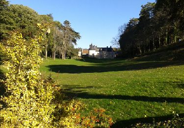
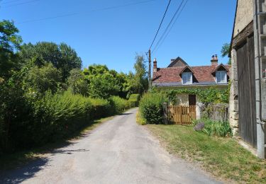
Ruta de 16,2 km a descubrir en Centro, Indre y Loira, Cheillé. Esta ruta ha sido propuesta por destrieux.
Descripción
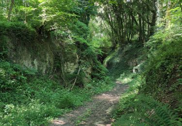
Première partie intéressante, milieu moins bien car grande allée. Dernière partie dans vallon de Maupas.
3H de marche
Localización
País:
France
Región :
Centro
Departamento/provincia :
Indre y Loira
Municipio :
Cheillé
Localidad:
Unknown
Salida:(Dec)
Salida:(UTM)
303632 ; 5235839 (31T) N.
Comentarios
Excursiones cerca
![Excursión Bicicleta Cheillé - Au Pays d'Azay-le-Rideau - Photo](https://media.geolcdn.com/t/375/260/ext.jpg?maxdim=2&url=https%3A%2F%2Fstatic1.geolcdn.com%2Fsiteimages%2Fupload%2Ffiles%2F1524743154velo.jpg)
![Bicicleta Bicicleta](https://static1.geolcdn.com/sitytour/trail-icons/200.png)
Au Pays d'Azay-le-Rideau
Bicicleta
Fácil
(1)
Cheillé,
Centro,
Indre y Loira,
France
![](/images/other/stat-length.png)
53 km | 58 km-effort
2h 40min
![](https://static1.geolcdn.com/siteimages/upload/files/16400158638029165_repeat_loop_refresh_sync_direction_icon.png)
No
![Excursión Senderismo Rivarennes - Rivarennes - Zig zag GR3 Cheillé - 23.4km 405m 5h05 (50mn) - 2024 06 09 - Photo](https://media.geolcdn.com/t/375/260/ext.jpg?maxdim=2&url=https%3A%2F%2Fmedia.geolcdn.com%2Ff%2Fa700836a-a1be-4ab5-8f09-42ab101fa387.jpg)
![Senderismo Senderismo](https://static1.geolcdn.com/sitytour/trail-icons/101.png)
Rivarennes - Zig zag GR3 Cheillé - 23.4km 405m 5h05 (50mn) - 2024 06 09
Senderismo
Medio
Rivarennes,
Centro,
Indre y Loira,
France
![](/images/other/stat-length.png)
23 km | 29 km-effort
5h 5min
![](https://static1.geolcdn.com/siteimages/upload/files/16400158638029165_repeat_loop_refresh_sync_direction_icon.png)
Sí
![Excursión Senderismo Cheillé - Cheillé - GR3 Abbaye de Turpenay Château de la Cour - 18.9km 280m 4h05 - 2022 02 05 - Photo](https://media.geolcdn.com/t/375/260/ext.jpg?maxdim=2&url=https%3A%2F%2Fmedia.geolcdn.com%2Ff%2Fb7e79bc0-bce7-46b1-93d1-40c275ee6472.jpg)
![Senderismo Senderismo](https://static1.geolcdn.com/sitytour/trail-icons/101.png)
Cheillé - GR3 Abbaye de Turpenay Château de la Cour - 18.9km 280m 4h05 - 2022...
Senderismo
Medio
Cheillé,
Centro,
Indre y Loira,
France
![](/images/other/stat-length.png)
18,9 km | 23 km-effort
4h 5min
![](https://static1.geolcdn.com/siteimages/upload/files/16400158638029165_repeat_loop_refresh_sync_direction_icon.png)
Sí
![Excursión Senderismo Azay-le-Rideau - Azay-le-Rideau - l'Islette - 17km 220m 4h05 (20mn) - 2021 06 12 - Photo](https://media.geolcdn.com/t/375/260/ext.jpg?maxdim=2&url=https%3A%2F%2Fmedia.geolcdn.com%2Ff%2Fed17a717-c8e8-4396-b1e0-0d3bc31c4be8.jpg)
![Senderismo Senderismo](https://static1.geolcdn.com/sitytour/trail-icons/101.png)
Azay-le-Rideau - l'Islette - 17km 220m 4h05 (20mn) - 2021 06 12
Senderismo
Fácil
Azay-le-Rideau,
Centro,
Indre y Loira,
France
![](/images/other/stat-length.png)
17 km | 20 km-effort
4h 5min
![](https://static1.geolcdn.com/siteimages/upload/files/16400158638029165_repeat_loop_refresh_sync_direction_icon.png)
Sí
![Excursión Senderismo Cheillé - Cheillé - Circuits 1 et 2 - 13.2km 225m 2h40 - 2020 07 18 - Photo](https://media.geolcdn.com/t/375/260/ext.jpg?maxdim=2&url=https%3A%2F%2Fmedia.geolcdn.com%2Ff%2F6e9838f9-1aad-41b5-8530-bd037ffd24b6.jpg)
![Senderismo Senderismo](https://static1.geolcdn.com/sitytour/trail-icons/101.png)
Cheillé - Circuits 1 et 2 - 13.2km 225m 2h40 - 2020 07 18
Senderismo
Fácil
Cheillé,
Centro,
Indre y Loira,
France
![](/images/other/stat-length.png)
13,2 km | 16,2 km-effort
2h 40min
![](https://static1.geolcdn.com/siteimages/upload/files/16400158638029165_repeat_loop_refresh_sync_direction_icon.png)
Sí
![Excursión Senderismo Rivarennes - Rivarennes - Circuit 1 - 18.2km 225m 3h55 - 2020 07 13 - Photo](https://media.geolcdn.com/t/375/260/ext.jpg?maxdim=2&url=https%3A%2F%2Fmedia.geolcdn.com%2Ff%2F787eacec-2808-4b7a-b7e4-990b0e9f64fa.jpg)
![Senderismo Senderismo](https://static1.geolcdn.com/sitytour/trail-icons/101.png)
Rivarennes - Circuit 1 - 18.2km 225m 3h55 - 2020 07 13
Senderismo
Fácil
Rivarennes,
Centro,
Indre y Loira,
France
![](/images/other/stat-length.png)
18,2 km | 21 km-effort
3h 55min
![](https://static1.geolcdn.com/siteimages/upload/files/16400158638029165_repeat_loop_refresh_sync_direction_icon.png)
Sí
![Excursión Senderismo Azay-le-Rideau - Azay le Rideau (les vergers) - Photo](https://media.geolcdn.com/t/375/260/ext.jpg?maxdim=2&url=https%3A%2F%2Fservices.sitytrail.com%2FGeolivesWS%2FDownloadMedia.ashx%3FTrailID%3D230711%26Media%3Dc71694d3-d36d-4911-841b-580c1bfa7b6d.jpg)
![Senderismo Senderismo](https://static1.geolcdn.com/sitytour/trail-icons/101.png)
Azay le Rideau (les vergers)
Senderismo
Fácil
Azay-le-Rideau,
Centro,
Indre y Loira,
France
![](/images/other/stat-length.png)
11,3 km | 13,2 km-effort
3h 3min
![](https://static1.geolcdn.com/siteimages/upload/files/16400158638029165_repeat_loop_refresh_sync_direction_icon.png)
No
![Excursión Senderismo Cheillé - Azay le Rideau 2012-04-15 - Photo](https://media.geolcdn.com/t/375/260/ext.jpg?maxdim=2&url=https%3A%2F%2Fstatic1.geolcdn.com%2Fsiteimages%2Fupload%2Ffiles%2F1553511878bg_sport_marche.png)
![Senderismo Senderismo](https://static1.geolcdn.com/sitytour/trail-icons/101.png)
Azay le Rideau 2012-04-15
Senderismo
Muy fácil
(1)
Cheillé,
Centro,
Indre y Loira,
France
![](/images/other/stat-length.png)
9,9 km | 11,7 km-effort
2h 33min
![](https://static1.geolcdn.com/siteimages/upload/files/16400158638029165_repeat_loop_refresh_sync_direction_icon.png)
No
![Excursión Senderismo Cheillé - La-Chapelle-St-Blaise (Azay) - GR3 nord - 18.3km 180m 3h55 - 2018 04 15 - Photo](https://media.geolcdn.com/t/375/260/ext.jpg?maxdim=2&url=https%3A%2F%2Fmedia.geolcdn.com%2Ff%2F635a2481-2495-4be8-acd6-d2083cba9846.jpg)
![Senderismo Senderismo](https://static1.geolcdn.com/sitytour/trail-icons/101.png)
La-Chapelle-St-Blaise (Azay) - GR3 nord - 18.3km 180m 3h55 - 2018 04 15
Senderismo
Medio
Cheillé,
Centro,
Indre y Loira,
France
![](/images/other/stat-length.png)
18,3 km | 21 km-effort
3h 55min
![](https://static1.geolcdn.com/siteimages/upload/files/16400158638029165_repeat_loop_refresh_sync_direction_icon.png)
Sí