8,7 km | 9,3 km-effort
SityTrail - 2664955 - rando-pierre-du-8-fevrier-2021-tourvillexlaxriviere
doudet
Usuario
Longitud
10,4 km
Altitud máxima
89 m
Desnivel positivo
117 m
Km-Effort
12 km
Altitud mínima
6 m
Desnivel negativo
117 m
Boucle
Sí
Fecha de creación :
2021-10-14 08:55:22.63
Última modificación :
2021-10-14 08:55:22.63
--
Dificultad : Desconocido
Aplicación GPS de excursión GRATIS
A propósito
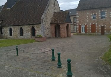
Ruta Senderismo de 10,4 km a descubrir en Normandía, Sena-Marítimo, Tourville-la-Rivière. Esta ruta ha sido propuesta por doudet.
Localización
País:
France
Región :
Normandía
Departamento/provincia :
Sena-Marítimo
Municipio :
Tourville-la-Rivière
Localidad:
Unknown
Salida:(Dec)
Salida:(UTM)
362016 ; 5465782 (31U) N.
Comentarios
Excursiones cerca
Sotteville sous le Val vers Igoville
Senderismo
Fácil
(1)
Sotteville-sous-le-Val,
Normandía,
Sena-Marítimo,
France
1h 48min
Sí
076-36-Oissel /les Essarts 13km-511-205
Senderismo
Medio
(1)
Oissel,
Normandía,
Sena-Marítimo,
France
12,7 km | 15,2 km-effort
3h 19min
No
Oissel 13 km
Senderismo
Muy fácil
(1)
Oissel,
Normandía,
Sena-Marítimo,
France
13,3 km | 15,2 km-effort
2h 35min
Sí
Oissel 13 km
Senderismo
Muy fácil
(1)
Oissel,
Normandía,
Sena-Marítimo,
France
14,9 km | 16,9 km-effort
2h 35min
Sí
20200120-Cléon COOL
Senderismo
Fácil
(2)
Cléon,
Normandía,
Sena-Marítimo,
France
8,8 km | 9,4 km-effort
2h 10min
Sí
Oissel 13 km
Senderismo
Muy fácil
(1)
Oissel,
Normandía,
Sena-Marítimo,
France
13,6 km | 15,4 km-effort
2h 35min
Sí
Pont de l'Arche/ Les Damps (126)
Senderismo
Medio
(4)
Pont-de-l'Arche,
Normandía,
Eure,
France
11,5 km | 13,9 km-effort
3h 3min
Sí
*les Authieux Igoville 15km
Senderismo
Muy fácil
(1)
Les Authieux-sur-le-Port-Saint-Ouen,
Normandía,
Sena-Marítimo,
France
13,9 km | 16,5 km-effort
3h 37min
Sí
20240903-Martot -Cool
Senderismo
Fácil
Martot,
Normandía,
Eure,
France
7,5 km | 8,4 km-effort
2h 9min
Sí