


5,9 km | 10,9 km-effort
Annot: Descubra las mejores excursiones: 10 a pie, 63 senderismo y 1 ruta. Todos estos circuitos, recorridos, itinerarios y actividades al aire libre están disponibles en nuestras aplicaciones SityTrail para smartphone y tablet.
A pie


• Trail created by Département des Alpes-de-Haute-Provence. Sitio web: https://www.rando-alpes-haute-provence.fr/ran...
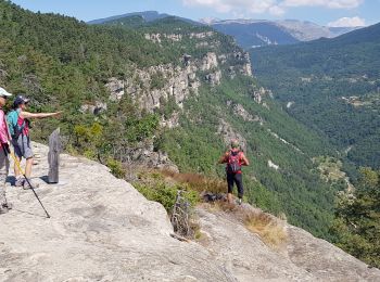
Senderismo

Senderismo
Senderismo
Senderismo
Senderismo
Senderismo
A pie
• Trail created by Département des Alpes-de-Haute-Provence. Sitio web: https://www.rando-alpes-haute-provence.fr/ran...
Senderismo
Senderismo
Senderismo

Senderismo
Senderismo
Senderismo
Senderismo

Senderismo
• facile
Senderismo

Senderismo
Senderismo
Senderismo
20 excursiones mostradas en 73
Aplicación GPS de excursión GRATIS
 SityTrail
IGN / Institutos geográficos
SityTrail World
El mundo es suyo