Trail Mountain bike Arzenc-de-Randon - Boucle Le Giraldès - Photo

Boucle Le Giraldès

 phcol
phcol

User

© OpenStreetMap contributors
Length
Length
40 km
Max alt
Max alt
1544 m
Uphill gradient
Uphill gradient
873 m
Km-Effort
Km-Effort  
51 km
Min alt
Min alt
1177 m
Downhill gradient
Downhill gradient
871 m
Boucle
Boucle
Yes
Creation date :
2017-07-24 00:00:00.0
Updated on :
2017-07-24 00:00:00.0

(0 Reviews)

Mountain bike
Mountain bike
4h10
Difficulty : Medium

Scan this QR Code to open this trail in the SityTrail application

FREE GPS app for hiking

Logo SityTrail SityTrail

IGN / Geographical institutes

Download SityTrail from the App Store Download SityTrail from Google Play

Logo SityTrail SityTrail World

The world is yours!

Download SityTrail from the App Store Download SityTrail from Google Play Download SityTrail on Huawei AppGallery

About

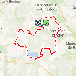
Trail Mountain bike of 40 km to be discovered at Occitania, Lozère, Arzenc-de-Randon. This trail is proposed by phcol.

Description

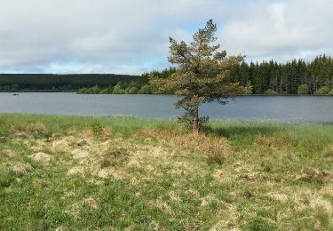
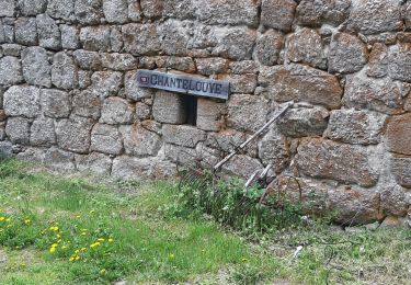
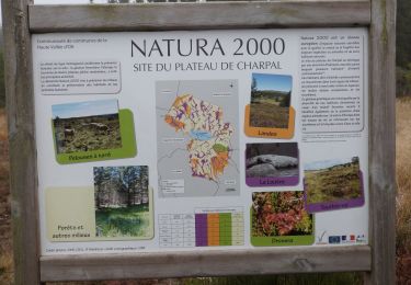
Boucle passant par le Truc de Fortunio, le lac de Charpal et Arzenc sur Randon.

Elevation profile

Points of interest

Point of interest Monts-de-Randon - Variante 1 - Photo
phcol
MONTS-DE-RANDON 
Point of interest Monts-de-Randon - Truc de Fortunio - Photo
phcol
MONTS-DE-RANDON 

Positioning

Country:
France
Region :
Occitania
Department/Province :
Lozère
Municipality :
Arzenc-de-Randon
Location:
Unknown
Start:(UTM)
547184 ; 4946203 (31T) N.

Trails nearby

Trail Mountain bike Arzenc-de-Randon - 06 GTMC Le Giraldès-Le Pont de Monvert - Photo
Mountain bike
nicolas54230

Mountain bike

Easy
(1)
Arzenc-de-Randon, Occitania, Lozère, France
90 km | 113 km-effort
15min
No
Trail Walking Monts-de-Randon - Le tour du lac de Charpal - Photo
Walking
alainjoseph6

Walking

Very easy
(1)
Monts-de-Randon, Occitania, Lozère, France
9 km | 10.2 km-effort
2h 20min
Yes
Trail Walking Monts-de-Randon - tour du lamc Charpal - Photo
Walking
eerm

Walking

Easy
(2)
Monts-de-Randon, Occitania, Lozère, France
9.4 km | 10.8 km-effort
3h 5min
Yes
Trail Mountain bike Arzenc-de-Randon - Fait GTMC 2022  E2 3,3 b - Photo
Mountain bike
jl77130

Mountain bike

Difficult
Arzenc-de-Randon, Occitania, Lozère, France
54 km | 69 km-effort
6h 14min
No
Trail Walking Arzenc-de-Randon - Arzenc de Rendon - Photo
Walking
FLORENSAC

Walking

Easy
Arzenc-de-Randon, Occitania, Lozère, France
10.6 km | 14.5 km-effort
3h 9min
Yes
Trail Walking Monts-de-Randon - Truc de Fortunio et lac de Charpal - Photo
Walking
jesusmarieclaire

Walking

Medium
Monts-de-Randon, Occitania, Lozère, France
16.6 km | 22 km-effort
5h 48min
Yes
Trail Mountain bike Arzenc-de-Randon - GTMC de Claire - 6 - Photo
Mountain bike
tracegps

Mountain bike

Very difficult
Arzenc-de-Randon, Occitania, Lozère, France
58 km | 74 km-effort
4h 30min
No
Trail Fishing Monts-de-Randon - La Colagne - Photo
Fishing
dedehenry

Fishing

Very easy
Monts-de-Randon, Occitania, Lozère, France
49 km | 56 km-effort
12min
No
Trail Horseback riding Arzenc-de-Randon - Circuit Petites Prairies en Margeride MAJ 2020  - Photo
Horseback riding
Lozère Cheval

Horseback riding

Medium
Arzenc-de-Randon, Occitania, Lozère, France
58 km | 74 km-effort
2h 45min
Yes


Close
My subscriptions