Trail Equestrian Chalais - Chalais dans la Brenne - Photo

Chalais dans la Brenne

 Gus23
Gus23

User

© OpenStreetMap contributors
Length
Length
21 km
Max alt
Max alt
157 m
Uphill gradient
Uphill gradient
226 m
Km-Effort
Km-Effort  
24 km
Min alt
Min alt
102 m
Downhill gradient
Downhill gradient
226 m
Boucle
Boucle
Yes
Creation date :
2017-06-13 00:00:00.0
Updated on :
2017-06-13 00:00:00.0

(3 Reviews)

Equestrian
Equestrian
3h02
Difficulty : Medium

Scan this QR Code to open this trail in the SityTrail application

FREE GPS app for hiking

Logo SityTrail SityTrail

IGN / Geographical institutes

Download SityTrail from the App Store Download SityTrail from Google Play

Logo SityTrail SityTrail World

The world is yours!

Download SityTrail from the App Store Download SityTrail from Google Play Download SityTrail on Huawei AppGallery

About

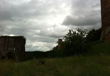
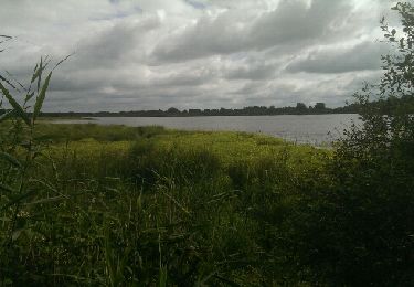
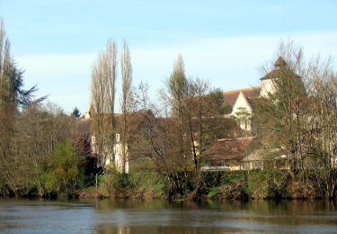
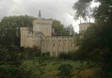
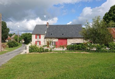
Trail Equestrian of 21 km to be discovered at Centre-Loire Valley, Indre, Chalais. This trail is proposed by Gus23.

Description

Rando avec les cavaliers de Beaumont

Elevation profile

Photos

Points of interest

Point of interest Chalais - Un bon repas - Photo
Gus23
CHALAIS 
Point of interest Chalais - Etang - Photo
Gus23
CHALAIS 
Point of interest Chalais -  - Photo
Gus23
CHALAIS 

Positioning

Country:
France
Region :
Centre-Loire Valley
Department/Province :
Indre
Municipality :
Chalais
Location:
Unknown
Start:(UTM)
363828 ; 5154292 (31T) N.

Comments

Please log in to post a review or rate the element


belle promenade


Trails nearby

Trail Walking Chaillac - Les gorges de l'Anglin - Photo
Walking
DERAISON

Walking

Medium
Chaillac, Centre-Loire Valley, Indre, France
9.8 km | 12.9 km-effort
4h 27min
No
Trail Walking Ciron - CIRON - Photo
Walking
CAMBON

Walking

Easy
Ciron, Centre-Loire Valley, Indre, France
9.9 km | 10.8 km-effort
2h 24min
Yes
Trail Walking Fontgombault - Le village des Roches - Fontgombault - Photo
Walking
tracegps

Walking

Easy
Fontgombault, Centre-Loire Valley, Indre, France
5.1 km | 5.8 km-effort
1h 15min
Yes
Trail Walking Lignac - lignc - Photo
Walking
Patlac3

Walking

Easy
(1)
Lignac, Centre-Loire Valley, Indre, France
9.2 km | 10.4 km-effort
2h 48min
Yes
Trail Walking Azerables - Azerables  - Photo
Walking
micheletissier

Walking

Very easy
Azerables, New Aquitaine, Creuse, France
13.5 km | 15.7 km-effort
3h 43min
Yes
Trail Mountain bike Le Blanc - Brenne-Le Blanc-Rufec-retour - Photo
Mountain bike
Arnoldr8491

Mountain bike

Medium
Le Blanc, Centre-Loire Valley, Indre, France
33 km | 37 km-effort
3h 10min
Yes
Trail Road bike Saint-Gaultier -  Voie verte  - Photo
Road bike
sereton

Road bike

Easy
Saint-Gaultier, Centre-Loire Valley, Indre, France
30 km | 33 km-effort
2h 11min
Yes
Trail Road bike Rivarennes - dondon rivarenne - Photo
Road bike
mib65

Road bike

Very difficult
Rivarennes, Centre-Loire Valley, Indre, France
68 km | 80 km-effort
4h 12min
Yes
Trail Walking Luzeret -  Loup y es-tu ?  (Les plus belles balades de la Brenne ) - Photo
Walking
Phil36

Walking

Easy
Luzeret, Centre-Loire Valley, Indre, France
8.8 km | 9.8 km-effort
1h 58min
Yes


Close
My subscriptions