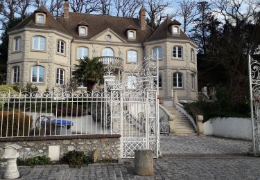
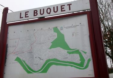
Trail Walking Grand-Couronne - Les Essards -26-01-2016 - GD 10KM  - Photo

Les Essards -26-01-2016 - GD 10KM

© OpenStreetMap contributors
Length
Length
10.2 km
Max alt
Max alt
140 m
Uphill gradient
Uphill gradient
234 m
Km-Effort
Km-Effort  
13.3 km
Min alt
Min alt
32 m
Downhill gradient
Downhill gradient
232 m
Boucle
Boucle
Yes
Creation date :
2017-01-19 00:00:00.0
Updated on :
2017-01-19 00:00:00.0

(0 Reviews)

Walking
Walking
2h51
Difficulty : Medium

Scan this QR Code to open this trail in the SityTrail application

FREE GPS app for hiking

Logo SityTrail SityTrail

IGN / Geographical institutes

Download SityTrail from the App Store Download SityTrail from Google Play

Logo SityTrail SityTrail World

The world is yours!

Download SityTrail from the App Store Download SityTrail from Google Play Download SityTrail on Huawei AppGallery

About

Trail Walking of 10.2 km to be discovered at Normandy, Seine-Maritime, Grand-Couronne. This trail is proposed by philippe76.

Description

Départ aux Essards -  terminal du bus. Rue du champ du bois, AG chemin, TD suivre GR -La coquille bleue. AD et le GR; Tjours TD "Les Roches". Au carrefour (alt 118) dir La Roche Fouet, AG (balise jaune, alt 117) vers la Roche Fouet. AG le long de la falaise, ATTENTION ravin. Aux balustrades AG vers mare aux Anglais. Tjours TD et AD  bas de la côte,niveau du Nouveau monde (alt 37). Remonter vers l'allées des Roches et suivre le chemin tracé, passer devant la mare à nouveau, AG puis AD dir la Maison Ftière des Roches, garder ce cap.
OPTION LONGUE : à la Mson ftière TD allée des roches,AG chemin du début et AD vers PKG (10,2KM) OPTION COURTE : AG à la Mson ftière vers le poste Gaz puis AD et TD vers parking (9,2KM)

Elevation profile

Positioning

Country:
France
Region :
Normandy
Department/Province :
Seine-Maritime
Municipality :
Grand-Couronne
Location:
Unknown
Start:(UTM)
356790 ; 5466838 (31U) N.

Trails nearby

Trail Walking Hautot-sur-Seine - Hautot-sur-seine  11km  - Photo
Walking
MichelRando7656

Walking

Medium
(2)
Hautot-sur-Seine, Normandy, Seine-Maritime, France
11 km | 12.2 km-effort
2h 37min
Yes
Trail Walking Oissel - 076-36-Oissel /les Essarts 13km-511-205 - Photo
Walking
rvs147

Walking

Medium
(1)
Oissel, Normandy, Seine-Maritime, France
12.7 km | 15.2 km-effort
3h 19min
No
Trail Walking Moulineaux - Robert-le-Diable - château - GD - V2 - Photo
Walking
philippe76

Walking

Difficult
(1)
Moulineaux, Normandy, Seine-Maritime, France
10.4 km | 13.1 km-effort
2h 58min
Yes
Trail Walking Oissel - Oissel 13 km  - Photo
Walking
MichelRando7656

Walking

Very easy
(1)
Oissel, Normandy, Seine-Maritime, France
13.3 km | 15.2 km-effort
2h 35min
Yes
Trail Walking Oissel - Oissel 13 km  - Photo
Walking
MichelRando7656

Walking

Very easy
(1)
Oissel, Normandy, Seine-Maritime, France
14.9 km | 16.9 km-effort
2h 35min
Yes
Trail Walking Cléon - 20200120-Cléon COOL - Photo
Walking
doudet

Walking

Easy
(2)
Cléon, Normandy, Seine-Maritime, France
8.8 km | 9.4 km-effort
2h 10min
Yes
Trail Walking Oissel - Oissel 13 km  - Photo
Walking
MichelRando7656

Walking

Very easy
(1)
Oissel, Normandy, Seine-Maritime, France
13.6 km | 15.4 km-effort
2h 35min
Yes
Trail Walking Martot - 20240903-Martot -Cool - Photo
Walking
doudet

Walking

Easy
Martot, Normandy, Eure, France
7.5 km | 8.4 km-effort
2h 9min
Yes
Trail Walking La Londe - 20240312-La londe cool - Photo
Walking
doudet

Walking

Easy
(1)
La Londe, Normandy, Seine-Maritime, France
7.7 km | 8.9 km-effort
2h 7min
Yes


Close
My subscriptions