Trail Walking Perpignan - 66 PERPIGNAN, entre moulin à vent mas Balande et Cabestany - Photo

66 PERPIGNAN, entre moulin à vent mas Balande et Cabestany

 jeff66
jeff66

User

© OpenStreetMap contributors
Length
Length
7.5 km
Max alt
Max alt
73 m
Uphill gradient
Uphill gradient
61 m
Km-Effort
Km-Effort  
8.3 km
Min alt
Min alt
28 m
Downhill gradient
Downhill gradient
61 m
Boucle
Boucle
Yes
Creation date :
2015-12-14 00:00:00.0
Updated on :
2015-12-14 00:00:00.0

(0 Reviews)

Walking
Walking
1h22
Difficulty : Easy

Scan this QR Code to open this trail in the SityTrail application

FREE GPS app for hiking

Logo SityTrail SityTrail

IGN / Geographical institutes

Download SityTrail from the App Store Download SityTrail from Google Play

Logo SityTrail SityTrail World

The world is yours!

Download SityTrail from the App Store Download SityTrail from Google Play Download SityTrail on Huawei AppGallery

About

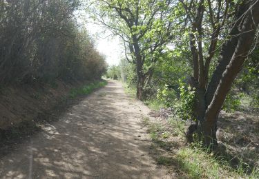
Trail Walking of 7.5 km to be discovered at Occitania, Pyrénées-Orientales, Perpignan. This trail is proposed by jeff66.

Description

66 PERPIGNAN, av.P.Alduy, Mas Gaffard, le hameau DANTJOU, mas Balande, el pou de les Coulobres, station de pompage, chemin VC203, passage sous la RD22C, av. j.Giraudoux, moulin à vent, rond point des palmes académiques, rue de port-Vendred, av. du RÉART, rembla d'occitanie, av. F. De sardane, espace vert de la butte, résidence P.Alduy, Château d'Eau av. Said Boualam, collège St expert, parc des sports A.Mimoun, piscine, lycée Léon Blum, parcours de santé

Elevation profile

Photos

Positioning

Country:
France
Region :
Occitania
Department/Province :
Pyrénées-Orientales
Municipality :
Perpignan
Location:
Unknown
Start:(UTM)
492213 ; 4724196 (31T) N.

Trails nearby

Trail Walking Théza - 66 THEZA - CORNEILLA-DEL-VERCOL - Photo
Walking
jeff66

Walking

Easy
(2)
Théza, Occitania, Pyrénées-Orientales, France
7 km | 7.5 km-effort
1h 8min
Yes
Trail Walking Cabestany - Chemins autour de Cabestany - Photo
Walking
tracegps

Walking

Medium
(2)
Cabestany, Occitania, Pyrénées-Orientales, France
11.8 km | 12.7 km-effort
3h 0min
Yes
Trail Walking Perpignan - Perpignan 01.10.2017  - Photo
Walking
jeff66

Walking

Easy
(1)
Perpignan, Occitania, Pyrénées-Orientales, France
6.7 km | 7.5 km-effort
1h 39min
No
Trail Walking Villeneuve-de-la-Raho - 66 VILLENEUVE-DE-LA-RAHO - grand tour périphérique du lac par les lignes de crêtes  - Photo
Walking
jeff66

Walking

Easy
(2)
Villeneuve-de-la-Raho, Occitania, Pyrénées-Orientales, France
10 km | 11.5 km-effort
1h 44min
Yes
Trail Walking Saleilles - 66 SALEILLES - St-NAZAIRE, entre FOSSEILLE et REART - Photo
Walking
jeff66

Walking

Easy
(1)
Saleilles, Occitania, Pyrénées-Orientales, France
7.3 km | 7.7 km-effort
1h 8min
Yes
Trail Quad Villeneuve-de-la-Raho - Villeneuve-de-la-Raho-Collioure(Juillet-Aout) - Photo
Quad
Quad Ride

Quad

Very easy
(1)
Villeneuve-de-la-Raho, Occitania, Pyrénées-Orientales, France
39 km | 44 km-effort
1h 40min
No
Trail Walking Cabestany - cabestany - Photo
Walking
66Gribouille83

Walking

Medium
Cabestany, Occitania, Pyrénées-Orientales, France
7.5 km | 8.2 km-effort
2h 35min
Yes
Trail Walking Perpignan - petit tour à Perpignan  - Photo
Walking
GUIDE
stef789

Walking

Very easy
Perpignan, Occitania, Pyrénées-Orientales, France
3.9 km | 4.2 km-effort
1h 53min
Yes
Trail Walking Perpignan - Perpignan  - Photo
Walking
ombrabella

Walking

Very easy
Perpignan, Occitania, Pyrénées-Orientales, France
18 km | 19.9 km-effort
2h 23min
No


Close
My subscriptions