Trail Walking Loupershouse - Autour de Metzing - Guebenhouse - Photo

Autour de Metzing - Guebenhouse

 piem
piem

User

© OpenStreetMap contributors
Length
Length
12.3 km
Max alt
Max alt
281 m
Uphill gradient
Uphill gradient
246 m
Km-Effort
Km-Effort  
15.6 km
Min alt
Min alt
215 m
Downhill gradient
Downhill gradient
242 m
Boucle
Boucle
Yes
Creation date :
2015-11-08 00:00:00.0
Updated on :
2015-11-08 00:00:00.0

(1 Reviews)

Walking
Walking
3h19
Difficulty : Easy

Scan this QR Code to open this trail in the SityTrail application

FREE GPS app for hiking

Logo SityTrail SityTrail

IGN / Geographical institutes

Download SityTrail from the App Store Download SityTrail from Google Play

Logo SityTrail SityTrail World

The world is yours!

Download SityTrail from the App Store Download SityTrail from Google Play Download SityTrail on Huawei AppGallery

About

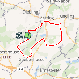
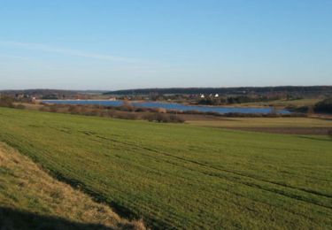
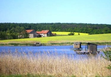
Trail Walking of 12.3 km to be discovered at Grand Est, Moselle, Loupershouse. This trail is proposed by piem.

Description

Circuit facile autour de Metzing-Guebenhouse.

Elevation profile

Positioning

Country:
France
Region :
Grand Est
Department/Province :
Moselle
Municipality :
Loupershouse
Location:
Unknown
Start:(UTM)
349082 ; 5439277 (32U) N.

Comments

Please log in to post a review or rate the element


attention en fin de parcours arbres et branches coupés encombrent le chemin


Trails nearby

Trail Walking Metzing - Metzing Loupershouse - Photo
Walking
piem

Walking

Easy
(1)
Metzing, Grand Est, Moselle, France
8.7 km | 10.7 km-effort
2h 18min
Yes
Trail On foot Hoste - Circuit de Guten Brunnen - Photo
On foot
PRO

On foot

Easy
Hoste, Grand Est, Moselle, France
11.5 km | 14 km-effort
3h 11min
Yes
Trail Walking Saint-Jean-Rohrbach - lac diefenbach - Photo
Walking
fredodlageo

Walking

Easy
Saint-Jean-Rohrbach, Grand Est, Moselle, France
4.4 km | 5.5 km-effort
1h 14min
Yes
Trail Walking Hoste - Randonnée de Hoste à Barst - Photo
Walking
tracegps

Walking

Medium
Hoste, Grand Est, Moselle, France
13.7 km | 16.1 km-effort
3h 0min
Yes
Trail Mountain bike Puttelange-aux-Lacs - Randonnée au Pays des Lacs - Puttelange aux Lacs - Photo
Mountain bike
tracegps

Mountain bike

Difficult
(1)
Puttelange-aux-Lacs, Grand Est, Moselle, France
56 km | 69 km-effort
4h 0min
Yes
Trail Walking Hoste - Chemin de crête  - Photo
Walking
SylvainRando

Walking

Medium
Hoste, Grand Est, Moselle, France
8.8 km | 10.2 km-effort
2h 19min
Yes
Trail Walking Hoste - étangs hoste - Photo
Walking
mitch1915

Walking

Easy
Hoste, Grand Est, Moselle, France
16.6 km | 19.3 km-effort
3h 28min
Yes
Trail Mountain bike Farschviller - Autour du Lehtrisch - Photo
Mountain bike
Renard57

Mountain bike

Medium
Farschviller, Grand Est, Moselle, France
27 km | 32 km-effort
3h 2min
Yes
Trail Road bike Hoste - P’tit tour - Photo
Road bike
SylvainRando

Road bike

Easy
Hoste, Grand Est, Moselle, France
31 km | 37 km-effort
2h 14min
Yes


Close
My subscriptions