Trail Running Guebwiller - yannis - Photo
© OpenStreetMap contributors
Length
Length
4.2 km
Max alt
Max alt
409 m
Uphill gradient
Uphill gradient
125 m
Km-Effort
Km-Effort  
5.8 km
Min alt
Min alt
288 m
Downhill gradient
Downhill gradient
123 m
Boucle
Boucle
No
Creation date :
2024-07-20 07:12:41.0
Updated on :
2024-07-20 09:09:20.425

(0 Reviews)

Running
Running
1h15
Difficulty : Unknown

Scan this QR Code to open this trail in the SityTrail application

FREE GPS app for hiking

Logo SityTrail SityTrail

IGN / Geographical institutes

Download SityTrail from the App Store Download SityTrail from Google Play

Logo SityTrail SityTrail World

The world is yours!

Download SityTrail from the App Store Download SityTrail from Google Play Download SityTrail on Huawei AppGallery

About

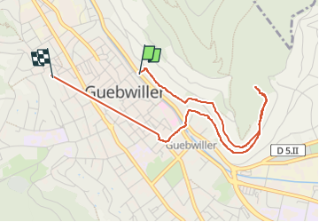
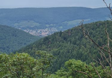
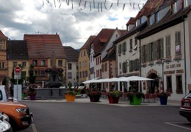
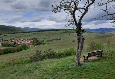
Trail Running of 4.2 km to be discovered at Grand Est, Haut-Rhin, Guebwiller. This trail is proposed by 001133.1542f5cafe374b94ab47a7712f505601.1530.

Description

la lala

Elevation profile

Positioning

Country:
France
Region :
Grand Est
Department/Province :
Haut-Rhin
Municipality :
Guebwiller
Location:
Unknown
Start:(UTM)
366449 ; 5307912 (32T) N.

Trails nearby

Trail Mountain bike Guebwiller - P4  Circuits du Florival 2021   - Photo
Mountain bike
duchaine.nicolas

Mountain bike

Medium
(1)
Guebwiller, Grand Est, Haut-Rhin, France
40 km | 53 km-effort
4h 31min
No
Trail Walking Murbach - Rando du 01/08/2024 - Photo
Walking
boubou68

Walking

Very difficult
Murbach, Grand Est, Haut-Rhin, France
18.9 km | 30 km-effort
5h 53min
Yes
Trail Walking Westhalten - WESTHALTEN ZINKOEPHLE - Photo
Walking
MarcOBRECHT

Walking

Medium
Westhalten, Grand Est, Haut-Rhin, France
10.6 km | 15.3 km-effort
2h 56min
Yes
Trail Walking Soultz-Haut-Rhin - Rando Marcheurs..04/04_2025 - Photo
Walking
boubou68

Walking

Very difficult
Soultz-Haut-Rhin, Grand Est, Haut-Rhin, France
21 km | 35 km-effort
4h 42min
Yes
Trail Walking Jungholtz - Rando Retrouvailles...01/03/2024.par Jean Marc - Photo
Walking
boubou68

Walking

Very difficult
Jungholtz, Grand Est, Haut-Rhin, France
11.3 km | 19.2 km-effort
1h 35min
Yes
Trail Walking Murbach - Murbach - Photo
Walking
oscar1

Walking

Difficult
Murbach, Grand Est, Haut-Rhin, France
15.4 km | 25 km-effort
4h 25min
Yes
Trail Walking Soultz-Haut-Rhin - Rando avec 0mar et Mouloud..18/02/2023 - Photo
Walking
boubou68

Walking

Very difficult
Soultz-Haut-Rhin, Grand Est, Haut-Rhin, France
12 km | 20 km-effort
3h 9min
Yes
Trail Road bike Issenheim - EXT-65 Issenheim-01 - Photo
Road bike
GUIDE
Specialized77

Road bike

Easy
Issenheim, Grand Est, Haut-Rhin, France
65 km | 73 km-effort
3h 54min
Yes
Trail Walking Orschwihr - Boucle pour Soultzmatt - Photo
Walking
GuyVachet

Walking

Medium
Orschwihr, Grand Est, Haut-Rhin, France
12.4 km | 16.5 km-effort
4h 4min
Yes


Close
My subscriptions