Trail Walking Bagnols-en-Forêt - Bagnols en Forêt circuit des meules 03-05-24 - Photo

Bagnols en Forêt circuit des meules 03-05-24

© OpenStreetMap contributors
Length
Length
15.8 km
Max alt
Max alt
440 m
Uphill gradient
Uphill gradient
475 m
Km-Effort
Km-Effort  
22 km
Min alt
Min alt
208 m
Downhill gradient
Downhill gradient
473 m
Boucle
Boucle
Yes
Creation date :
2024-05-03 07:51:48.042
Updated on :
2024-05-12 16:31:06.607

(0 Reviews)

Walking
Walking
4h14
Difficulty : Medium

Scan this QR Code to open this trail in the SityTrail application

FREE GPS app for hiking

Logo SityTrail SityTrail

IGN / Geographical institutes

Download SityTrail from the App Store Download SityTrail from Google Play

Logo SityTrail SityTrail World

The world is yours!

Download SityTrail from the App Store Download SityTrail from Google Play Download SityTrail on Huawei AppGallery

About

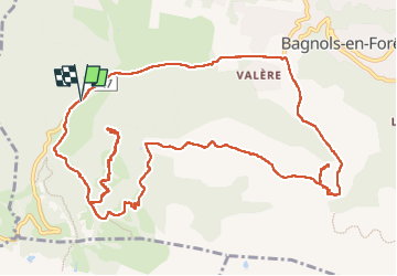
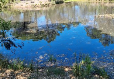
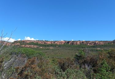
Trail Walking of 15.8 km to be discovered at Provence-Alpes-Côte d'Azur, Var, Bagnols-en-Forêt. This trail is proposed by Christiancordin.

Description

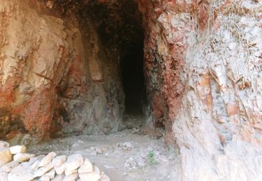
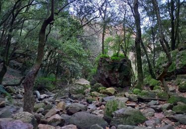
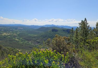
Piste de Bayonne, point de vue, église des païens, ancienne meulière, oppidum la forteresse, col de la pierre du coucou, les Cigarières, ND de la Pitié, D47.

Elevation profile

Photos

Positioning

Country:
France
Region :
Provence-Alpes-Côte d'Azur
Department/Province :
Var
Municipality :
Bagnols-en-Forêt
Location:
Unknown
Start:(UTM)
310687 ; 4822454 (32T) N.

Trails nearby

Trail Walking Le Muy - les grottes Baume Renaude - Photo
Walking
boulinevelyne

Walking

Difficult
(1)
Le Muy, Provence-Alpes-Côte d'Azur, Var, France
13.3 km | 18.3 km-effort
5h 13min
No
Trail Mountain bike Puget-sur-Argens - Forêt de la Colle du Rouet aux Gorges de Blavet - Fréjus - Photo
Mountain bike
tracegps

Mountain bike

Difficult
(1)
Puget-sur-Argens, Provence-Alpes-Côte d'Azur, Var, France
23 km | 28 km-effort
3h 0min
Yes
Trail Walking Bagnols-en-Forêt - La Colle du Rouet par le Castel Diaou - Le Muy - Photo
Walking
tracegps

Walking

Difficult
(2)
Bagnols-en-Forêt, Provence-Alpes-Côte d'Azur, Var, France
18.2 km | 27 km-effort
6h 0min
Yes
Trail On foot Bagnols-en-Forêt - BAGNOLS EN FORET- Bois du défens DRI - Photo
On foot

On foot

Easy
(2)
Bagnols-en-Forêt, Provence-Alpes-Côte d'Azur, Var, France
9.3 km | 12.7 km-effort
2h 52min
Yes
Trail Walking Bagnols-en-Forêt - Gorges du Blavet au col de la pierre du coucou - Photo
Walking
GUIDE
nadinebondoux

Walking

Difficult
Bagnols-en-Forêt, Provence-Alpes-Côte d'Azur, Var, France
15.8 km | 22 km-effort
4h 44min
Yes
Trail Walking Bagnols-en-Forêt - Gorges du Blavet - Photo
Walking
GrouGary

Walking

Easy
Bagnols-en-Forêt, Provence-Alpes-Côte d'Azur, Var, France
11.3 km | 18.6 km-effort
5h 0min
Yes
Trail Walking Puget-sur-Argens - z la Lieutenante 7 21-05-24 - Photo
Walking
cb8310

Walking

Medium
Puget-sur-Argens, Provence-Alpes-Côte d'Azur, Var, France
7.9 km | 9 km-effort
2h 2min
Yes
Trail Walking Le Muy - Le Rouet Vignes - Photo
Walking
Pascal-83

Walking

Medium
Le Muy, Provence-Alpes-Côte d'Azur, Var, France
8.2 km | 9.9 km-effort
2h 52min
Yes
Trail Walking Roquebrune-sur-Argens - La Bouverie - Gorges du Blavet - Grotte du Muéron - Photo
Walking
LtZIP

Walking

Easy
Roquebrune-sur-Argens, Provence-Alpes-Côte d'Azur, Var, France
7.9 km | 11.3 km-effort
2h 27min
Yes


Close
My subscriptions