Trail Walking Belœil - Le long du canal Ath-Blaton - Photo

Le long du canal Ath-Blaton

 Greg813
Greg813

User

© OpenStreetMap contributors
Length
Length
22 km
Max alt
Max alt
99 m
Uphill gradient
Uphill gradient
206 m
Km-Effort
Km-Effort  
25 km
Min alt
Min alt
52 m
Downhill gradient
Downhill gradient
209 m
Boucle
Boucle
Yes
Creation date :
2024-04-21 07:33:31.187
Updated on :
2024-05-11 15:29:38.995

(0 Reviews)

Walking
Walking
5h39
Difficulty : Medium

Scan this QR Code to open this trail in the SityTrail application

FREE GPS app for hiking

Logo SityTrail SityTrail

IGN / Geographical institutes

Download SityTrail from the App Store Download SityTrail from Google Play

Logo SityTrail SityTrail World

The world is yours!

Download SityTrail from the App Store Download SityTrail from Google Play Download SityTrail on Huawei AppGallery

About

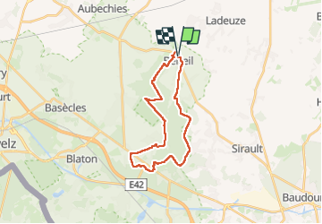
Trail Walking of 22 km to be discovered at Wallonia, Hainaut, Belœil. This trail is proposed by Greg813.

Description

Randonnée avec Mettons le Monde en Marche dans le Hainaut belge.

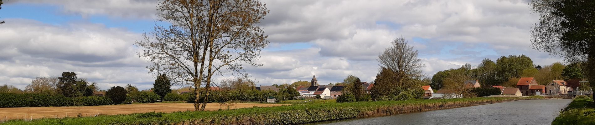
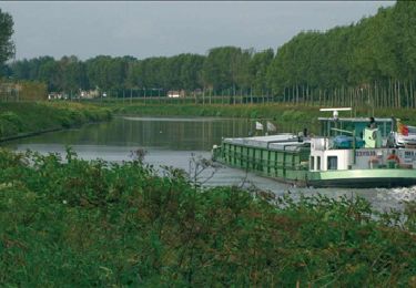
Au départ de Beloeil, la première partie du trajet permet de découvrir Stambruges et sa forêt mystérieuse : la fontaine bouillonnante et l’arbre à clous. Le chemin du retour permet de déambuler le long du canal de Blaton avant d'arpenter le grand parc du chateau de Beloeil, point final de la randonnée.

Pour d'autres photos, voir le site de l'association :
https://mmm-rando.org/randonnee-beloeuil-belgique-2024/

Elevation profile

Photos

Positioning

Country:
Belgium
Region :
Wallonia
Department/Province :
Hainaut
Municipality :
Belœil
Location:
Unknown
Start:(UTM)
552117 ; 5600062 (31U) N.

Trails nearby

Trail Walking Belœil - RB-Ha-C1_QR2_16_3_km - Photo
Walking
PRO

Walking

Difficult
(3)
Belœil, Wallonia, Hainaut, Belgium
16.3 km | 18.3 km-effort
4h 2min
Yes
Trail Walking Belœil - RB-Ha-C1_QR_19_5_km - Photo
Walking
PRO

Walking

Very difficult
(3)
Belœil, Wallonia, Hainaut, Belgium
19.4 km | 22 km-effort
4h 49min
Yes
Trail Walking Belœil - Chemin de la fontaine bouillante - Photo
Walking

Walking

Very easy
(3)
Belœil, Wallonia, Hainaut, Belgium
3.6 km | 4.2 km-effort
Unknown
Yes
Trail Walking Belœil - Beloeil - Circuit Natura 2000, des sites qui valent le détour -  Ht06 - Photo
Walking
GUIDE+

Walking

Very easy
(4)
Belœil, Wallonia, Hainaut, Belgium
3.5 km | 4 km-effort
51min
Yes
Trail Equestrian Belœil - Boucle de Beloeil - Photo
Equestrian
GUIDE+

Equestrian

Very easy
Belœil, Wallonia, Hainaut, Belgium
26 km | 30 km-effort
Unknown
No
Trail On foot Chièvres - Pedestrian Loop - Photo
On foot
GUIDE+

On foot

Easy
Chièvres, Wallonia, Hainaut, Belgium
7.3 km | 7.8 km-effort
1h 46min
Yes
Trail On foot Belœil - The Burbling Spring Walk - Photo
On foot
GUIDE+

On foot

Easy
Belœil, Wallonia, Hainaut, Belgium
3.8 km | 4.5 km-effort
1h 0min
Yes
Trail Walking Belœil - RB-Ha-15 – Raccourci 1 - Dans le parc naturel des Plaines de l’Escaut et dans les pépinières - Photo
Walking
PRO

Walking

Difficult
Belœil, Wallonia, Hainaut, Belgium
15.7 km | 17.8 km-effort
4h 2min
Yes
Trail Walking Belœil - RB-Ha-15 - Dans le parc naturel des Plaines de l’Escaut et dans les pépinières - Photo
Walking
PRO

Walking

Very difficult
(2)
Belœil, Wallonia, Hainaut, Belgium
23 km | 26 km-effort
5h 48min
Yes


Close
My subscriptions