Trail Walking Ablis - découverte de l'étang de Ablis - Photo

découverte de l'étang de Ablis

© OpenStreetMap contributors
Length
Length
874 m
Max alt
Max alt
150 m
Uphill gradient
Uphill gradient
9 m
Km-Effort
Km-Effort  
987 m
Min alt
Min alt
139 m
Downhill gradient
Downhill gradient
7 m
Boucle
Boucle
Yes
Creation date :
2024-04-11 15:09:25.606
Updated on :
2024-04-11 15:29:41.006

(0 Reviews)

Walking
Walking
20m
Difficulty : Easy

Scan this QR Code to open this trail in the SityTrail application

FREE GPS app for hiking

Logo SityTrail SityTrail

IGN / Geographical institutes

Download SityTrail from the App Store Download SityTrail from Google Play

Logo SityTrail SityTrail World

The world is yours!

Download SityTrail from the App Store Download SityTrail from Google Play Download SityTrail on Huawei AppGallery

About

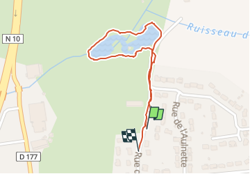
Trail Walking of 874 m to be discovered at Ile-de-France, Yvelines, Ablis. This trail is proposed by Carole Blejean.

Description

découverte de l'étang de Ablis

Elevation profile

Positioning

Country:
France
Region :
Ile-de-France
Department/Province :
Yvelines
Municipality :
Ablis
Location:
Unknown
Start:(UTM)
414043 ; 5374856 (31U) N.

Trails nearby

Trail Walking Prunay-en-Yvelines - Prunay-en-Yvelines-Chartres - Photo
Walking
aucamus

Walking

Very difficult
Prunay-en-Yvelines, Ile-de-France, Yvelines, France
33 km | 36 km-effort
8h 16min
No
Trail Other activity Auneau-Bleury-Saint-Symphorien - telport - Photo
Other activity
fengels

Other activity

Very easy
Auneau-Bleury-Saint-Symphorien, Centre-Loire Valley, Eure-et-Loir, France
15 km | 15.8 km-effort
23min
No
Trail Walking Prunay-en-Yvelines - Chartres.29062022 - Photo
Walking
aucamus

Walking

Very difficult
Prunay-en-Yvelines, Ile-de-France, Yvelines, France
34 km | 38 km-effort
8h 16min
No
Trail Walking Orphin - Orphin - Photo
Walking
MarcMC

Walking

Orphin, Ile-de-France, Yvelines, France
3.7 km | 3.9 km-effort
50min
Yes


Close
My subscriptions