139 km | 161 km-effort
gggg
eric004
User
Length
13.8 km
Max alt
152 m
Uphill gradient
111 m
Km-Effort
15.3 km
Min alt
117 m
Downhill gradient
111 m
Boucle
Yes
Creation date :
2023-10-01 13:28:58.123
Updated on :
2023-10-01 14:03:13.783
34m
Difficulty : Easy
FREE GPS app for hiking
About
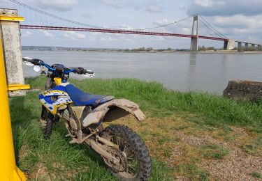
Trail Road bike of 13.8 km to be discovered at Normandy, Seine-Maritime, Terres-de-Caux. This trail is proposed by eric004.
Positioning
Country:
France
Region :
Normandy
Department/Province :
Seine-Maritime
Municipality :
Terres-de-Caux
Location:
Unknown
Start:(Dec)
Start:(UTM)
326171 ; 5502563 (31U) N.
Comments
Trails nearby
42b44d17cf2f8a344573a8acd327c912a5bcf0c3
Moto cross
Easy
Terres-de-Caux,
Normandy,
Seine-Maritime,
France
5h 0min
Yes
21032021 Bermonville Hericourt en caux
Moto cross
Very easy
Terres-de-Caux,
Normandy,
Seine-Maritime,
France
73 km | 85 km-effort
2h 2min
Yes
ancourteville surhericouet
Walking
Very difficult
Ancourteville-sur-Héricourt,
Normandy,
Seine-Maritime,
France
27 km | 32 km-effort
7h 23min
Yes
Raid en Normandie Hattenville Suisse Normande A construire
Motor
Very easy
Hattenville,
Normandy,
Seine-Maritime,
France
248 km | 308 km-effort
10min
No
Hattenville Terre de Caux
Mountain bike
Medium
Hattenville,
Normandy,
Seine-Maritime,
France
19.9 km | 23 km-effort
1h 31min
Yes