Trail Walking Pradelles - Etape 3 Pradelles  Haut cheylard l évêque  - Photo

Etape 3 Pradelles Haut cheylard l évêque

© OpenStreetMap contributors
Length
Length
23 km
Max alt
Max alt
1238 m
Uphill gradient
Uphill gradient
514 m
Km-Effort
Km-Effort  
30 km
Min alt
Min alt
899 m
Downhill gradient
Downhill gradient
500 m
Boucle
Boucle
No
Creation date :
2023-08-02 05:51:02.532
Updated on :
2023-08-02 13:10:57.244

(0 Reviews)

Walking
Walking
5h46
Difficulty : Difficult

Scan this QR Code to open this trail in the SityTrail application

FREE GPS app for hiking

Logo SityTrail SityTrail

IGN / Geographical institutes

Download SityTrail from the App Store Download SityTrail from Google Play

Logo SityTrail SityTrail World

The world is yours!

Download SityTrail from the App Store Download SityTrail from Google Play Download SityTrail on Huawei AppGallery

About

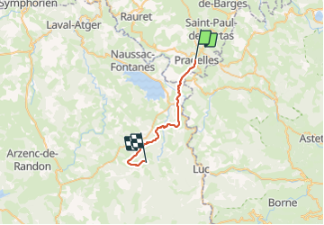
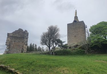
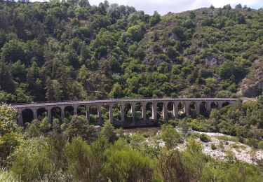
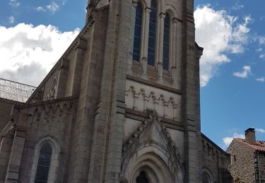
Trail Walking of 23 km to be discovered at Auvergne-Rhône-Alpes, Haute-Loire, Pradelles. This trail is proposed by Nathalie. Mercier.

Description

Sortie de Pradelles agréable  les  fontaines pour la plupart a vide cependant 1 robinet a la sortie  prévoir quand même suffisamment  d eau pour l étape  route assez longue
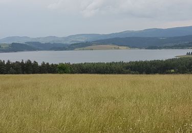
ravitaillement  langogne  puis ça monte lentement et plus durement.vers l herm , 1 café pas de chance fermé  1 ère fontaine fermée on en trouve 1 plus eau
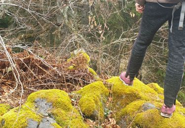
après l.herm et sa petite côte passage sous bois agréable avec au bout du sentier 100 m plusieurs tables pique nique  , le chemin est ensuite beaucoup plus agréable  ombragé  
je quitte le Gr pour le gîte le haut  du cheylard .

Elevation profile

Photos

Positioning

Country:
France
Region :
Auvergne-Rhône-Alpes
Department/Province :
Haute-Loire
Municipality :
Pradelles
Location:
Unknown
Start:(UTM)
569863 ; 4957848 (31T) N.

Trails nearby

Trail Mountain bike Langogne - Espace VTT FFC du Gévaudan - n°08 - Circuit  du Ras Chambon - Photo
Mountain bike
tracegps

Mountain bike

Difficult
(2)
Langogne, Occitania, Lozère, France
17.2 km | 22 km-effort
2h 15min
Yes
Trail Walking Langogne - E4 Langogne - Luc GR70 - Photo
Walking
GUIDE
Kargil

Walking

Difficult
Langogne, Occitania, Lozère, France
28 km | 38 km-effort
7h 6min
No
Trail Walking Langogne - 09-05-2023 E4 Langogne - Luc - Photo
Walking
GUIDE
Kargil

Walking

Difficult
Langogne, Occitania, Lozère, France
28 km | 38 km-effort
8h 35min
No
Trail Road bike Langogne - Langogne, le nouveau monde - Photo
Road bike
nadd73

Road bike

Medium
Langogne, Occitania, Lozère, France
68 km | 85 km-effort
4h 31min
Yes
Trail Road bike Langogne - NAUSSAC - COL DE LA PIERRE PLANTEE - Photo
Road bike
jean-marie.parachini

Road bike

Easy
Langogne, Occitania, Lozère, France
76 km | 91 km-effort
6h 20min
Yes
Trail Road bike Langogne - NAUSSAC - FORÊT DE MERCOIRE - Photo
Road bike
jean-marie.parachini

Road bike

Medium
Langogne, Occitania, Lozère, France
68 km | 81 km-effort
5h 40min
Yes
Trail Road bike Langogne - NAUSSAC - CHAPEAUROUX - Photo
Road bike
jean-marie.parachini

Road bike

Medium
Langogne, Occitania, Lozère, France
74 km | 94 km-effort
6h 29min
No
Trail Road bike Langogne - NAUSSAC - COL CROIX DE BOR ET COL DES 3 SOEURS - Photo
Road bike
jean-marie.parachini

Road bike

Medium
Langogne, Occitania, Lozère, France
67 km | 83 km-effort
5h 19min
Yes
Trail Walking Pradelles - Tour sommets live de Pradelles  - Photo
Walking
Spinnaker

Walking

Easy
Pradelles, Auvergne-Rhône-Alpes, Haute-Loire, France
11.1 km | 15.3 km-effort
2h 12min
Yes


Close
My subscriptions