Trail Walking Névache - J4 2023 - Le Thabor épisode 2 - Photo

J4 2023 - Le Thabor épisode 2

 ETMU5496
ETMU5496

User

© OpenStreetMap contributors
Length
Length
24 km
Max alt
Max alt
3168 m
Uphill gradient
Uphill gradient
1492 m
Km-Effort
Km-Effort  
44 km
Min alt
Min alt
1753 m
Downhill gradient
Downhill gradient
1494 m
Boucle
Boucle
Yes
Creation date :
2023-07-04 06:26:33.0
Updated on :
2023-07-08 12:27:13.113

(0 Reviews)

Walking
Walking
7h13
Difficulty : Very difficult

Scan this QR Code to open this trail in the SityTrail application

FREE GPS app for hiking

Logo SityTrail SityTrail

IGN / Geographical institutes

Download SityTrail from the App Store Download SityTrail from Google Play

Logo SityTrail SityTrail World

The world is yours!

Download SityTrail from the App Store Download SityTrail from Google Play Download SityTrail on Huawei AppGallery

About

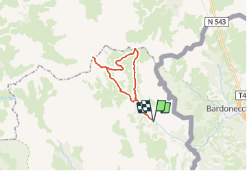
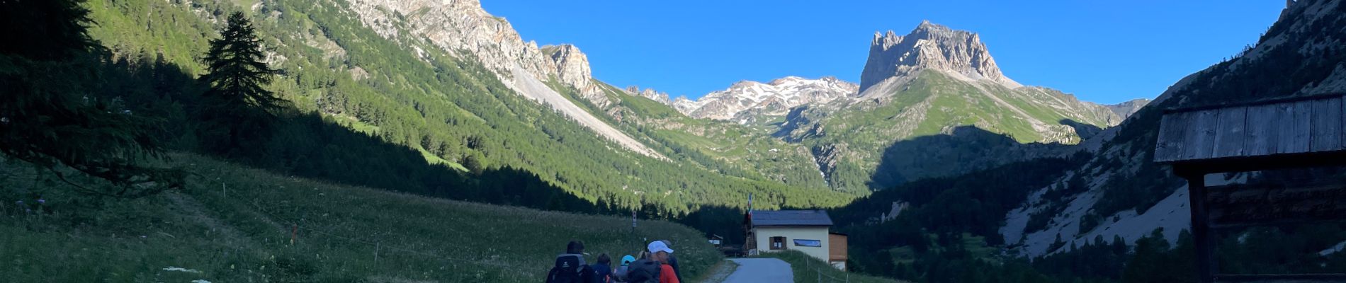
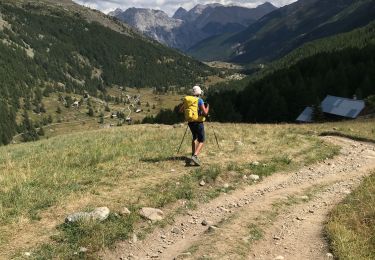
Trail Walking of 24 km to be discovered at Provence-Alpes-Côte d'Azur, Hautes-Alpes, Névache. This trail is proposed by ETMU5496.

Description

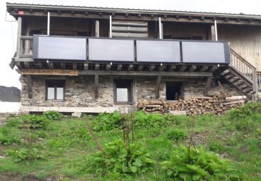
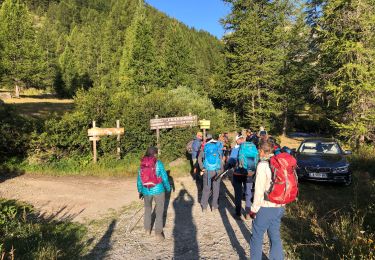
Depuis la vallée étroite et le col des Méandes
Randonnée assez difficile de part sa longueur.
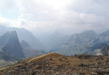
L'ascension finale depuis le col des Méandes est sportive
450 m de dénivelé en 1,5 km linéaire

Elevation profile

Photos

31 photos in total. Please click on a photo to see them all in the gallery.

Positioning

Country:
France
Region :
Provence-Alpes-Côte d'Azur
Department/Province :
Hautes-Alpes
Municipality :
Névache
Location:
Unknown
Start:(UTM)
313094 ; 4993307 (32T) N.

Trails nearby

Trail Walking Névache - Lac Vert.Vallée Etroite.(27-09-17) - Photo
Walking
Dervalmarc

Walking

Very easy
(1)
Névache, Provence-Alpes-Côte d'Azur, Hautes-Alpes, France
4.2 km | 5.9 km-effort
1h 19min
Yes
Trail Walking Névache - les granges de la vallée étroite au refuge du Mont Thabor - Photo
Walking
reneperrin

Walking

Easy
(1)
Névache, Provence-Alpes-Côte d'Azur, Hautes-Alpes, France
8.6 km | 16.2 km-effort
3h 44min
No
Trail Mountain bike Névache - Tour des Rois Mages en VTT - Névache - Photo
Mountain bike
tracegps

Mountain bike

Difficult
(2)
Névache, Provence-Alpes-Côte d'Azur, Hautes-Alpes, France
35 km | 55 km-effort
5h 0min
Yes
Trail Walking Névache - le Mont Thabor - Photo
Walking
GUIDE
amiral13

Walking

Difficult
Névache, Provence-Alpes-Côte d'Azur, Hautes-Alpes, France
19.9 km | 40 km-effort
8h 44min
Yes
Trail Walking Névache - Vallée  étroite    refuge du Thabor - Photo
Walking
Sorriaux

Walking

Difficult
Névache, Provence-Alpes-Côte d'Azur, Hautes-Alpes, France
10.2 km | 18.4 km-effort
3h 6min
No
Trail Walking Névache - Mont Thabor à partir des Granges  - Photo
Walking
Hugues Michel

Walking

Very difficult
Névache, Provence-Alpes-Côte d'Azur, Hautes-Alpes, France
18.1 km | 37 km-effort
6h 39min
No
Trail Walking Névache - Col roche noire  - Photo
Walking
jouans

Walking

Difficult
Névache, Provence-Alpes-Côte d'Azur, Hautes-Alpes, France
17.1 km | 31 km-effort
6h 37min
Yes
Trail Walking Névache - Vallée de la Clarée - Buffère / Moulette / Roche noire / Chardonnet - Photo
Walking
ETMU5496

Walking

Difficult
Névache, Provence-Alpes-Côte d'Azur, Hautes-Alpes, France
18 km | 32 km-effort
7h 37min
Yes
Trail Walking Névache - J2 G1 Pont de Souchère Col de Buffère Moulette Col Roche Noire Refuge Chardonnet - Photo
Walking

Walking

Difficult
Névache, Provence-Alpes-Côte d'Azur, Hautes-Alpes, France
15.4 km | 28 km-effort
5h 45min
No


Close
My subscriptions